Bruchem | |
|---|---|
Village | |
 | |
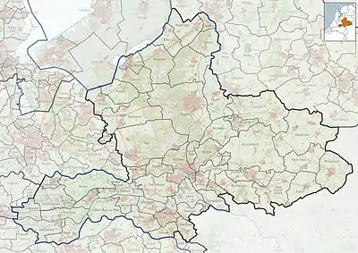
 Bruchem Location in the Netherlands  Bruchem Bruchem (Netherlands) | |
| Coordinates: 51°47′7″N 5°14′12″E / 51.78528°N 5.23667°E | |
| Country | Netherlands |
| Province | Gelderland |
| Municipality | Zaltbommel |
| Area | |
| • Total | 16.23 km2 (6.27 sq mi) |
| Elevation | 3 m (10 ft) |
| Population (2021)[1] | |
| • Total | 2,090 |
| • Density | 130/km2 (330/sq mi) |
| Time zone | UTC+1 (CET) |
| • Summer (DST) | UTC+2 (CEST) |
| Postal code | 5314[1] |
| Dialing code | 0418 |
Bruchem is a village in the Dutch province of Gelderland. It is a part of the municipality of Zaltbommel, and lies about 11 km north of 's-Hertogenbosch.
Bruchem was a separate municipality, which was renamed in 1818, to "Kerkwijk".[3]
It was first mentioned in the first quarter of the 13th century as Bruchem, and means "settlement on swampy land". There is an 868 reference to Brucheim, however it is not clear whether it is the same settlement.[4] The village developed into a stretched out esdorp. The nave of the Protestant church dates from around 1300, and the choir dates from the 14th century.[5] In 1840, Bruchem was home to 452 people.[6]

Villa Groenhoven
References
- 1 2 3 "Kerncijfers wijken en buurten 2021". Central Bureau of Statistics. Retrieved 25 March 2022.
Overlap with Delwijnen and Kerwijk
- ↑ "Postcodetool for 5314AA". Actueel Hoogtebestand Nederland (in Dutch). Het Waterschapshuis. Retrieved 25 March 2022.
- ↑ Ad van der Meer and Onno Boonstra, Repertorium van Nederlandse gemeenten, KNAW, 2011.
- ↑ "Bruchem - (geografische naam)". Etymologiebank (in Dutch). Retrieved 25 March 2022.
- ↑ Ronald Stenvert & Sabine Broekhoven (2000). "Bruchem" (in Dutch). Zwolle: Waanders. ISBN 90 400 9406 3. Retrieved 25 March 2022.
- ↑ "Bruchem". Plaatsengids (in Dutch). Retrieved 25 March 2022.
Wikimedia Commons has media related to Bruchem.
This article is issued from Wikipedia. The text is licensed under Creative Commons - Attribution - Sharealike. Additional terms may apply for the media files.