Bruhanja Vas | |
|---|---|
 | |
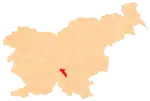
 Bruhanja Vas Location in Slovenia | |
| Coordinates: 45°50′16.54″N 14°42′15.45″E / 45.8379278°N 14.7042917°E | |
| Country | |
| Traditional region | Lower Carniola |
| Statistical region | Central Slovenia |
| Municipality | Dobrepolje |
| Area | |
| • Total | 4.27 km2 (1.65 sq mi) |
| Elevation | 435.4 m (1,428.5 ft) |
| Population (2020) | |
| • Total | 119 |
| • Density | 28/km2 (72/sq mi) |
| [1] | |
Bruhanja Vas (pronounced [ˈbɾuːxanja ˈʋaːs]; Slovene: Bruhanja vas) is a settlement in the Municipality of Dobrepolje in Slovenia. It lies in the karst field south of Videm. The area is part of the traditional region of Lower Carniola. The municipality is now included in the Central Slovenia Statistical Region.[2]
Name
Bruhanja Vas was attested in historical sources as Guetenueld in 1343, Mükendorff in 1436, Fleygendorff in 1463, and Veigundarff in 1484, among other names and spellings.[3]
Gallery
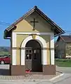
 Chapel-shrine in Bruhanja Vas
References
- ↑ Statistical Office of the Republic of Slovenia
- ↑ Dobrepolje municipal site
- ↑ "Bruhanja Vas". Slovenska historična topografija. ZRC SAZU Zgodovinski inštitut Milka Kosa. Retrieved August 20, 2020.
External links
This article is issued from Wikipedia. The text is licensed under Creative Commons - Attribution - Sharealike. Additional terms may apply for the media files.
