Buais | |
|---|---|
Part of Buais-les-Monts | |
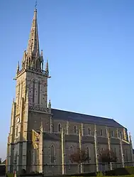 The church of Sainte-Anne | |
Location of Buais | |
 Buais  Buais | |
| Coordinates: 48°31′23″N 0°58′04″W / 48.5231°N 0.9678°W | |
| Country | France |
| Region | Normandy |
| Department | Manche |
| Arrondissement | Avranches |
| Canton | Saint-Hilaire-du-Harcouët |
| Commune | Buais-les-Monts |
| Area 1 | 17.92 km2 (6.92 sq mi) |
| Population (2019)[1] | 487 |
| • Density | 27/km2 (70/sq mi) |
| Time zone | UTC+01:00 (CET) |
| • Summer (DST) | UTC+02:00 (CEST) |
| Postal code | 50640 |
| Elevation | 115–238 m (377–781 ft) (avg. 216 m or 709 ft) |
| 1 French Land Register data, which excludes lakes, ponds, glaciers > 1 km2 (0.386 sq mi or 247 acres) and river estuaries. | |
Buais (French pronunciation: [bɥɛ]) is a former commune in the Manche department in Normandy in northwestern France. On 1 January 2016, it was merged into the new commune of Buais-les-Monts.[2]
Location
Buais is a small village southeast of Saint-Hilaire-du-Harcouët.
Population
|
|
Amenities
It has a bakery, bar/post office, corner shop, hairdresser, taxi office, and veterinarian.
See also
References
- ↑ Téléchargement du fichier d'ensemble des populations légales en 2019, INSEE
- ↑ Arrêté préfectoral 9 December 2015 (in French)
Wikimedia Commons has media related to Buais.
This article is issued from Wikipedia. The text is licensed under Creative Commons - Attribution - Sharealike. Additional terms may apply for the media files.