Burg, Dithmarschen | |
|---|---|
.png.webp) Flag  Coat of arms | |
Location of Burg, Dithmarschen within Dithmarschen district 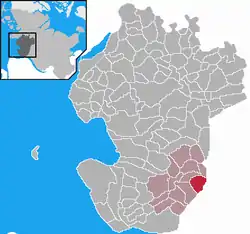 | |
 Burg, Dithmarschen 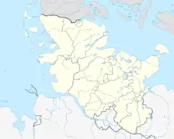 Burg, Dithmarschen | |
| Coordinates: 54°0′N 9°16′E / 54.000°N 9.267°E | |
| Country | Germany |
| State | Schleswig-Holstein |
| District | Dithmarschen |
| Municipal assoc. | Burg-Sankt Michaelisdonn |
| Government | |
| • Mayor | Werner Hill |
| Area | |
| • Total | 11.23 km2 (4.34 sq mi) |
| Highest elevation | 65 m (213 ft) |
| Lowest elevation | 1 m (3 ft) |
| Population (2022-12-31)[1] | |
| • Total | 4,206 |
| • Density | 370/km2 (970/sq mi) |
| Time zone | UTC+01:00 (CET) |
| • Summer (DST) | UTC+02:00 (CEST) |
| Postal codes | 25712 |
| Dialling codes | 04825 |
| Vehicle registration | HEI |
| Website | www.burg-dithmarschen.de |
Burg is a municipality in the district of Dithmarschen, in Schleswig-Holstein, Germany. It lies at the rim of the Heide-Itzehoe Geest with parts of the village in the marshland below. It was named after a fortress "Bökelnburg" of which a 9th-century earth wall ring remains. According to legend Burg was the site of a farmer's revolt. They burned down the castle and killed the count who had asked for a "tenth" tribute despite it being a time of drought.
_-_Apotheke.jpg.webp) kgl. priv. Apotheke am Markt
kgl. priv. Apotheke am Markt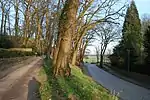 Auffahrt zur Bökelnburg
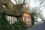 Krenzerstraße
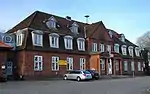 Bahnhof Burg
References
Wikimedia Commons has media related to Burg.
This article is issued from Wikipedia. The text is licensed under Creative Commons - Attribution - Sharealike. Additional terms may apply for the media files.