| Bush Fire Part of the Maricopa County wildfires | |
|---|---|
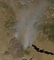
 The Bush Fire seen from Fort McDowell on June 16. | |
| Location | Tonto National Forest |
| Coordinates | 33°37′44″N 111°33′50″W / 33.629°N 111.564°W |
| Statistics | |
| Date(s) | June 13, 2020 - July 6, 2020 |
| Burned area | 193,455 acres (78,288 ha) |
| Cause | Human |
| Map | |
 Location in Arizona | |
| 2020 Western U.S. wildfires |
|---|
 |
The Bush Fire was a human-caused[1] wildfire that started in the Tonto National Forest northeast of Phoenix, Arizona. It burned 193,455 acres (78,288 ha). The fire started on June 13, 2020 near the intersection of Bush Highway and SR 87 and was fully contained on July 6, 2020[2]
Events
By June 16, 2020, the fire had burned more than 64,500 acres (26,100 ha) with 0% containment and was the largest fire burning in the US at that time.[3]
By the morning of June 17, 2020, the fire had burned more than 89,059 (36,041 ha) acres with 5% containment.[1]
By the morning of June 18, 2020, the fire had burned around 25,882 acres since the previous morning. The burned area has grown to 114,941 while containment remained at 5%.
On July 6, 2020 the fire was fully contained.
Impact
On June 15, 2020, the Gila County Sheriff's Office began issuing evacuation orders for nearby residents with the Maricopa County Sheriff's Office issuing orders the following day.[4]
Multiple highways were closed due to the fire.[4]
Gallery
 The Bush Fire burning in central Arizona on June 17, 2020 as seen from space
References
- 1 2 "Bush Fire Information - InciWeb the Incident Information System". inciweb.nwcg.gov. Retrieved 2020-06-17.
- ↑ "Incident Overview". InciWeb. Archived from the original on 2020-06-15. Retrieved 15 June 2020.
- ↑ Jensen, Audrey (16 June 2020). "Arizona's Bush Fire in Tonto National Forest now largest active fire burning in U.S." azcentral. Retrieved 16 June 2020.
- 1 2 "Evacuations issued for 37,900 acre 'Bush Fire' along State Route 87 near Bush Highway". abc15. 13 June 2020. Retrieved 16 June 2020.