Bushehr County
Persian: شهرستان بوشهر | |
|---|---|
County | |
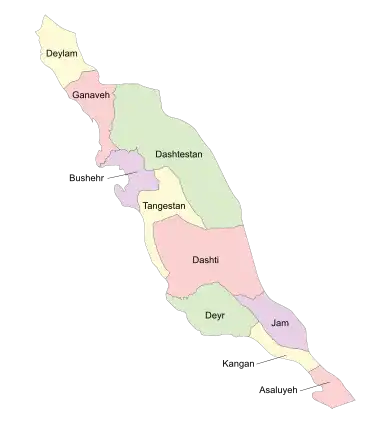 Location of Bushehr County in Bushehr province (center, purple) | |
 Location of Bushehr province in Iran | |
| Coordinates: 29°01′N 50°58′E / 29.017°N 50.967°E[1] | |
| Country | |
| Province | Bushehr |
| Capital | Bushehr |
| Districts | Central, Choghadak, Kharg |
| Area | |
| • Total | 1,386 km2 (535 sq mi) |
| Population (2016)[2] | |
| • Total | 298,594 |
| • Density | 220/km2 (560/sq mi) |
| Time zone | UTC+3:30 (IRST) |
| Bushehr County can be found at GEOnet Names Server, at this link, by opening the Advanced Search box, entering "9206090" in the "Unique Feature Id" form, and clicking on "Search Database". | |
Bushehr County (Persian: شهرستان بوشهر) is in Bushehr province, Iran. Its capital is the city of Bushehr.
At the 2006 census, the county's population was 216,087 in 53,173 households.[3] The following census in 2011 counted 258,906 people in 68,819 households.[4] At the 2016 census, the county's population was 298,594 in 85,523 households.[2]
Administrative divisions
The population history and structural changes of Bushehr County's administrative divisions over three consecutive censuses are shown in the following table. The latest census shows two districts, two rural districts, and four cities.[2]
In October 2018, the city of Choghadak and parts of Howmeh Rural District were separated from the Central District in the establishment of Choghadak District, which was divided into two rural districts and the city.[5]
| Administrative Divisions | 2006[3] | 2011[4] | 2016[2] |
|---|---|---|---|
| Central District | 207,891 | 251,120 | 290,359 |
| Angali RD | 2,636 | 2,301 | 2,209 |
| Howmeh RD | 27,156 | 35,525 | 22,766 |
| Ali Shahr (city) | 23,178 | ||
| Bushehr (city) | 161,674 | 195,222 | 223,504 |
| Choghadak (city) | 16,425 | 18,072 | 18,702 |
| Choghadak District1 | |||
| Chah Kutah RD | |||
| Doveyreh RD | |||
| Choghadak (city) | |||
| Kharg District | 8,196 | 7,722 | 8,193 |
| Kharg (city) | 8,196 | 7,722 | 8,193 |
| Total | 216,087 | 258,906 | 298,594 |
| RD: Rural District 1Established after the 2016 census[5] | |||
References
- ↑ OpenStreetMap contributors (29 March 2023). "Bushehr County" (Map). OpenStreetMap. Retrieved 29 March 2023.
- 1 2 3 4 "Census of the Islamic Republic of Iran, 1395 (2016)". AMAR (in Persian). The Statistical Center of Iran. p. 18. Archived from the original (Excel) on 3 August 2017. Retrieved 19 December 2022.
- 1 2 "Census of the Islamic Republic of Iran, 1385 (2006)". AMAR (in Persian). The Statistical Center of Iran. p. 18. Archived from the original (Excel) on 20 September 2011. Retrieved 25 September 2022.
- 1 2 "Census of the Islamic Republic of Iran, 1390 (2011)". Syracuse University (in Persian). The Statistical Center of Iran. p. 18. Archived from the original (Excel) on 3 April 2023. Retrieved 19 December 2022.
- 1 2 Jahangiri, Ishaq (14 October 2018). "Approval letter regarding country divisions of Bushehr County, Bushehr province". Islamic Parliament Research Center of the Islamic Republic of Iran (in Persian). Ministry of Interior, Council of Ministers. Archived from the original on 28 October 2020. Retrieved 29 March 2023.
Bushehr Province, Iran | |||||||||||||||||||||
|---|---|---|---|---|---|---|---|---|---|---|---|---|---|---|---|---|---|---|---|---|---|
| Capital |  | ||||||||||||||||||||
| Counties and cities |
| ||||||||||||||||||||
| Landmarks |
| ||||||||||||||||||||
| populated places | |||||||||||||||||||||
| Capital | |||||||||||||||||
|---|---|---|---|---|---|---|---|---|---|---|---|---|---|---|---|---|---|
| Districts |
| ||||||||||||||||