| Cae Llwyd Reservoir | |
|---|---|
| Cronfa Cae Llwyd (Welsh) | |
 Cae Llwyd in the foreground, with Ty Mawr in the background. | |
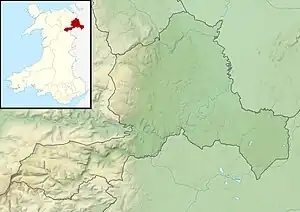
 Cae Llwyd Reservoir Location in Wrexham County Borough | |
| Location | Wrexham, Wales |
| Coordinates | 53°01′23″N 3°05′24″W / 53.023°N 3.090°W |
| Type | Inland Water reservoir |
| Built | 1878 |
| Water volume | 177,000 m3 (39,000,000 imp gal) |
| Settlements | Wrexham, Rhosllanerchrugog, Chirk |
| References | [1] |
Cae Llwyd is a reservoir located between Llwyneinion and the Ruabon Moors in Wrexham County Borough, Wales.
Description
The reservoir is an impounded lake holding raw water. It is dammed with a soil embankment consisting of a puddle clay core. It rises up to 15 metres (49 ft), holds a total water capacity of 177,000 m3 (39,000,000 imp gal).
The contract to build the reservoir was signed in 1875, with a cost of 608356. The plans are described to be "commendably brief", only containing seven items. One of the drawings was later found in 1984 to have been drawn on the back of a print for various Mersey crossing proposals including a suspension bridge and two tunnels.[2] The reservoir was constructed in 1878 by the Wrexham Waterworks Company, it is operated by Hafren Dyfrdwy on behalf of Severn Trent.[3]
The reservoir is part of the Ty Mawr/Cae Llwyd/Pen-y-Cae Reservoir System, one of the two reservoir systems by Hafren Dyfrdwy to supply the Wrexham Resource Zone.[4]
There is a Scouting site located next to the reservoir.[5]

See also
References
- ↑ "CAE-LLWYD RESERVOIR, WREXHAM (WRECSAM) (LL14 1UH)". OS GetOutside. Retrieved 26 April 2022.
- ↑ Tedd, P., ed. (2000). Dams 2000: Proceedings of the Biennial Conference of the BDS Held at the University of Bath on 14-17 June 2000. British Dam Society. p. 68.
- ↑ Maintaining the safety of our reservoirs – Raw water reservoir surveillance training manual (PDF). Severn Trent. 4 March 2019. p. 18.
- ↑ Hafren Dyfrdwy Drought Plan 2020 - 2025 Main Report (PDF). Hafren Dyfrdwy. p. 25.
- ↑ "Cae Llwyd". Clwyd Scouts. Retrieved 26 April 2022.
