Cal-Ida, California | |
|---|---|
 Cal-Ida, California  Cal-Ida, California | |
| Coordinates: 39°31′34″N 121°00′57″W / 39.52611°N 121.01583°W | |
| Country | United States |
| State | California |
| County | Sierra |
| Elevation | 3,537 ft (1,078 m) |
| Time zone | UTC-8 (Pacific (PST)) |
| • Summer (DST) | UTC-7 (PDT) |
| Area code | 530 |
| GNIS feature ID | 1658189[1] |
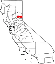
Cal-Ida is an unincorporated community in Sierra County, California, United States. Cal-Ida is 7 miles (11 km) west of Goodyears Bar.[2] A former sawmill camp, Cal-Ida was down to four residents by 1971;[3] a few buildings remain at the site today.
References
- ↑ "US Board on Geographic Names". United States Geological Survey. October 25, 2007. Retrieved January 31, 2008.
- ↑ Durham, David L. (1998). California's Geographic Names: A Gazetteer of Historic and Modern Names of the State. Quill Driver Books. p. 459. ISBN 1-884995-14-4.
- ↑ "Snowed-in Cal Ida residents rap road policy". The Sacramento Bee. Sacramento, CA. December 30, 1971. Retrieved December 29, 2023.
This article is issued from Wikipedia. The text is licensed under Creative Commons - Attribution - Sharealike. Additional terms may apply for the media files.
