| Camira Ipswich, Queensland | |||||||||||||||
|---|---|---|---|---|---|---|---|---|---|---|---|---|---|---|---|
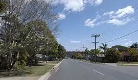
 Addison Road, 2014 | |||||||||||||||
 Camira | |||||||||||||||
| Coordinates | 27°38′06″S 152°55′12″E / 27.635°S 152.9199°E | ||||||||||||||
| Population | 7,415 (2021 census)[1] | ||||||||||||||
| • Density | 927/km2 (2,401/sq mi) | ||||||||||||||
| Postcode(s) | 4300 | ||||||||||||||
| Area | 8.0 km2 (3.1 sq mi) | ||||||||||||||
| Time zone | AEST (UTC+10:00) | ||||||||||||||
| Location | 25 km (16 mi) from Brisbane CBD | ||||||||||||||
| LGA(s) | City of Brisbane | ||||||||||||||
| State electorate(s) | Jordan | ||||||||||||||
| Federal division(s) | Oxley | ||||||||||||||
| |||||||||||||||
Camira is a suburb in the City of Brisbane, Queensland, Australia.[2] At the 2021 census, Camira had a population of 7,415 people.[1]
Geography
Camira is located approximately 25 kilometres (16 mi) from Brisbane CBD, near Springfield Lakes.
History
The origin of the suburb name is from an Aboriginal word meaning windy.[2]
Camira State School opened on 29 January 1974.[3]
At the 2011 census Camira had a population of 7,391 people.[4]
At the 2016 census Camira had a population of 7,414 people.[5]
Education
Camira State School is a government primary (Prep-6) school for boys and girls at 184-202 Old Logan Road (27°37′17″S 152°54′53″E / 27.6213°S 152.9146°E).[6][7] In 2018, the school had an enrolment of 617 students with 42 teachers (40 full-time equivalent) and 30 non-teaching staff (21 full-time equivalent).[8] It includes a special education program.[6][9]
Amenities
The Ipswich City Council operates a fortnightly mobile library service which visits the community centre.[10]
References
- 1 2 Australian Bureau of Statistics (28 June 2022). "Camira (Qld)". 2021 Census QuickStats. Retrieved 5 June 2023.
- 1 2 "Camira – suburb in City of Brisbane (entry 45034)". Queensland Place Names. Queensland Government. Retrieved 27 December 2020.
- ↑ Queensland Family History Society (2010), Queensland schools past and present (Version 1.01 ed.), Queensland Family History Society, ISBN 978-1-921171-26-0
- ↑ Australian Bureau of Statistics (31 October 2012). "Camira (State Suburb)". 2011 Census QuickStats. Retrieved 16 February 2014.
- ↑ Australian Bureau of Statistics (27 June 2017). "Camira (SSC)". 2016 Census QuickStats. Retrieved 20 October 2018.
- 1 2 "State and non-state school details". Queensland Government. 9 July 2018. Archived from the original on 21 November 2018. Retrieved 21 November 2018.
- ↑ "Camira State School". Archived from the original on 21 March 2020. Retrieved 21 November 2018.
- ↑ "ACARA School Profile 2018". Australian Curriculum, Assessment and Reporting Authority. Archived from the original on 27 August 2020. Retrieved 28 January 2020.
- ↑ "Camira SS - Special Education Program". Archived from the original on 21 March 2020. Retrieved 21 November 2018.
- ↑ "Ipswich Libraries: Mobile library schedule of stops - January to June 2018" (PDF). Ipswich City Council. Archived from the original (PDF) on 30 January 2018. Retrieved 30 January 2018.