Canton–Plymouth Mettetal Airport Mettetal Airport | |||||||||||
|---|---|---|---|---|---|---|---|---|---|---|---|
| Summary | |||||||||||
| Airport type | Public | ||||||||||
| Owner | State of Michigan - MDOT | ||||||||||
| Serves | Plymouth, Michigan | ||||||||||
| Elevation AMSL | 696 ft / 212 m | ||||||||||
| Coordinates | 42°20′53″N 083°27′23″W / 42.34806°N 83.45639°W | ||||||||||
| Map | |||||||||||
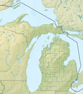
 1D2 Location of airport in Michigan  1D2 1D2 (the United States) | |||||||||||
| Runways | |||||||||||
| |||||||||||
| Statistics (2020) | |||||||||||
| |||||||||||


Canton–Plymouth Mettetal Airport (FAA LID: 1D2) is a public use airport located in Canton Township, Michigan, United States. The airport lies two nautical miles (3.7 km) south of the central business district of Plymouth, in Wayne County.[2] The airport is owned and operated by the Michigan Department of Transportation (MDOT).[1] It is also referred to as Mettetal Airport.[3] The airport is uncontrolled (non-towered), and is used for general aviation purposes.
It is included in the Federal Aviation Administration (FAA) National Plan of Integrated Airport Systems for 2017–2021, in which it is categorized as a local reliever airport facility.[4]
In 2017, the airport was home to a prototype flying cars produced by Detroit Flying Cars. The company's goal was to produce an aircraft that both drove like a standard car and flew like a standard aircraft. The project has been exhibited at shows such as the EAA AirVenture Airshow in Oshkosh, Wisconsin.[5][6][7]
There is an ongoing effort to close 1D2. A local group cites prohibited test flights, noise abatement procedures, illegally registered aircraft, the presence of two dozen nearby airports, a high annual budget, numerous fatal crashes, and more to advocate for the airfield's closure.[8]
History
The airport was founded in the 1930s as a grass strip to support crop dusting for nearby farmers. It was established as a public-use airport in 1939.[8]
Facilities and aircraft
Canton–Plymouth Mettetal Airport covers an area of 63 acres (25 ha) at an elevation of 696 feet (212 m) above mean sea level. It has one runway designated 18/36 with an asphalt surface measuring 2,303 by 75 feet (702 x 23 m).[1] No commercial airline service is available, although many small flight schools are based there. Due to the short runway length, touch and go operations, commonly used in flight training, are prohibited.
For the 12-month period ending December 31, 2020, the airport had 13,870 general aviation aircraft operations, an average of 38 per day. For the same time period, there were 78 aircraft based at the field: 72 single-engine and 3 multi-engine airplanes as well as 3 helicopters.[1][9]
In late 2015, the airport was damaged by a sudden, unforecasted tornado.[10]
The airport has several hangars for aircraft storage. In early 2022, a new helicopter-focused hangar opened that doubled available hangar space.[11]
The airport has an FBO, which offers fuel as well as aircraft parking.[12]
Accidents & Incidents
- On April 18, 1998, a Cessna 150 crashed south of the airport during a training flight. The aircraft had just departed Canton–Plymouth Mettetal Airport en route to Willow Run when the engine lost power, and the aircraft executed a forced landing in a nearby field.[13]
- On October 20, 2002, a Piper PA-32 Cherokee Six crashed while landing at Canton. The aircraft went off the side of the runway and struck the VASI lighting system, after which the aircraft caught fire. The probable cause was found to be the pilot's failure to maintain directional control of the aircraft as well as inoperative right main landing gear brake. Contributing factors include a failed brake master cylinder seal, an inadequate preflight inspection by the pilot, a fuel fire, and the pilot's decision to operate the aircraft with a known brake problem.[14]
- On October 14, 2019, a Vans RV-4 crashed during landing at Canton-Plymouth.[15]
See also
References
- 1 2 3 4 FAA Airport Form 5010 for 1D2 PDF. Federal Aviation Administration. effective 27 Aug 2008.
- ↑ "Canton township, Wayne county, Michigan." U.S. Census Bureau. Retrieved on October 28, 2009.
- ↑ Kitze Aviation, the fixed-base operator (FBO). Accessed 7 Sep 2009.
- ↑ "List of NPIAS Airports" (PDF). FAA.gov. Federal Aviation Administration. 21 October 2016. Retrieved 25 November 2016.
- ↑ "A Flying Car Is Taking off Near the Motor City". Robb Report. 18 September 2017. Retrieved 2022-11-17.
- ↑ "Flying Cars? Local engineer aims to get a fanciful idea off the ground". Detroit Free Press. Retrieved 2022-11-17.
- ↑ "Flying Car Should Be Practical: Canton Inventor". Patch. 25 July 2017. Retrieved 2022-11-17.
- 1 2 "Timeline". Close 1D2 – Canton-Plymouth Mettetal Airport. Retrieved 2022-11-17.
- ↑ "AirNav: 1D2 – Canton-Plymouth-Mettetal Airport". AirNav.com. Retrieved 2022-11-17.
- ↑ "Canton tornado left no time for warning". Detroit Free Press. Retrieved 2022-11-17.
- ↑ "McMahon Helicopter Services to nearly double hangar capacity". Vertical Mag. Retrieved 2022-11-17.
- ↑ "Canton Plymouth Mettetal". FlightAware. Retrieved 2022-11-17.
- ↑ "Aviation Accident Summary CHI98LA131". Aviation Accidents. Retrieved 2022-11-17.
- ↑ "N56655 accident description". Plane Crash Map. Retrieved 2022-11-17.
- ↑ [Van's RV-4, N59RB: Incident occurred October 14, 2019 at Canton-Plymouth Mettetal Airport (1D2), Michigan "N56655 accident description"]. Kathryn's Report. Retrieved 2022-11-17.
{{cite web}}: Check|url=value (help)
External links
- "Plymouth, Mettetal (1D2)" (PDF). at Michigan Airport Directory
- Aerial photo as of 27 March 1999 from USGS The National Map
- FAA Terminal Procedures for 1D2, effective December 28, 2023
- Resources for this airport:
- FAA airport information for 1D2
- AirNav airport information for 1D2
- FlightAware airport information and live flight tracker
- SkyVector aeronautical chart for 1D2