Carajás Airport Aeroporto de Carajás | |||||||||||
|---|---|---|---|---|---|---|---|---|---|---|---|
 | |||||||||||
| Summary | |||||||||||
| Airport type | Public | ||||||||||
| Operator | |||||||||||
| Serves | Carajás (Parauapebas) | ||||||||||
| Opened | September 23, 1982 | ||||||||||
| Time zone | BRT (UTC−03:00) | ||||||||||
| Elevation AMSL | 629 m / 2,064 ft | ||||||||||
| Coordinates | 06°06′55″S 050°00′05″W / 6.11528°S 50.00139°W | ||||||||||
| Map | |||||||||||
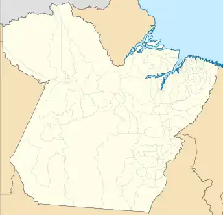
 CKS Location in Brazil  CKS CKS (Brazil) | |||||||||||
| Runways | |||||||||||
| |||||||||||
| Statistics (2022) | |||||||||||
| |||||||||||
Carajás Airport (IATA: CKS, ICAO: SBCJ) is the airport serving Parauapebas, Brazil, located in the Carajás Mining Complex.
It is operated by AENA.
History
The airport was built by Companhia Vale do Rio Doce as a support the mining activities of Carajás Mine. It was commissioned on September 23, 1982. Between 1985 and 2022 it is operated by Infraero.
Previously operated by Infraero, on August 18, 2022 the consortium AENA won a 30-year concession to operate the airport.[3]
Airlines and destinations
| Airlines | Destinations |
|---|---|
| Azul Brazilian Airlines | Belém, Belo Horizonte–Confins |
| Gol Transportes Aéreos | Belo Horizonte–Confins |
Accidents and incidents
- 8 September 1987: a Brazilian Air Force Hawker Siddeley HS.125 registration FAB-2129 crashed upon take-off from Carajás. All nine occupants died.[4]
- 14 February 1997: a Varig Boeing 737-241 registration PP-CJO operating flight 265, flying from Marabá to Carajás while on touch-down procedures at Carajás during a thunderstorm, had its right main gear collapsed rearwards causing the aircraft to veer off the right of the runway. The aircraft crashed into the forest. One crew member died.[5]
Access
The airport is located 18 km (11 mi) from downtown Parauapebas.
See also
References
- ↑ "Estatísticas". Infraero (in Portuguese). 24 February 2022. Retrieved 5 May 2023.
- ↑ "Aeródromos". ANAC (in Portuguese). 15 October 2019. Retrieved 22 May 2020.
- ↑ "Única empresa a apresentar proposta, Aena leva Aeroporto de Congonhas". Agência Brasil (in Portuguese). 18 August 2022. Retrieved 19 August 2022.
- ↑ "Accident description FAB-2129". Aviation Safety Network. Retrieved June 17, 2011.
- ↑ "Accident description PP-CJO". Aviation Safety Network. Retrieved June 17, 2011.
External links
- Airport information for SBCJ at Great Circle Mapper. Source: DAFIF (effective October 2006).
- Current weather for SBCJ at NOAA/NWS
- Accident history for CKS at Aviation Safety Network
This article is issued from Wikipedia. The text is licensed under Creative Commons - Attribution - Sharealike. Additional terms may apply for the media files.