Cartersville Historic District | |
 View of the district at dusk, April 2017 | |
  | |
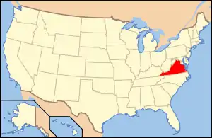
| Location | Roughly bounded by VA 45, VA 649 and VA 656, Cartersville, Virginia |
|---|---|
| Coordinates | 37°40′1″N 78°5′24″W / 37.66694°N 78.09000°W |
| Area | 48 acres (19 ha) |
| Architectural style | Colonial Revival, Queen Anne, Federal |
| NRHP reference No. | 93000505 [1] |
| VLR No. | 024-0126 |
| Significant dates | |
| Added to NRHP | June 10, 1993 |
| Designated VLR | April 21, 1993[2] |
Cartersville Historic District is a national historic district located at Cartersville, Cumberland County, Virginia. It encompasses 51 contributing buildings and 2 contributing sites in the village of Cartersville. Most of the buildings date to the turn of the 20th century, with a number of late-18th- and 19th-century dwellings and former taverns, two churches, a few commercial buildings, a post office, and a former school. Notable buildings include the Deanery (1780s), Glaser House (1790s), Baptist Parsonage (1790s), Cartersville Tavern (c. 1810), Cartersville Baptist Church (c. 1906), St. Catherine's Catholic Church (1910), Cartersville Methodist Episcopal Church (1883), Cartersville Post Office (1910), Cartersville Bank (c. 1900), Culbertson House (c. 1910), H. T. Harrison House (c. 1800, c. 1900), and W. E. Robinson House (c. 1909), Newstead Manor (c. 1920).[3]
It was added to the National Register of Historic Places in 1993.[1]
References
- 1 2 "National Register Information System". National Register of Historic Places. National Park Service. March 13, 2009.
- ↑ "Virginia Landmarks Register". Virginia Department of Historic Resources. Archived from the original on September 21, 2013. Retrieved June 5, 2013.
- ↑ David Edwards (December 1992). "National Register of Historic Places Inventory/Nomination: Cartersville Historic District" (PDF). Virginia Department of Historic Resources. and Accompanying photo and Accompanying map

