Cedral | |
|---|---|
Municipality and town | |
 Cedral Location in Mexico  Cedral Cedral (Mexico) | |
| Coordinates: 23°49′13″N 100°43′25″W / 23.82028°N 100.72361°W | |
| Country | |
| State | San Luis Potosí |
| Area | |
| • Total | 1,169 km2 (451 sq mi) |
| Elevation | 1,853 m (6,079 ft) |
| Population (2020) | |
| • Total | 19,840 |
| • Density | 17/km2 (44/sq mi) |
| Time zone | UTC-6 (Central Standard Time) |
| • Summer (DST) | UTC-5 (Central Daylight Time) |
| Postal code | 78520 |
Cedral is a town and municipality in the Mexican state of San Luis Potosí in central Mexico.[1] As of the year 2020, it has a total population of 19,840.[2]
Geography
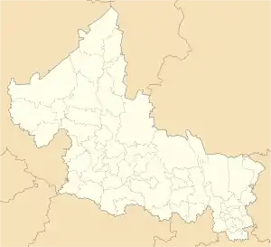
Cedral is located on the northern part of San Luis Potosí, along the Mexican Federal Highway 62. It borders Doctor Arroyo in the east, Matehuala and Villa de La Paz in the south, as well as Catorce and Vanegas in the west. Its average elevation is 1,853 meters above the sea level.[3]
Climate
Cedral has a Cold Semi-arid Climate (BSk). It sees the least amount of rainfall in December, with an average precipitation of 13 mm; and the most amount of rainfall in September, with an average precipitation of 76 mm.
| Climate data for Cedral | |||||||||||||
|---|---|---|---|---|---|---|---|---|---|---|---|---|---|
| Month | Jan | Feb | Mar | Apr | May | Jun | Jul | Aug | Sep | Oct | Nov | Dec | Year |
| Mean daily maximum °C (°F) | 20.1 (68.2) |
23 (73) |
25.6 (78.1) |
28.2 (82.8) |
28.8 (83.8) |
27.8 (82.0) |
27 (81) |
27.7 (81.9) |
25.3 (77.5) |
24.6 (76.3) |
22 (72) |
20.5 (68.9) |
25.1 (77.1) |
| Daily mean °C (°F) | 12.4 (54.3) |
14.7 (58.5) |
17.2 (63.0) |
20 (68) |
21.3 (70.3) |
21.4 (70.5) |
20.7 (69.3) |
21.2 (70.2) |
19.7 (67.5) |
18.2 (64.8) |
15 (59) |
13 (55) |
17.9 (64.2) |
| Mean daily minimum °C (°F) | 6.7 (44.1) |
8.3 (46.9) |
10.4 (50.7) |
12.9 (55.2) |
15.2 (59.4) |
16 (61) |
15.5 (59.9) |
15.9 (60.6) |
15.4 (59.7) |
13.3 (55.9) |
9.8 (49.6) |
7.4 (45.3) |
12.2 (54.0) |
| Average rainfall mm (inches) | 17 (0.7) |
15 (0.6) |
18 (0.7) |
31 (1.2) |
55 (2.2) |
54 (2.1) |
56 (2.2) |
48 (1.9) |
76 (3.0) |
40 (1.6) |
15 (0.6) |
13 (0.5) |
438 (17.3) |
| Source: Climate-Data.org[4] | |||||||||||||
References
- ↑ Enciclopedia de los Municipios de México. Instituto Nacional para el Federalismo y el Desarrollo Municipal https://web.archive.org/web/20070128021947/http://www.e-local.gob.mx/work/templates/enciclo/sanluispotosi/. Archived from the original on January 28, 2007. Retrieved January 11, 2010.
{{cite web}}: Missing or empty|title=(help) - ↑ "Cedral (Municipality, Mexico) - Population Statistics, Charts, Map and Location". www.citypopulation.de. Retrieved 2023-05-22.
- ↑ "Cedral topographic map, elevation, terrain". Topographic maps. Retrieved 2023-05-22.
- ↑ "Cedral climate: Temperature Cedral & Weather By Month - Climate-Data.org". en.climate-data.org. Retrieved 2023-05-22.
This article is issued from Wikipedia. The text is licensed under Creative Commons - Attribution - Sharealike. Additional terms may apply for the media files.
