Central District (Meshgin Shahr County)
Persian: بخش مرکزی شهرستان مشگين شهر | |
|---|---|
 Central District (Meshgin Shahr County) | |
| Coordinates: 38°23′32″N 47°38′36″E / 38.39222°N 47.64333°E[1] | |
| Country | |
| Province | Ardabil |
| County | Meshgin Shahr |
| Capital | Meshginshahr |
| Population (2016)[2] | |
| • Total | 107,557 |
| Time zone | UTC+3:30 (IRST) |
The Central District of Meshgin Shahr County (Persian: بخش مرکزی شهرستان مشگين شهر) is in Ardabil province, Iran. Its capital is the city of Meshginshahr.
At the 2006 census, its population was 112,128 in 26,284 households.[3] The following census in 2011 counted 114,726 people in 30,979 households.[4] At the latest census in 2016, the district had 107,557 inhabitants living in 32,434 households.[2]
In July 2019, the village of Alni was elevated to the status of a city.[5]
| Administrative Divisions | 2006[3] | 2011[4] | 2016[2] |
|---|---|---|---|
| Dasht RD | 19,750 | 18,662 | 23,699 |
| Meshgin-e Gharbi RD1 | 15,277 | 14,185 | |
| Meshgin-e Sharqi RD | 10,335 | 10,624 | 9,749 |
| Shaban RD1 | 5,470 | 4,372 | |
| Alni (city)2 | |||
| Meshginshahr (city) | 61,296 | 66,883 | 74,109 |
| Total | 112,128 | 114,726 | 107,557 |
| RD: Rural District 1Became a part of Qosabeh District[6] 2Became a city after the 2016 census[5] | |||
References
- ↑ OpenStreetMap contributors (28 March 2023). "Central District (Meshgin Shahr County)" (Map). OpenStreetMap. Retrieved 28 March 2023.
- 1 2 3 "Census of the Islamic Republic of Iran, 1395 (2016)". AMAR (in Persian). The Statistical Center of Iran. p. 24. Archived from the original (Excel) on 22 March 2019. Retrieved 19 December 2022.
- 1 2 "Census of the Islamic Republic of Iran, 1385 (2006)". AMAR (in Persian). The Statistical Center of Iran. p. 24. Archived from the original (Excel) on 20 September 2011. Retrieved 25 September 2022.
- 1 2 "Census of the Islamic Republic of Iran, 1390 (2011)". Syracuse University (in Persian). The Statistical Center of Iran. p. 24. Archived from the original (Excel) on 15 January 2023. Retrieved 19 December 2022.
- 1 2 "With the approval of the government board Arallu and Alni villages became cities". IRIB News (in Persian). Ministry of Interior, Cabinet of Ministers. 17 July 2019. Archived from the original on 19 July 2019. Retrieved 26 March 2023.
- ↑ Rahimi, Mohammad Reza (6 March 2012). "With some changes in the geography of the two provinces of the country: Three new cities were added to the map of the country's divisions". DOLAT (in Persian). Ministry of Interior, Political and Defense Commission. Archived from the original on 10 February 2018. Retrieved 22 November 2023.
| Capital | 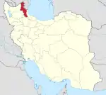 | ||||||||||||||||||||||
|---|---|---|---|---|---|---|---|---|---|---|---|---|---|---|---|---|---|---|---|---|---|---|---|
| Counties and cities |
| ||||||||||||||||||||||
| Landmarks |
| ||||||||||||||||||||||
| Places | |||||||||||||||||||||||
This article is issued from Wikipedia. The text is licensed under Creative Commons - Attribution - Sharealike. Additional terms may apply for the media files.