Chadual | |
|---|---|
village | |
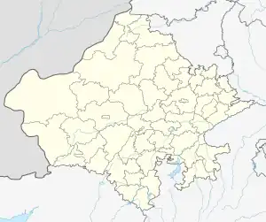 Chadual Location in Rajasthan, India  Chadual Chadual (India) | |
| Coordinates: 24°54′43″N 72°38′49″E / 24.91194°N 72.64694°E | |
| Country | |
| State | Rajasthan |
| District | Sirohi |
| Government | |
| • Body | Gram Panchayat |
| Languages | |
| • Official | Hindi Marwari |
| Time zone | UTC+5:30 (IST) |
| ISO 3166 code | RJ-IN |
| Vehicle registration | RJ-24 |
| Coastline | 0 kilometres (0 mi) |
Chadual is a village in Sirohi district in the Indian state of Rajasthan
Geography
It is located about 25 km west of Sirohi.[1]
Demographics
This village has many castes including Purohit, Rawal Brahmin, Rajput, Jain, Suthar, Mali, Prajapat, Bhatt Brahmin, Dewasi, Boda Prajapat, Meghwal and Bheel.
Governance
This village is represented by the Govt. Local Body Gram Panchayat tanwari.
Culture
This village has many Hindu temples and also one Jain temple.
Gallery
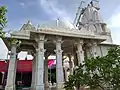 Shri Vaijnath Mahadev Temple in Chadual
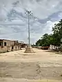 Chadual Bus Station
References
- ↑ "Pin code Chadual". Pin code india. Retrieved 27 March 2017.
This article is issued from Wikipedia. The text is licensed under Creative Commons - Attribution - Sharealike. Additional terms may apply for the media files.