Champ-du-Boult | |
|---|---|
Part of Noues de Sienne | |
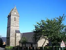 Notre-Dame church in Champ-du-Boult | |
Location of Champ-du-Boult | |
 Champ-du-Boult  Champ-du-Boult | |
| Coordinates: 48°47′38″N 1°00′25″W / 48.7939°N 1.0069°W | |
| Country | France |
| Region | Normandy |
| Department | Calvados |
| Arrondissement | Vire |
| Canton | Vire Normandie |
| Commune | Noues de Sienne |
| Area 1 | 13.85 km2 (5.35 sq mi) |
| Population (2019)[1] | 374 |
| • Density | 27/km2 (70/sq mi) |
| Time zone | UTC+01:00 (CET) |
| • Summer (DST) | UTC+02:00 (CEST) |
| Postal code | 14380 |
| Elevation | 170–351 m (558–1,152 ft) (avg. 309 m or 1,014 ft) |
| 1 French Land Register data, which excludes lakes, ponds, glaciers > 1 km2 (0.386 sq mi or 247 acres) and river estuaries. | |
Champ-du-Boult (French pronunciation: [ʃɑ̃ dy bu]) is a former commune in the Calvados department in the Normandy region in northwestern France. On 1 January 2017, it was merged into the new commune Noues de Sienne.[2]
Population
| Year | Pop. | ±% |
|---|---|---|
| 1962 | 663 | — |
| 1968 | 636 | −4.1% |
| 1975 | 503 | −20.9% |
| 1982 | 503 | +0.0% |
| 1990 | 432 | −14.1% |
| 1999 | 435 | +0.7% |
| 2008 | 382 | −12.2% |
See also
References
- ↑ Téléchargement du fichier d'ensemble des populations légales en 2019, INSEE
- ↑ Arrêté préfectoral 6 December 2016 (in French)
External links
Wikimedia Commons has media related to Champ-du-Boult.
This article is issued from Wikipedia. The text is licensed under Creative Commons - Attribution - Sharealike. Additional terms may apply for the media files.