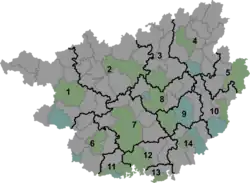
Changmei Township
长美乡 | |||||||
|---|---|---|---|---|---|---|---|
 Changmei Township Location in Guangxi | |||||||
| Coordinates: 24°57′19″N 108°28′09″E / 24.95528°N 108.46917°E | |||||||
| Country | People's Republic of China | ||||||
| Autonomous region | Guangxi | ||||||
| Prefecture-level city | Hechi | ||||||
| Autonomous county | Huanjiang Maonan Autonomous County | ||||||
| Incorporated (township) | 1933 | ||||||
| Area | |||||||
| • Total | 238.17 km2 (91.96 sq mi) | ||||||
| Population (2019) | |||||||
| • Total | 15,881 | ||||||
| • Density | 67/km2 (170/sq mi) | ||||||
| Time zone | UTC+08:00 (China Standard) | ||||||
| Postal code | 547116 | ||||||
| Area code | 0778 | ||||||
| Chinese name | |||||||
| Simplified Chinese | 长美乡 | ||||||
| Traditional Chinese | 長美鄉 | ||||||
| |||||||
Changmei Township (Chinese: 长美乡) is a township in Huanjiang Maonan Autonomous County, Guangxi, China. As of the 2019 census it had a population of 15,881 and an area of 238.17-square-kilometre (91.96 sq mi).
Administrative division
As of 2021, the township is divided into one community and five villages:
- Changmei Community (长美社区)
- Neitong (内同村)
- Bafu (八福村)
- Neidian (内典村)
- Guan'an (关安村)
- Aidong (爱洞村)
History
The area belonged to Si'en County (思恩县) during the Qing dynasty (1644–1911).[1]
In 1933 during the Republic of China, Changzhi Township (长治乡) was set up.[1]
In 1950, it came under the jurisdiction of the Fifth District. In 1958, its name was changed to Da'an People's Commune (大安人民公社).[2] It was incorporated as a township in September 1984.[2]
Geography
The township is situated at the eastern of Huanjiang Maonan Autonomous County.[1] It is bordered to the north by Minglun Town and Dongxing Town, to the east by Jian'ai Township, to the south by Yizhou District, and to the west by Da'an Township.[1]
The highest point in the township is Yangjiao Mountain (羊角山) which stands 1,169 metres (3,835 ft) above sea level.[1] The lowest point is the village of Bafu (八福村), which, at 167 metres (548 ft) above sea level.[1]
The Zhongzhou Stream (中洲河) flows through the township.[1]
Economy
The economy is supported primarily by agriculture and mineral resources. The main crops of the region are rice, followed by corn and soybean.[1] Sugarcane is one of the important economic crops in the region.[1] The region also has an abundance of iron, aluminum, zinc, silicon, and crystal.[1]
Demographics
| Year | Pop. | ±% |
|---|---|---|
| 2011 | 14,346 | — |
| 2019 | 15,881 | +10.7% |
The 2019 census showed the township's population to be 15,881, an increase of 10.7% from the 2011 census.
References
Bibliography
- Jiang Xiangming, ed. (2008). 《环江毛南族自治县概况》 [General Situation of Huanjiang Maonan Autonomous County] (in Chinese). Beijing: Nationalities Publishing House. ISBN 978-7-105-08616-0.