Changuinola | |
|---|---|
Corregimiento and town | |
 Changuinola | |
| Coordinates: 9°26′N 82°31′W / 9.433°N 82.517°W | |
| Country | |
| Province | Bocas del Toro |
| District | Changuinola |
| Area | |
| • Land | 96.7 km2 (37.3 sq mi) |
| Population (2010)[1] | |
| • Total | 31,223 |
| Time zone | UTC-5 (Eastern Time) |
| • Summer (DST) | UTC-5 (No DST) |
| Climate | Af |
| Website | [2] |
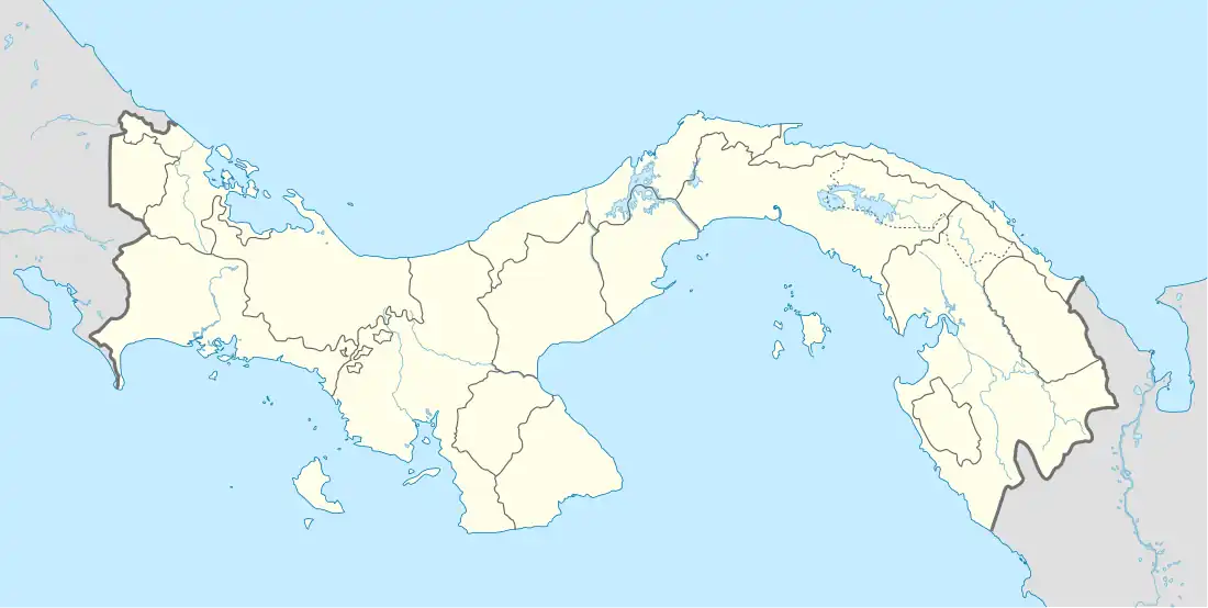
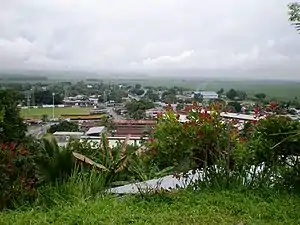
Changuinola is a city in the Bocas del Toro Province of Panama and seat city of the Changuinola District. The city attracts tourists as a popular gateway to Bocas Town and nearby cities Almirante and Chiriqui Grande.
Changuinola is surrounded by Changuinola River and extensive banana plantations.
Demographics
The corregimiento of Changuinola has a land area of 96.7 square kilometres (37.3 sq mi) and had a population of 31,223 as of 2010, giving it a population density of 323 inhabitants per square kilometre (840/sq mi).[1] Its population as of 1990 was 33,721; its population as of 2000 was 39,896.[1]
Climate
Changuinola is a coastal location with a tropical climate, more specifically a trade-wind tropical rainforest climate. The area does not have a predictable dry season. The driest times are late August to mid-October, February, and March.[3] Changuinola is humid. Thundershowers and heavy rain are common.[4] Normal temperatures are consistent all year (Hi: 80°-84 °F, low: 71°-75 °F).[3] Due to its low latitude, sunrise is around 6 AM, and sunset is around 6 PM local time. These times vary slightly during the year. Weather data is collected at Capitán Manuel Niño International Airport.[3]
| Climate data for Changuinola, Panama | |||||||||||||
|---|---|---|---|---|---|---|---|---|---|---|---|---|---|
| Month | Jan | Feb | Mar | Apr | May | Jun | Jul | Aug | Sep | Oct | Nov | Dec | Year |
| Mean daily maximum °F (°C) | 80 (27) |
80 (27) |
82 (28) |
83 (28) |
83 (28) |
83 (28) |
82 (28) |
82 (28) |
84 (29) |
83 (28) |
81 (27) |
80 (27) |
82 (28) |
| Mean daily minimum °F (°C) | 71 (22) |
71 (22) |
72 (22) |
73 (23) |
75 (24) |
75 (24) |
74 (23) |
74 (23) |
75 (24) |
75 (24) |
73 (23) |
72 (22) |
73 (23) |
| Average precipitation inches (mm) | 12.56 (319) |
7.90 (201) |
7.61 (193) |
11.30 (287) |
11.08 (281) |
10.87 (276) |
16.06 (408) |
11.37 (289) |
6.42 (163) |
7.80 (198) |
14.45 (367) |
15.81 (402) |
133.23 (3,384) |
| Source: Weather Underground [3] | |||||||||||||
Transportation

Changuinola is accessible by air, land, or sea. Visitors can fly into Capitán Manuel Niño International Airport from Panama City by Air Panama. It has daily flights but can be delayed due to frequent thunderstorms and heavy rains. Direct flights from the United States, Canada, and Mexico are not available.
Buses run between Changuinola, Almirante, David and Panama City. When traveling by land, tourists coming from or going to Costa Rica must clear both Costa Rican customs in Sixaola and Panamanian customs in Guabito. Buses are more reliable in bad weather.[4]
Infrastructure

Changuinola is divided into small farm communities called "Fincas", since all of the city is surrounded by banana plantations. as example, "Finca 4" which means Farm 4.
Changuinola has one main road that crosses all town from south to north, at the end you could take left to reach Guabito border town.
The "Manuel Niño" International Airport is a small international airport where you can take flights to Panama City.
The Calvin Byron Stadium for is located in El Empalme neighborhood, home of Bocas del Toro baseball team.
The Changuinola River bridge was built in 2009 and replaced 1920 railroad bridge next to it.
Changuinola was struck in April 1991 by 7.7 powerful earthquake, the town was reconstructed in the following years.
Public Services
Private and Public health care available. The CSS Changuinola Hospital is located right next to the Police station, and private clinics are also a great choice and available in the city.
Changuinola has several public and private schools, to mention most important IPT Changuinola and Empalme School.
University of Panama extension "CRUB" is located in Empalme, Changuinola
References
- 1 2 3 4 "Cuadro 11 (Superficie, población y densidad de población en la República...)" [Table 11 (Area, population, and population density in the Republic...)] {{webarchive |url=https://web.archive.org/web/20160304030354/http://www.contraloria.gob.pa/inec/archivos/P3601Cuadro11.xls |date=4 March 2016 }} (.xls). In "Resultados Finales Básicos" [Basic Final Results] (in Spanish). National Institute of Statistics and Census of Panama. Archived from the original on 10 July 2015. Retrieved 26 May 2015.
- ↑ World Gazeteer: Panama
- 1 2 3 4 "Changuinola, Panama". Weather Underground. Archived from the original on 5 March 2020. Retrieved 29 May 2009.
- 1 2 Frommer's Panama (2E, 2009), ISBN 978-0-470-37183-1.
External links
- Tropic river woods Archived 2 April 2004 at the Wayback Machine
- Portal of Changuinola
- Weather Underground: Changuinola, Panama (not Costa Rica).
