37°40′08″N 095°29′06″W / 37.66889°N 95.48500°W
Chanute Martin Johnson Airport | |||||||||||
|---|---|---|---|---|---|---|---|---|---|---|---|
 | |||||||||||
| Summary | |||||||||||
| Airport type | Public | ||||||||||
| Owner | City of Chanute | ||||||||||
| Serves | Chanute, Kansas | ||||||||||
| Elevation AMSL | 1,002 ft / 305 m | ||||||||||
| Map | |||||||||||
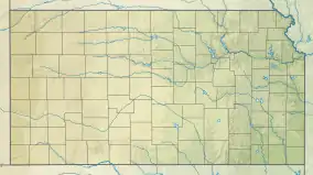
 CNU Location of airport in Kansas  CNU CNU (the United States) | |||||||||||
| Runways | |||||||||||
| |||||||||||
| Statistics | |||||||||||
| |||||||||||
Chanute Martin Johnson Airport (IATA: CNU, ICAO: KCNU, FAA LID: CNU) is a city-owned airport located two miles southwest of Chanute, in Neosho County, Kansas.[1] It is named for Martin Johnson, of the husband-and-wife explorers Martin and Osa Johnson, although it was Osa and not Martin who was native to Chanute.
Facilities
The airport covers 290 acres (120 ha) at an elevation of 1,002 feet (305 m) above mean sea level. It has one runway: 18/36 is 4,255 x 75 ft (1,297 x 23 m) asphalt.[1]
In the year ending December 31, 2016 the airport had 1,700 aircraft operations, an average of 5 per day: 99% general aviation and less than 1% military. In March 2022, there were 15 aircraft based at this airport: 13 single-engine and 2 multi-engine.[1]
See also
References
External links
- Resources for this airport:
- FAA airport information for CNU
- AirNav airport information for KCNU
- ASN accident history for CNU
- FlightAware airport information and live flight tracker
- NOAA/NWS weather observations: current, past three days
- SkyVector aeronautical chart, Terminal Procedures