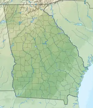
| Lake Chatuge | |
|---|---|
 Lake Chatuge reservoir on Aug. 3, 2022 | |
 Lake Chatuge  Lake Chatuge | |
| Location | United States |
| Coordinates | 34°59′28″N 83°47′06″W / 34.991°N 83.785°W |
| Surface area | 10.9 sq mi (28 km2) |
| Average depth | 9.1 m (30 ft) |
| Max. depth | 44 m (144 ft) at dam |
| Water volume | 62,619 m3 (2,211,400 cu ft) maximum |
| Shore length1 | 132 mi (212 km) |
| Surface elevation | 1,926 ft (587 m) [1] |
| Settlements | Hayesville, Hiawassee, |
| 1 Shore length is not a well-defined measure. | |

Lake Chatuge is a man-made reservoir in Towns County, Georgia, and Clay County, North Carolina. It lies along the Hiwassee River created by the Chatuge Dam which finished construction in 1942.[2] The lake is relatively shallow with depths of 30 feet (9.1 m) and reaches 144 feet (44 m) by the dam. Lake Chatuge is the highest major lake in the state of Georgia. [3]
Chatuge Lake takes up 7,000 acres (2,800 ha).[4] The construction of Chatuge Dam and its reservoir required the purchase of 11,641 acres (4,711 ha) of land, 1,904 acres (771 ha) of which had to be cleared. 278 families, 532 graves, and 40 miles (64 km) of roads (including part of U.S. Route 64) had to be relocated. One house relocated from the Elf community during the clearing of the land later became the Clay County School District superintendent’s office until 2005.[5]
Chatuge Dam was raised ten feet in 1954 so the lake level could rise an additional four feet.[6][7]
See also
References
- ↑ "Georgia Lake Levels".
- ↑ Chatuge Reservoir at TVA
- ↑ "Lake Chatuge Vacation Info - Lakelubbers". Lakelubbers. Retrieved 2017-05-28.
- ↑ Tennessee Valley Authority, The Nickajack Project: A Report on the Planning, Design, Construction, Initial Operations, and Costs, Technical Report No. 16 (Knoxville, Tenn.: Tennessee Valley Authority, 1972), pp. 10-11.
- ↑ Moore, Carl S. (1 Jan 2007). "Impact of National Forest & TVA Chatuge Dam". Clay County, NC Then and Now: A Written and Pictorial History. Genealogy Publishing Service. ISBN 9781881851240.
- ↑ Moore, Carl S. (1 Jan 2007). "Impact of National Forest & TVA Chatuge Dam". Clay County, NC Then and Now: A Written and Pictorial History. Genealogy Publishing Service. ISBN 9781881851240.
- ↑ "Chatuge Lake to rise 4 ft". The Cherokee Scout. Murphy, N.C. 1954-04-15. p. A1.