Chaulnes | |||||||||||
|---|---|---|---|---|---|---|---|---|---|---|---|
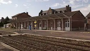 The station with its platform in August 2009 | |||||||||||
| General information | |||||||||||
| Location | 2 Rte Hallu, 80320 Chaulnes | ||||||||||
| Coordinates | 49°48′27″N 2°48′4″E / 49.80750°N 2.80111°E | ||||||||||
| Owned by | RFF/SNCF | ||||||||||
| Line(s) | Amiens–Laon railway | ||||||||||
| Platforms | 2 | ||||||||||
| Tracks | 3 | ||||||||||
| Other information | |||||||||||
| Station code | 87313478 | ||||||||||
| History | |||||||||||
| Opened | 1 June 1867 | ||||||||||
| Services | |||||||||||
| |||||||||||
Chaulnes is a railway station located in the commune of Chaulnes in the Somme department, France. The station is served by TER Hauts-de-France trains from Amiens to Laon.[1] Its elevation is 94 m.
History
Formerly, the station was also connected to a railway line from Paris-Nord to Cambrai via Saint-Just-en-Chaussée, Montdidier, Chaulnes and Roisel. The sections between Saint-Just-en-Chaussée and Roye, and between Péronne and Épehy have been dismantled, and the line has been partly replaced by bus services to Montdidier and Roisel.
See also
References
Wikimedia Commons has media related to Gare de Chaulnes.
- ↑ "Plan des lignes TER Hauts-de-France" (PDF). www.ter.sncf.com (in French). Retrieved 20 April 2022.
This article is issued from Wikipedia. The text is licensed under Creative Commons - Attribution - Sharealike. Additional terms may apply for the media files.