Chestnut Township | |
|---|---|
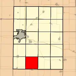 Location in Knox County | |
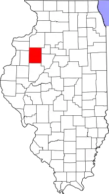 Knox County's location in Illinois | |
| Coordinates: 40°45′12″N 90°16′27″W / 40.75333°N 90.27417°W | |
| Country | |
| State | |
| County | Knox |
| Established | November 2, 1852 |
| Area | |
| • Total | 36.18 sq mi (93.7 km2) |
| • Land | 36.18 sq mi (93.7 km2) |
| • Water | 0 sq mi (0 km2) 0% |
| Elevation | 676 ft (206 m) |
| Population (2010) | |
| • Estimate (2016)[1] | 246 |
| • Density | 7/sq mi (3/km2) |
| Time zone | UTC-6 (CST) |
| • Summer (DST) | UTC-5 (CDT) |
| ZIP codes | 61410, 61436, 61458, 61474, 61544 |
| FIPS code | 17-095-13217 |
Chestnut Township is one of twenty-one townships in Knox County, Illinois, United States. As of the 2010 census, its population was 253 and it contained 121 housing units.[2]
Geography
According to the 2010 census, the township has a total area of 36.18 square miles (93.7 km2), all land.[2]
Cities, towns, villages
- London Mills (northeast quarter)
Unincorporated towns
(This list is based on USGS data and may include former settlements.)
Extinct towns
- Bridgeport at 40°44′36″N 90°14′13″W / 40.743372°N 90.237068°W
- Burnside at 40°46′10″N 90°16′24″W / 40.769483°N 90.273458°W
(These towns are listed as "historical" by the USGS.)
Cemeteries
The township contains these four cemeteries: Elias Bragg, Harper, Hermon Christian and Hermon Methodist.
Airports and landing strips
- Davies Landing Strip
Demographics
| Census | Pop. | Note | %± |
|---|---|---|---|
| 2016 (est.) | 246 | [1] | |
| U.S. Decennial Census[3] | |||
School districts
- Abingdon Community Unit School District 217
- Knoxville Community Unit School District 202
- Spoon River Valley Community Unit School District 4
Political districts
- Illinois's 17th congressional district
- State House District 74
- State Senate District 37
References
- "Chestnut Township, Knox County, Illinois". Geographic Names Information System. United States Geological Survey, United States Department of the Interior. Retrieved February 20, 2010.
- United States Census Bureau 2009 TIGER/Line Shapefiles
- United States National Atlas
- 1 2 "Population and Housing Unit Estimates". Retrieved June 9, 2017.
- 1 2 "Population, Housing Units, Area, and Density: 2010 - County -- County Subdivision and Place -- 2010 Census Summary File 1". United States Census. Archived from the original on February 12, 2020. Retrieved May 28, 2013.
- ↑ "Census of Population and Housing". Census.gov. Retrieved June 4, 2016.
External links
Places adjacent to Chestnut Township, Knox County, Illinois | |
|---|---|
Municipalities and communities of Knox County, Illinois, United States | ||
|---|---|---|
| Cities | Map of Illinois highlighting Knox County | |
| Villages | ||
| Townships | ||
| CDPs | ||
| Other unincorporated communities | ||
| Ghost towns | ||
| Footnotes | ‡This populated place also has portions in an adjacent county or counties | |
This article is issued from Wikipedia. The text is licensed under Creative Commons - Attribution - Sharealike. Additional terms may apply for the media files.