Chhatak
ছাতক | |
|---|---|
 | |
| Division | Sylhet Division |
| District | Sunamganj |
| Government | |
| • MP (Sunamganj-5) | Muhibur Rahman Manik (Bangladesh Awami League) |
| Area | |
| • Total | 434.76 km2 (167.86 sq mi) |
| Population | |
| • Total | 273,153 |
| • Density | 628/km2 (1,630/sq mi) |
| Demonym(s) | Chhataki, Satoki |
| Time zone | UTC+6 (BST) |
| Postal code | 3080-93 |
| Website | chhatak |
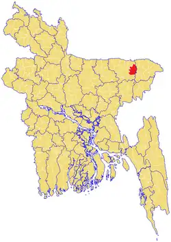
Chhatak (Bengali: ছাতক) is an upazila of the Sunamganj District in Sylhet Division, Bangladesh.[1]
Climate
Chhatak has a humid subtropical climate. The Köppen-Geiger climate classification is Cwa. The climate of Chhatak is generally marked with monsoons, high temperature, considerable humidity and heavy rainfall. The hot season commences early in April and continues till July. The average annual temperature in Chhatak is 23.3 °C (73.9 °F). About 5,048 mm (198.74 in) of precipitation falls annually.
| Climate data for Chhatak | |||||||||||||
|---|---|---|---|---|---|---|---|---|---|---|---|---|---|
| Month | Jan | Feb | Mar | Apr | May | Jun | Jul | Aug | Sep | Oct | Nov | Dec | Year |
| Mean daily maximum °C (°F) | 25.6 (78.1) |
27.7 (81.9) |
31.6 (88.9) |
32.7 (90.9) |
31.5 (88.7) |
31.6 (88.9) |
31.6 (88.9) |
31.6 (88.9) |
31.8 (89.2) |
30.8 (87.4) |
29.1 (84.4) |
26.5 (79.7) |
30.2 (86.3) |
| Mean daily minimum °C (°F) | 9.7 (49.5) |
12.2 (54.0) |
17.1 (62.8) |
21.1 (70.0) |
23.0 (73.4) |
24.4 (75.9) |
25.0 (77.0) |
24.9 (76.8) |
24.6 (76.3) |
21.9 (71.4) |
16.3 (61.3) |
11.5 (52.7) |
19.3 (66.8) |
| Average precipitation mm (inches) | 13 (0.5) |
29 (1.1) |
103 (4.1) |
249 (9.8) |
422 (16.6) |
570 (22.4) |
460 (18.1) |
402 (15.8) |
313 (12.3) |
204 (8.0) |
34 (1.3) |
6 (0.2) |
2,805 (110.4) |
| Source: Climate-Data.org,Climate data | |||||||||||||
Geography

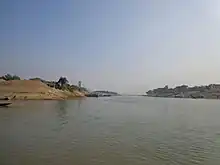
Chhatak is located at 25°02′30″N 91°40′30″E / 25.0417°N 91.6750°E. It has 43,727 households and a total area 434.76 km2.
Demographics
According to the 2011 Bangladesh census, Chhatak Upazila had 66,724 households and a population of 397,642. 115,129 (28.95%) were under 10 years of age. Chhatak had a literacy rate (age 7 and over) of 38.55%, compared to the national average of 51.8%, and a sex ratio of 1009 females per 1000 males. 50,678 (12.74%) lived in urban areas.[2][3]
At the time of the 1991 Bangladesh census, Chhatak had a population of 273,153. Males constituted 51.05% of the population and females 48.95%. The adult (18+) population was 135,445. Chhatak had an average literacy rate of 24.5% (7+ years) compared with the national average of 32.4%.[4] Religious affiliation was: Muslim 83.08%, Hindu 16.75%, Buddhist, Christian and others 0.17%.
Administration
Chhatak Upazila is divided into Chhatak Municipality and 13 union parishads: Bhatgaon, Chhaila Afjalabad, Chhatak, Chormoholla, Dolarbazar, Gobindganj-Syedergaon, Islampur, Jauwa Bazar, Kalaruka, Khurma Dakshin, Khurma Uttar, Noarai, and Singchapair. The union parishads are subdivided into 287 mauzas and 539 villages.[5]
Chhatak Municipality is subdivided into 9 wards and 23 mahallas.[5]
See also
References
- ↑ Ashfaq Hossain (2012), "Chhatak Upazila", in Sirajul Islam and Ahmed A. Jamal (ed.), Banglapedia: National Encyclopedia of Bangladesh (Second ed.), Asiatic Society of Bangladesh
- 1 2 "Bangladesh Population and Housing Census 2011 Zila Report – Sunamganj" (PDF). bbs.gov.bd. Bangladesh Bureau of Statistics.
- ↑ "Community Tables: Sunamganj district" (PDF). bbs.gov.bd. Bangladesh Bureau of Statistics. 2011.
- ↑ "Population Census Wing, BBS". Archived from the original on 27 March 2005. Retrieved November 10, 2006.
- 1 2 "District Statistics 2011: Sunamganj" (PDF). Bangladesh Bureau of Statistics. Archived from the original (PDF) on 13 November 2014. Retrieved 14 July 2014.
Capital: Sunamganj | ||
| Upazilas | ||
| Constituencies | ||
| Attractions and sites | ||
| Rivers | ||
| Inhabited areas | ||
| Educational institutions |
| |
| Transport | ||
| History | ||
Capital: Sylhet | ||
| Habiganj District | 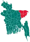 | |
| Moulvibazar District | ||
| Sunamganj District | ||
| Sylhet District | ||