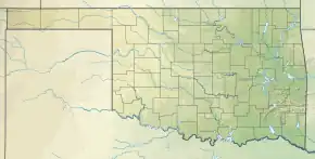
| Chickasha Lake | |
|---|---|
 Chickasha Lake  Chickasha Lake | |
| Location | Caddo County, Oklahoma |
| Coordinates | 35°08′28″N 98°08′20″W / 35.141°N 98.139°W |
| Type | Reservoir |
| Etymology | Named for city of Chickasha, Oklahoma |
| Primary inflows | Spring Creek, Stinking Creek |
| Primary outflows | Spring Creek |
| Built | 1958 |
| Surface area | 2,068.6 acres (8.371 km2) |
| Average depth | 16.65 feet (5.07 m) |
| Max. depth | 38.2 feet (11.6 m) |
| Water volume | 41,080 acre-feet (50,670,000 m3) |
| Shore length1 | 10 miles (16 km) |
| Surface elevation | 1,192 feet (363 m) |
| Settlements | Chickasha, Oklahoma; Verden, Oklahoma |
| 1 Shore length is not a well-defined measure. | |
Chickasha Lake, also known as Lake Chickasha,[1] is a man-made reservoir in the central part of the state of Oklahoma. Located in Caddo County, Oklahoma, it was completed in 1958. The main purposes were supplying water (especially to the city of Chickasha) and for recreation.[2] The lake is about 9 miles (14 km) west of Chickasha, and is owned and operated by that city.[3]
A 2011 survey showed that the lake has a surface area of 2,068.6 acres (8.371 km2) a capacity of 41,080 acre-feet (50,670,000 m3) of water when filled to an elevation of 1,192 feet (363 m). The mean depth was 16.65 feet (5.07 m) and the maximum depth was 38.2 feet (11.6 m).[2] It also has 10 miles of shoreline.[4]
The lake is fed by multiple streams, but primarily Spring Creek on the west arm and Stinking Creek on the east arm.[5]
Spring Creek
The Spring Creek that feeds Lake Chickasha originates east of Salyer Lake and just south of Oklahoma State Highway 152 in Caddo County.[6] It travels generally south and slightly to the east[7] until impounded by the lake.[5] Spring Creek then continues at the south end of the lake,[5] traveling south-southeast to its mouth on the Washita River.[8]
This creek is not to be confused with at least five other creeks in Oklahoma with the “Spring Creek” name,[9] nor with numerous other watercourses named Spring Creek in other states and countries.
Stinking Creek
Stinking Creek originates east of Spring Creek and south of SH-152, at a point south of Cogar, Oklahoma.[10] It flows generally south[11] for 12 miles through Caddo County[12] until impounded at Lake Chickasha.[5] It does not continue past the lake.[5]
Despite the name, the water in Stinking Creek was found in 2012 to have improved enough to meet state dissolved oxygen criteria for support of warm-water aquatic communities, after implementation of best management practices in the watershed.[12]
References
- ↑ "Chickasha, Oklahoma to Lake Chickasha". Google Maps. Retrieved July 24, 2021.
- 1 2 "Chickasha Lake Hydrographic Survey Report." Oklahoma Water Resources Board.(ORWB). October 31, 2011. Accessed January 31, 2019.
- ↑ Morgan, Hazel. "Lakes in Caddo County, OK." USA Today. 2018 Accessed January 31, 2019.
- ↑ "Lake Chickasha, Oklahoma." OutdoorsOK. Undated. Accessed April 10, 2019.
- 1 2 3 4 5 "Chickasaw Lake". City of Chickasha. Retrieved August 2, 2021.
- ↑ "Salyer Lake, Oklahoma". Google Maps. Retrieved August 2, 2021.
- ↑ "(Origin of Spring Creek at 35.334872,-98.187248 south-southeast to Lake Chickasha)". Mapquest. Retrieved August 2, 2021.
- ↑ "(Spring Creek from Lake Chickasha south-southeast to Joinder with Washita at 35.102258827278966,-98.10689091682434)". Mapquest. Retrieved August 2, 2021.
- ↑ "Oklahoma creeks share common names". Bob Bledsoe, Tulsa World, February 2, 1989. Retrieved August 2, 2021.
- ↑ "Cogar, Oklahoma". Google Maps. Retrieved August 2, 2021.
- ↑ "(Origin of Stinking Creek at 35.311441,-98.127457 south to Lake Chickasha)". Mapquest. Retrieved August 2, 2021.
- 1 2 "Installing Best Management Practices Improves Dissolved Oxygen Levels in Oklahoma's Stinking Creek" (PDF). United States Environmental Protection Agency. Retrieved August 2, 2021.