Choiseul | |
|---|---|
 | |
| Coordinates: 13°46′28″N 61°03′02″W / 13.7744°N 61.0505°W | |
| Country | |
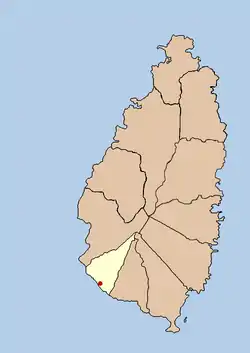
| District | Choiseul District |
| Founded | 18th Century |
| Original name | Anse Citron |
| Founded by | The French |
| Government | |
| • Governing body | Choiseul Village Council |
| Elevation | 58 m (190 ft) |
| Population (2005)[2] | |
| • Total | 6,323 (Choiseul District) |
| Time zone | UTC-4 (Eastern Caribbean Time Zone (ECT)) |
| Area code | 758 |
Choiseul was originally known as Anse Citron, and an independent parish was established in 1765. In 1769 a census was done and recorded 75 whites, 25 free coloured, 512 negroes and 69 estates in Choiseul. However, most activity was originally in the River Dorée area, south-east of Choiseul.
History
An Anglican church at River Dorée was built in 1846 and the first school was opened in 1848. The area was primarily run by English plantation owners and by the end of the 19th century the population was approximately 4,000.
A Catholic church was built in Choiseul village at the end of the 19th century by Father Pierre Prudent René. It took several years to build and by 1914 the church was completed.
Current activities
Today, Choiseul is known for its local arts and crafts such as grass place mats, chairs, coal pots and woven baskets.[3]
References
- ↑ "Weather in Choiseul. Current weather - lc.freemeteo.com". Retrieved 17 March 2017.
- ↑
- ↑ "乳酸菌でアンチエイジング エイジングケアは腸内改善から". Archived from the original on 16 April 2018. Retrieved 17 March 2017.
External links
| External image | |
|---|---|