| Christopher Creek | |
|---|---|
 | |
| Location | |
| Country | United States |
| State | Arizona |
| Physical characteristics | |
| Source | Natural Springs |
| • location | White Mountains, Arizona |
| • coordinates | 34°22′07″N 111°01′18″W / 34.36861°N 111.02167°W[1] |
| • elevation | 6,600 ft (2,000 m) |
| Mouth | Arroyo Valley |
• location | White Mountains |
• coordinates | 34°18′37″N 111°04′23″W / 34.31028°N 111.07306°W[1] |
• elevation | 5,100 ft (1,600 m)[1] |
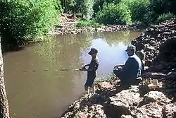
Christopher Creek is located at the base of the Mogollon Rim in the state of Arizona. The nearby town of Christopher Creek is named after this body of water. The closest city Payson is 22 mi (35 km) west of Christopher Creek.
Fish species
External links
References
- Information and Education Division (2007). "Arizona Fishin' Holes". Phoenix, AZ: Arizona Game and Fish Department.
This article is issued from Wikipedia. The text is licensed under Creative Commons - Attribution - Sharealike. Additional terms may apply for the media files.