Ciacova | |
|---|---|
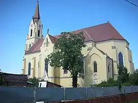
 The Roman Catholic church | |
 Coat of arms | |
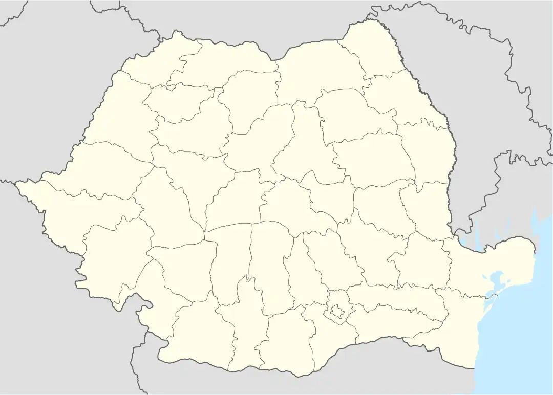
 Location in Timiș County | |
 Ciacova Location in Romania | |
| Coordinates: 45°32′22″N 21°6′44″E / 45.53944°N 21.11222°E | |
| Country | Romania |
| County | Timiș |
| Government | |
| • Mayor (2020–2024) | Petru Filip[1] (PNL) |
| Area | 130 km2 (50 sq mi) |
| Population (2021-12-01)[2] | 5,434 |
| • Density | 42/km2 (110/sq mi) |
| Time zone | EET/EEST (UTC+2/+3) |
| Postal code | 307110–307117 |
| Vehicle reg. | TM |
| Website | www |
Ciacova (Hungarian: Csák; German: Tschakowa; Serbian: Чаково, romanized: Čakovo; Turkish: Çakova) is a town in Timiș County, Romania. It administers four villages: Cebza, Macedonia, Obad and Petroman. When it was declared a town in 2004, the villages of Gad and Ghilad, which it administered up to that point, were split off to form Ghilad commune.
Name
In both Romanian and Hungarian vocabularies, there are the names ceacău (in Romanian), csákó (in Hungarian) and csák (in Old Hungarian):[3]
- ceacău, meaning "tall and hard military cap made of leather or felt"; it was used until the end of World War II by hunting and targeting troops, then only by police troops. It is therefore possible that Ciacova got its name from this word and meant a locality around a defense post.
- csák, meaning "peak". Accepting this translation, the Ciacova Fortress is explained as a "peak of defense" against any enemy intervention from the east or southeast.
Some local historians claim that the name comes from a Dacian word, ending in "-ava" and therefore Ciacava. However, no documents or other evidence can be found to support this thesis. In 1808 János Lipszky claims that the name Ciacova comes from the Romanian language, but does not provide evidence in support of this statement.[3]
| Romanian | Hungarian | German | Serbian | Croatian |
|---|---|---|---|---|
| Cebza | Csebze | Schebsen | Чебза/Čebza | |
| Ciacova | Csák | Tschakowa | Чаково/Čakovo | |
| Macedonia | Macedónia | Macedonia | Мацедонија/Macedonija | Macedonia |
| Obad | Obád | Wildhausen or Obad | ||
| Petroman | Petromány | Petermann |
Geography
Ciacova is located in the Timiș Plain, on Timișul Mort River, about 28 km (17 mi) southwest of Timișoara.
Relief
The relief is flat, with a slight inclination to the southwest in the divagation area of Banat rivers to the Tisa. The Timiș Plain is an accumulation plain originally connected to the Pannonian Plain, formed in the Quaternary by the waters that clogged the Pannonian Lake. This lake was formed by the sinking of a part of the Carpathians in the Mesozoic.
There is only slight dishevelment in the plain. There are small depressions (cenotes), remnants of lakes, ponds or swamps that existed here until the 18th century, when the Austro-Hungarian Empire executed a vast plan of drainage and damming. Today, the remains of these ponds can be seen in the field in the form of slightly deepened circles that are whiter than the black plowed land; these are the so-called salt marshes.
In the Ciacova area, the surface of the various forms of microrelief is occupied 85% by field, 2.5% by cenotes, 3% by valleys, 2% by terraces, 1% by riverbed sands, 0.8% by dry lakes, 0.5% by floodplain and 5.2% by roads, streets and ditches.[4]
Hydrography
Hydrologically, the territory of Ciacova belongs to the reception basin of Timiș. More precisely, Ciacova is located on the left bank of Timișul Mort. Timișul Mort ("Dead Timiș") is the old and natural valley of the Timiș River in the puszta area of Banat. It "died" in the 18th century with the drainage of the Banat swamps, when the Austro-Hungarian Empire artificially created the current anthropic valley of the Timiș by Cebza, Macedonia, etc. Timișul Mort is today a swampy area with small waterholes, ponds full of helophyte plants, rushes, reeds, duckweeds, etc.[4]
Climate
From a climatological point of view, Ciacova is part of the Tisa climate, i.e., a moderate continental climate with slight influences of the Mediterranean and oceanic climates, with relatively mild winters and hot but not excessively dry summers.
The average annual temperature is 11.1 °C (52.0 °F), and the frequency of warm years is higher than that of cool years, due to the fact that Ciacova is south of the annual isotherm of 11 °C. The warmest month is July. The coldest month is January, with an average multiannual temperature of −2.6 °C (27.3 °F).
The winds are determined by the development of baric systems that cross the Banat Plain. These baric systems are: the Azores High, the (winter) Siberian High, the Icelandic Low and the Mediterranean Low. In Ciacova, the dominant winds are the southwest ones.
Due to the cyclonic activity and the humid air invasions from the west, the southwest and the northwest, in Banat the precipitations are more abundant than in the Wallachian Plain. In the Ciacova area the average annual precipitation amount is 588 mm (23.1 in). The season with the richest rainfall is summer, then spring, autumn and winter. Heavy rains during the summer are due to cyclones and humid air masses coming from the Atlantic, to which is added the thermal convection that develops large cumulonimbus clouds from which heavy rains fall. The average number of snowy days is 20 annually. The first snow falls around 29 November, and the last around 14 March (106 days).[4]
Flora
Ciacova is located in the forest-steppe area. Here are plants that belong to the Eurasian, Central European, continental, Mediterranean and Balkan floristic elements. The natural vegetation has been largely changed due to human intervention, being replaced by agricultural crops. In the 18th century, Francesco Griselini mentioned the existence of Quercus forests in this area, with the predominance of sessile oak. Today these forests have been cleared. However, a small patch of forest can still be seen in the village of Macedonia, near the Timiș River. The species here include: Quercus robur, Ulmus glabra, Fraxinus excelsior, Acer campestre, Carpinus betulus, etc. The undergrowth in the forest has as representatives: Crataegus monogyna, Corylus avellana, Prunus spinosa, Cornus sanguinea, Euonymus europaeus, Ligustrum vulgare, hanging plants (Hedera helix, Clematis vitalba), etc.[4]
Gramineae predominate in the grassy layer: Poa pratensis, Festuca pratensis, Dactylis glomerata, etc. Along the Timiș and Timișul Mort there are remains of riverside coppices, but in the meadows there are species of Salix alba, Salix × fragilis, rarely Salix purpurea, Rosa canina and Robinia pseudoacacia. The grassy vegetation in the meadow consists of forage plants: Agrostis gigantea, Lolium perenne, etc. High humidity develops mesophilic and hydrophilic species: Juncus effusus, Carex acuta, Cyperus fuscus, etc. In ponds predominate: Phragmites australis, Typha angustifolia, Iris pseudacorus, etc. In the meadows, isolated specimens of Prunus spinosa and Rosa canina can be found. The pastures in the meadow are of good quality, providing the green mass for the animals.[4]
Fauna
Among the mammals, rodents predominate: hamster, mole rat, hare, otter, ground squirrel, then polecat, fox, badger and wild boar (in Macedonia Forest). Among the raptors are: buzzard, northern goshawk, etc. There are many species of galliformes, passerines and ciconiiformes. In the field can be found crawlers like lizards, and in the waters batrachians such as green frog and moor frog. In the dead arms of Timiș, on Timișul Mort and in Timiș there are fish: carp, pike, rudd, Prussian carp, etc.[4]
History

Ciacova first appears in written history in 1220, when Count Bebich named a certain Chak in his will.[3] The old name is of Hungarian origin and comes from the Csák family. The history of the locality is related to this family, which had extensive estates in the counties of Csanád, Arad, Temes and Zaránd. Some representatives of the family played an important role in the medieval history of Hungary, such as Ugrin Csák, who was metropolitan of Esztergom and prefect of Csanád. The invasion of the Tatars shattered the links of the settlement with the Csák family, and after its destruction, King Béla IV gave it to the Pechenegs and Cumans. In 1285, as a result of the Cuman revolution, Ciacova was liberated again and returned to Miklós Csák. It is very probable that the settlement was re-established at that time, because in the papal tithe records of 1332–1333, Ciacova already had the status of a rural commune.[5] After 1389, when the battle of Kosovo Polje took place on 28 June, the Serbs were defeated by the Turks, and thousands of Serb families fled across the Danube and settled in southern Hungary and Banat; this is how the first Serbs appeared in Ciacova.[6] They formed a separate settlement near the existing town, named Tót-Csák in Hungarian or Csakova in Serbian. Tót means "Slovak" in Hungarian, but Tótorság means Slavonia, as most settlers were Serbs from Drava–Sava area.[3]
Between 1392–1395, a fortress was built here,[6] surrounded by a network of canals, making it difficult to conquer. In 1395, brothers Miklós and György Csáky gave the fortress to King Sigismund of Luxembourg in exchange for property in Transylvania. Miklós even became voivode of Transylvania, and his son Ulászló baptized Matthias Corvinus, the future king of Hungary. On 18 September 1551, Ciacova is conquered by the Turks. The defenders of the fortress were prepared to withstand a long siege, but, according to one hypothesis, the Serbs, who had long been at enmity with the Hungarian chatelaines, betrayed the secrets of the fortress to the Turks. It is true that in this way they prevented the destruction of the fortress and the locality. The Turks built a veritable Turkish quarter in the town, superimposed approximately today by the Fortress' Square, on the land abandoned after the retreat of the Hungarians, south of the fortress. The Ciacova Fortress had a minor strategic importance for the Turks, being located "25 days on horseback" from Istanbul, the capital of the Ottoman Empire. For this reason, the fortress was left to ruin. In 1698–1699 Hamin Pasha brings settlers from Transylvania to Banat, and therefore to Ciacova.[6] Following the Treaty of Karlowitz on 26 January 1699, under the command of Count Wolf of Oettingen, the Ciacova Fortress was destroyed, leaving only the culă (defense tower).[7]

The conquest of Banat by the Habsburgs brought a new direction for the development of the small market town. After 1722, the town was heavily colonized by Germans (Swabians) but also Austrians, Czechs, Slovaks, Luxembourgers, Croats, etc.[3] The first Catholic church was built in 1733. But because Ciacova was repeatedly attacked by the Turks, many settlers left here. Colonization continued and in 1768 Ciacova adopted German as its official language. After 1787, 126 Slovak families were colonized, forming for a long time a large ethnic community and from which the present-day Slovak Street is preserved. At first Ciacova had been run by two separate town halls; in 1820 the German and Serbian town halls were reunited, and since 1823 Ciacova has had the status of a plain town (oppidum).[8]
In 1807, the Ciacova-based Religious Fund was established, which aimed to colonize Hungarians in the Győr, Moson and Szeged areas. But the Hungarians did not become as numerous as the Romanians and Germans. The latter left the town en masse until 1992.
Throughout its history, Ciacova has been a seat of district, plasă, raion and plain town. According to Law no. 83/2004, starting with April 2004, Ciacova received the status of town.[9]
Demographics
Ciacova had a population of 5,348 inhabitants at the 2011 census, up 0.9% from the 2002 census. Most inhabitants are Romanians (79.77%), larger minorities being represented by Hungarians (6.23%), Roma (4.28%), Germans (1.65%) and Serbs (1.23%). For 6.23% of the population, ethnicity is unknown.[10] By religion, most inhabitants are Orthodox (76.8%), but there are also minorities of Roman Catholics (9.78%) and Pentecostals (4.97%). For 6.21% of the population, religious affiliation is unknown.[11]
| Census[12] | Ethnic composition | |||||
|---|---|---|---|---|---|---|
| Year | Population | Romanians | Hungarians | Germans | Roma | Serbs |
| 1880 | 8,882 | 5,151 | 329 | 2,558 | – | 790 |
| 1890 | 9,778 | 5,455 | 518 | 2,971 | – | 670 |
| 1900 | 10,448 | 5,722 | 705 | 3,185 | – | 653 |
| 1910 | 10,128 | 5,749 | 797 | 2,765 | – | 537 |
| 1920 | 9,043 | 5,565 | 523 | 2,463 | – | – |
| 1930 | 8,775 | 5,442 | 594 | 2,160 | 197 | 224 |
| 1941 | 8,515 | 5,288 | 666 | 2,084 | – | – |
| 1956 | 7,955 | – | – | – | – | – |
| 1966 | 8,204 | 5,866 | 749 | 1,196 | 129 | 227 |
| 1977 | 7,173 | 5,163 | 590 | 907 | 248 | 210 |
| 1992 | 5,390 | 4,299 | 457 | 236 | 255 | 121 |
| 2002 | 5,301 | 4,406 | 406 | 126 | 240 | 86 |
| 2011 | 5,348 | 4,266 | 333 | 88 | 229 | 66 |
Economy
The economy has the characteristics of a small industrial-agricultural plain town. The light, textile and food industries are present here. Milling, fruit growing and animal husbandry are also developed.
Twin towns
Ciacova is twinned with:
Notable people
- Dositej Obradović (1742–1811), writer
- Dimitrije Tirol| (1793–1857), writer, grammarian, geographer and painter
- Branko Tanazević (1876–1945), architect
- Zeno Coste (1907–1985), singer
- Spiridon Jovanović
- Stefan Popović (bishop) (c. 1775-1849)
- Emilijan Čarnić (1914-1995)
- Milan Petrović (professor) (1879-1952)
- Emmerich Stoffel (1913–2008), politician
References
- ↑ "Results of the 2020 local elections". Central Electoral Bureau. Retrieved 16 June 2021.
- ↑ "Populaţia rezidentă după grupa de vârstă, pe județe și municipii, orașe, comune, la 1 decembrie 2021" (XLS). National Institute of Statistics.
- 1 2 3 4 5 Merschdorf, Wilhelm Josef (1997). Tschakowa: Marktgemeinde im Banat; Monographie und Heimatbuch. Augsburg: Heimatortsgemeinschaft Tschakowa. ISBN 9783922979449.
- 1 2 3 4 5 6 Stoica, Nicolae. "Date geografice". Primăria orașului Ciacova.
- ↑ Roller, Mihail (1954). Documente privind istoria României: C. Transilvania. Vol. III. Bucharest: Editura Academiei Române. pp. 229, 233, 242.
- 1 2 3 Kovacs Roșu, Florica (19 August 2008). "Cadrul istoric". Primăria orașului Ciacova.
- ↑ "Cetatea Ciacova (jud. Timiș) sau „Chaak, cetatea uitată"". Ziarul Națiunea. 17 April 2018.
- ↑ Bugarski, Stevan (2009). "Ciacova". In Barna, Bodó (ed.). Ghid cronologic al orașelor (PDF). Timișoara: Marineasa. p. 36. ISBN 978-973-631-570-1.
- ↑ "Lege nr. 83 din 5 aprilie 2004 pentru declararea ca orașe a unor comune". Portal Legislativ.
- 1 2 "Tab8. Populația stabilă după etnie – județe, municipii, orașe, comune". Institutul Național de Statistică. Archived from the original on 2016-01-18. Retrieved 2022-01-18.
- 1 2 "Tab13. Populația stabilă după religie – județe, municipii, orașe, comune". Institutul Național de Statistică. Archived from the original on 2020-08-07. Retrieved 2022-01-18.
- ↑ Varga, E. Árpád. "Temes megye településeinek etnikai (anyanyelvi/nemzetiségi) adatai 1880-2002" (PDF). Archived from the original (PDF) on 2007-06-10. Retrieved 2022-01-18.
