Claremont, Mississippi | |
|---|---|
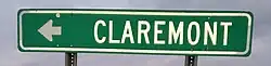 | |
 Claremont  Claremont | |
| Coordinates: 34°07′14″N 90°31′26″W / 34.12056°N 90.52389°W | |
| Country | United States |
| State | Mississippi |
| County | Coahoma |
| Elevation | 164 ft (50 m) |
| Time zone | UTC-6 (Central (CST)) |
| • Summer (DST) | UTC-5 (CDT) |
| ZIP code | 38739 |
| Area code | 662 |
| GNIS feature ID | 668499[1] |
Claremont, also known as Rose,[2] is an unincorporated community located in Coahoma County, Mississippi, United States. Claremont is approximately 2 miles (3.2 km) north of Mattson and approximately 4 miles (6.4 km) south of Clarksdale. Claremont is located on the former Yazoo and Mississippi Valley Railroad.[2] A post office operated under the name Rose from 1904 to 1905 and under the name Claremont from 1905 to 1932.[3]
References
- ↑ U.S. Geological Survey Geographic Names Information System: Claremont, Mississippi
- 1 2 Howe, Tony. "Claremont, Mississippi". Mississippi Rails. Retrieved June 3, 2020.
- ↑ "Coahoma County". Jim Forte Postal History. Retrieved June 3, 2020.
Municipalities and communities of Coahoma County, Mississippi, United States | ||
|---|---|---|
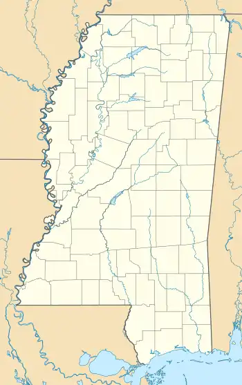
| City | 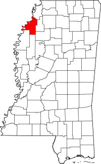 Map of Mississippi highlighting Coahoma County | |
| Towns | ||
| CDPs | ||
| Other communities | ||
| Ghost towns | ||
| Footnotes | ‡This populated place also has portions in an adjacent county or counties | |
This article is issued from Wikipedia. The text is licensed under Creative Commons - Attribution - Sharealike. Additional terms may apply for the media files.