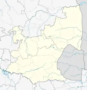
Clewer | |
|---|---|
 Clewer  Clewer | |
| Coordinates: 25°54′24″S 29°07′56″E / 25.90667°S 29.13222°E | |
| Country | South Africa |
| Province | Mpumalanga |
| District | Nkangala |
| Municipality | Emalahleni |
| Area | |
| • Total | 51.70 km2 (19.96 sq mi) |
| Population (2011)[1] | |
| • Total | 4,569 |
| • Density | 88/km2 (230/sq mi) |
| Racial makeup (2011) | |
| • Black African | 88.2% |
| • White African | 8.5% |
| • Coloured | 2.3% |
| • Indian or Asian | 0.6% |
| • Other | 0.2% |
| First languages (2011) | |
| • isiZulu | 33.6% |
| • isiNdebele | 13.8% |
| • Afrikaans | 9.9% |
| • Northern Sotho | 8.9% |
| • Sotho | 7.6% |
| • Swazi | 6.6% |
| • isiXhosa | 6.1% |
| • English | 4.9% |
| • Sign language | 0.3% |
| • Other | 7.8% |
| Time zone | UTC+2 (SAST) |
| PO box | 868006 |
Clewer is a town in the Emalahleni Local Municipality, Nkangala District Municipality in the Mpumalanga Province of South Africa. It is located near Kendal Power Station, surrounded by the farmstead of Tweefontein and the mountain of Doornrug.[2]
As of the 2011 census, Clewer had 1,487 households.[1]
See also
References
This article is issued from Wikipedia. The text is licensed under Creative Commons - Attribution - Sharealike. Additional terms may apply for the media files.