Colchester | |
|---|---|
 Colchester  Colchester  Colchester | |
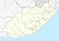
| Coordinates: 33°41′00″S 25°48′00″E / 33.683333°S 25.8°E | |
| Country | South Africa |
| Province | Eastern Cape |
| Municipality | Nelson Mandela Bay |
| Area | |
| • Total | 5.73 km2 (2.21 sq mi) |
| Population (2011)[1] | |
| • Total | 2,073 |
| • Density | 360/km2 (940/sq mi) |
| Racial makeup (2011) | |
| • Black African | 41.8% |
| • Coloured | 20.8% |
| • Indian/Asian | 0.4% |
| • White | 35.9% |
| • Other | 1.2% |
| First languages (2011) | |
| • Afrikaans | 48.5% |
| • Xhosa | 33.2% |
| • English | 14.7% |
| • Other | 3.6% |
| Time zone | UTC+2 (SAST) |
| Postal code (street) | 6175 |
| PO box | 6001 |
Colchester is a town in the Eastern Cape province of South Africa. It forms part of the Nelson Mandela Bay Metropolitan Municipality which governs Gqeberha and surrounding towns and suburbs.
Geography
The small town of Colchester lies about 40 kilometres north-east of Port Elizabeth (since 2021 renamed Gqeberha). It also lies on the N2 about 20 minutes from Port Elizabeth and an 1 hour from Makhanda.[2][3]
It lies on the banks of the Sundays River and the south-eastern border of the Sundays River Valley region.[4]
References
- 1 2 3 4 "Main Place Colchester". Census 2011.
- ↑ "Port Elizabeth Central to Colchester". Port Elizabeth Central to Colchester. Retrieved 1 August 2020.
- ↑ "Grahamstown to Colchester". Grahamstown to Colchester. Retrieved 1 August 2020.
- ↑ "Sundays River Valley". Visit Eastern Cape. Retrieved 1 August 2020.
This article is issued from Wikipedia. The text is licensed under Creative Commons - Attribution - Sharealike. Additional terms may apply for the media files.
.svg.png.webp)