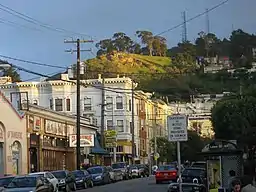
Cole Valley | |
|---|---|
 Cole Valley from below | |
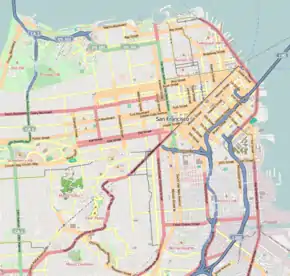
 Cole Valley Location within Central San Francisco | |
| Coordinates: 37°45′53″N 122°26′59″W / 37.76485°N 122.44975°W | |
| Government | |
| • Supervisor | Dean Preston |
| • State Assembly | Matt Haney (D)[1] |
| • State Senator | Scott Wiener (D)[1] |
| • U. S. Rep. | Nancy Pelosi (D)[2] |
| Area | |
| • Total | 0.44 km2 (0.169 sq mi) |
| • Land | 0.44 km2 (0.169 sq mi) |
| Population (2008)[3] | |
| • Total | 4,192 |
| • Density | 9,550/km2 (24,740/sq mi) |
| ZIP Code | 94117 |
| Area codes | 415/628 |
| [3] | |
Cole Valley is a small neighborhood in San Francisco, California. It borders Golden Gate Park to the north, Haight-Ashbury to the northeast, The Castro to the east. and Twin Peaks to the south. Near Kezar Stadium, Cole Valley is the smallest neighborhood in the city.
Location
The neighborhood is bordered on the west by Stanyan Street and the Sutro Forest, on the south by Tank Hill, and on the east by Clayton Street.[4] The main commercial strip is condensed into three blocks along Cole Street and part of Carl Street. This strip includes more than a dozen restaurants and cafés.
Cole Valley is surrounded by the neighborhoods of Inner Sunset, Haight Ashbury, Buena Vista/Ashbury Heights, Corona Heights, Clarendon Heights, and Forest Knolls.
History
Cole Valley grew up around the streetcar stop at the entrance to the Sunset Tunnel at the intersection of Carl and Cole Streets. That intersection is still the center of the neighborhood's small business district, and the N Judah light rail line still stops there.
Cole Valley was popular with dot-commers during the late 1990s dot-com bubble. Craig Newmark, founder of Craigslist, is a former resident. The area is home to young professionals, some University of California, San Francisco residents, staff and neighborhood families since the early 1960s.
References
- 1 2 "Statewide Database". UC Regents. Archived from the original on February 1, 2015. Retrieved December 8, 2014.
- ↑ "California's 11th Congressional District - Representatives & District Map". Civic Impulse, LLC.
- 1 2 3 "Cole Valley neighborhood in San Francisco, California (CA), 94117". City-data.com.
- ↑ "Cole Valley". SFGate. Retrieved 2015-12-28.
External links
![]() Media related to Cole Valley, San Francisco at Wikimedia Commons
Media related to Cole Valley, San Francisco at Wikimedia Commons
.svg.png.webp)