Columbia Airport | |||||||||||||||
|---|---|---|---|---|---|---|---|---|---|---|---|---|---|---|---|
 | |||||||||||||||
| Summary | |||||||||||||||
| Airport type | Public | ||||||||||||||
| Owner | County of Tuolumne | ||||||||||||||
| Location | Columbia, California | ||||||||||||||
| Elevation AMSL | 2,118 ft / 646 m | ||||||||||||||
| Coordinates | 38°01′50″N 120°24′52″W / 38.03056°N 120.41444°W | ||||||||||||||
| Runways | |||||||||||||||
| |||||||||||||||
| Statistics (2011) | |||||||||||||||
| |||||||||||||||
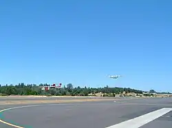
Columbia Airport (IATA: COA, FAA LID: O22) is located a mile southwest of Columbia, in Tuolumne County, California, United States. It is owned by the County of Tuolumne.[1]
Facilities
Columbia Airport covers 356 acres (144 ha) and has two runways: 17/35 is 4,670 x 75 ft (1,423 x 23 m) asphalt and 11/29 is 2,600 x 100 ft (792 x 30 m) turf.[1]
In the year ending August 3, 2011 the airport had 46,020 aircraft operations, average 126 per day: 96% general aviation, 4% air taxi and less than 1% military. 106 aircraft are based at the airport: 91% single engine, 4% helicopter, 3% multi-engine, 1% jet, and 1% ultralight.[1]
Cal Fire Firefighting Air Attack Base
The California Department of Forestry and Fire Protection (Cal Fire) operates an aerial firefighting air attack base at the airport with three fixed wing twin engine turboprop aircraft including one North American Rockwell OV-10 Bronco spotter airplane and two Grumman S-2 Tracker air tankers (S-2T version) which are based at the airfield.[2] Cal Fire also bases a Bell UH-1H "Huey" firefighting helicopter at the airport.[3]
Historical air service
The airport had scheduled passenger airline service operated by Yosemite Airlines, a small commuter air carrier which was based at Columbia Airport, from the mid-1970s to the early 1980s. According to the Official Airline Guide (OAG) as well as the airline's timetables, Yosemite Airlines flew nonstop and direct service between the airport and Sacramento International Airport (SMF), San Francisco International Airport (SFO) and Oakland International Airport (OAK) with small Beechcraft, Cessna and Piper prop aircraft.[4][5][6] The airline's route maps from this same time period also show nonstop service from the airport to Lake Tahoe, Modesto and Stockton.[7]
In 1999, Scenic Air, another commuter airline, was operating daily nonstop service between the airport and Oakland International Airport (OAK) with Grumman Gulfstream I propjet aircraft.[8]
The airport was used as a filming location for several sequences in the 1992 film Radio Flyer. [9]
References
- 1 2 3 4 FAA Airport Form 5010 for O22 PDF, effective 2/9/2012
- ↑ "Columbia Air Attack Base".
- ↑ "Archived copy" (PDF). Archived from the original (PDF) on 2018-05-08. Retrieved 2018-03-23.
{{cite web}}: CS1 maint: archived copy as title (link) - ↑ http://www.departedflights.com, Nov. 15, 1979 & April 1, 1981 editions, Official Airline Guide (OAG), San Francisco-Columbia schedules
- ↑ http://www.timetableimages.com, Jan. 24, 1977 & Dec. 11, 1979 Yosemite Airlines timetables
- ↑ Feb. 1, 1976 Official Airline Guide (OAG)
- ↑ http://www.departedflights.com, Yosemite Airlines route maps
- ↑ http://www.departedflights.com, June 1, 1999 Official Airline Guide (OAG), Oakland-Yosemite National Park schedules
- ↑ "Radio Flyer". Film America.
External links
- Resources for this airport:
- FAA airport information for O22
- AirNav airport information for O22
- ASN accident history for COA
- FlightAware airport information and live flight tracker
- SkyVector aeronautical chart for O22