Columbia Township Gibson County | |
|---|---|
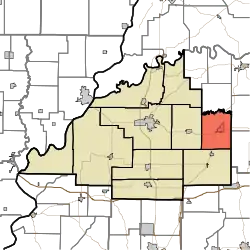 Location in Gibson County | |
| Coordinates: 38°20′07″N 87°21′42″W / 38.33528°N 87.36167°W | |
| Country | United States |
| State | Indiana |
| County | Gibson |
| Township Seat | Oakland City |
| School District | East Gibson School Corporation |
| Government | |
| • Type | Indiana township |
| • Trustee | Shannon Green |
| Area Smallest Township in Gibson County | |
| • Total | 31.03 sq mi (80.4 km2) |
| • Land | 30.49 sq mi (79.0 km2) |
| • Water | 0.55 sq mi (1.4 km2) |
| Elevation | 489 ft (149 m) |
| Population (2014) | |
| • Total | 3,868 |
| • Density | 124.65/sq mi (48.13/km2) |
| Time zone | UTC-6 (CST) |
| • Summer (DST) | UTC-5 (CDT) |
| ZIP code | 47660 |
| Area code | 812 |
| FIPS code | 18-14662[2] |
| GNIS feature ID | 453240 |
Columbia Township is one of ten townships in Gibson County, Indiana. As of the 2010 census, its population was 3,830 and it contained 1,757 housing units.[3] Oakland City is the township seat.
Columbia Township was established in 1825.[4]
Geography
According to the 2010 census, the township has a total area of 31.03 square miles (80.4 km2), of which 30.49 square miles (79.0 km2) (or 98.26%) is land and 0.55 square miles (1.4 km2) (or 1.77%) is water.[3]
Cities and towns
Unincorporated towns
(This list is based on USGS data and may include former settlements.)
Adjacent townships
- Barton Township (south)
- Center Township (west)
- Logan Township (north)
- Patoka Township (east)
- Monroe Township (southeast)
Cemeteries
The township contains one cemetery, Montgomery.
Major highways
Education
Columbia Township is the center of the East Gibson School Corporation.
Primary and secondary schools
- Oakland City Elementary
- Waldo J. Wood Memorial Jr/Sr High School
Higher education
- Oakland City University - Main Campus
Public library
Columbia Township residents may request a free library card at the Oakland City-Columbia Township Public Library in Oakland City.[5]
References
- "Columbia Township, Gibson County, Indiana". Geographic Names Information System. United States Geological Survey, United States Department of the Interior. Retrieved September 24, 2009.
- United States Census Bureau cartographic boundary files
- ↑ "US Board on Geographic Names". United States Geological Survey. October 25, 2007. Retrieved January 31, 2008.
- ↑ "U.S. Census website". United States Census Bureau. Retrieved January 31, 2008.
- 1 2 "Population, Housing Units, Area, and Density: 2010 - County -- County Subdivision and Place -- 2010 Census Summary File 1". United States Census. Archived from the original on February 10, 2020. Retrieved May 10, 2013.
- ↑ Stormont, Gil R. (1914). History of Gibson County, Indiana: Her People, Industries and Institutions. B.F. Bowen. pp. 359.
- ↑ "Policies". Oakland City Columbia Twp. Public Library. Retrieved March 7, 2018.
External links
Municipalities and communities of Gibson County, Indiana, United States | ||
|---|---|---|
| Cities | 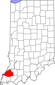 Map of Indiana highlighting Gibson County | |
| Towns | ||
| Townships | ||
| CDPs | ||
| Other communities | ||
| Ghost town | ||
| Footnotes | ‡This populated place also has portions in an adjacent county or counties | |