Conifer, Colorado | |
|---|---|
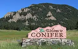
 Sign along Highway 285 | |
 | |
| Coordinates: 39°31′16″N 105°18′19″W / 39.52111°N 105.30528°W[1] | |
| Country | United States |
| State | Colorado |
| County | Jefferson County |
| Settled | 1860s |
| Government | |
| • Type | Unincorporated community |
| Elevation | 8,277 ft (2,523 m) |
| Population (2009 [2]) | |
| • Total | 19,683 [3] |
| Time zone | UTC-7 (MST) |
| • Summer (DST) | UTC-6 (MDT) |
| ZIP code | 80433 [4] |
| Area code(s) | 303 and 720 |
| FIPS code | 08-16770 [1] |
| GNIS feature ID | 0204717 [1] |
| Website | Conifer CoC |
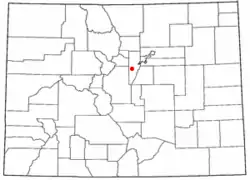
Conifer is an unincorporated community in Jefferson County, Colorado, United States.[1] Conifer is located along U.S. Route 285 in the foothills west of Denver.
History
A post office called Conifer was established in 1894.[5] Some say the community was named after George Conifer, the proprietor of a local tavern, while others believe conifer trees near the original town site caused the name to be selected.[6]
Geography
Conifer is located at 39°31′16″N 105°18′19″W / 39.52111°N 105.30528°W (39.5210995,-105.3052708).[1] A magnitude 3.1 tremor centered on Berrian Mountain about 1 mile north of Conifer occurred on November 1, 1981, at 8:03 p.m. MST.
Climate
Conifer has a humid continental climate (Koppen: Dfb) with a yearly temperature average of 38.6 °F (3.7 °C). Summertime is warm with cool nights, while winter is chilly with nights approaching zero.[7]
| Climate data for Conifer, Colorado | |||||||||||||
|---|---|---|---|---|---|---|---|---|---|---|---|---|---|
| Month | Jan | Feb | Mar | Apr | May | Jun | Jul | Aug | Sep | Oct | Nov | Dec | Year |
| Record high °F (°C) | 65 (18) |
70 (21) |
72 (22) |
78 (26) |
86 (30) |
95 (35) |
95 (35) |
93 (34) |
91 (33) |
83 (28) |
72 (22) |
66 (19) |
95 (35) |
| Mean daily maximum °F (°C) | 38 (3) |
41 (5) |
46 (8) |
53 (12) |
62 (17) |
73 (23) |
78 (26) |
76 (24) |
69 (21) |
59 (15) |
45 (7) |
38 (3) |
57 (14) |
| Mean daily minimum °F (°C) | 7 (−14) |
10 (−12) |
17 (−8) |
23 (−5) |
31 (−1) |
38 (3) |
43 (6) |
42 (6) |
34 (1) |
24 (−4) |
15 (−9) |
9 (−13) |
24 (−4) |
| Record low °F (°C) | −46 (−43) |
−48 (−44) |
−25 (−32) |
−15 (−26) |
6 (−14) |
22 (−6) |
28 (−2) |
26 (−3) |
7 (−14) |
−9 (−23) |
−26 (−32) |
−33 (−36) |
−48 (−44) |
| Average precipitation inches (mm) | 0.40 (10) |
0.54 (14) |
1.28 (33) |
1.92 (49) |
2.10 (53) |
1.76 (45) |
2.55 (65) |
2.68 (68) |
1.25 (32) |
1.15 (29) |
0.89 (23) |
0.58 (15) |
17.1 (436) |
| Average snowfall inches (cm) | 14 (36) |
11.3 (29) |
7.2 (18) |
2.5 (6.4) |
0.6 (1.5) |
0.1 (0.25) |
0 (0) |
0 (0) |
0.2 (0.51) |
1.7 (4.3) |
8.3 (21) |
17.6 (45) |
63.5 (161.96) |
| Source: [8] | |||||||||||||
Landmarks
- The Clifton House Inn, Jefferson County Register of Historic Places
- Conifer Junction Schoolhouse, National Register of Historic Places
- The Conley Coffee Shop, Jefferson County Register of Historic Places
- The Lubin-Blakeslee Place at Meyer Ranch, Conifer, Jefferson County Register of Historic Places
- Midway House at Meyers Ranch, built 1889, National Register of Historic Places 5JF.303
- Original Elk Creek Fire House, Jefferson County Register of Historic Places
- Pleasant Park School, built 1894, Colorado Register of Historic Places 5JF.972
- Yellow Barn at Bradford Junction, built 1918, Jefferson County Register of Historic Places
- Coney Island Hot Dog Stand for many years it was in Aspen Park area of Conifer, but was moved to the nearby community of Bailey.
- Staunton State Park - 3,908-acre state park located 6 miles west of Conifer
Education
Students living within Jefferson County attend Jefferson County schools. Those neighborhood schools are Elk Creek Elementary School, West Jefferson Elementary School, Marshdale Elementary School, West Jefferson Middle School, and Conifer High School. In 2011, Conifer High School was ranked 434 in the top 500 schools in the nation by Newsweek.[9]
Infrastructure
Conifer residents are served by the Elk Creek Fire Protection District, a mixed career/volunteer fire department with approximately 60 active duty firefighters.
Notable people
- Amy Bruckner, American actress
- Trey Parker, South Park co-creator
- Blaine Sumner, American powerlifter
- Sarah Thomas (marathon swimmer), American marathon swimmer
See also
References
- 1 2 3 4 5 6 Geographic Names Information System (GNIS) details for Conifer, Colorado; United States Geological Survey (USGS); October 13, 1978.
- ↑ "Year that population was last estimated". Archived from the original on January 29, 2016. Retrieved January 23, 2016.
- ↑ "Population numbers". Archived from the original on January 29, 2016. Retrieved January 23, 2016.
- ↑ United States Postal Service (2012). "USPS - Look Up a ZIP Code". Retrieved February 15, 2012.
- ↑ "Post offices". Jim Forte Postal History. Archived from the original on March 6, 2016. Retrieved June 25, 2016.
- ↑ Dawson, John Frank (1954). Place names in Colorado: why 700 communities were so named, 150 of Spanish or Indian origin. Denver, CO: The J. Frank Dawson Publishing Co. p. 15.
- ↑ "Conifer climate: Average Temperature, weather by month, Conifer weather averages - Climate-Data.org". en.climate-data.org. Retrieved May 25, 2020.
- ↑ "Intellicast | Weather Underground".
- ↑ "Newsweek 2011 US Best 500 High Schools, Representing Top 2% - A Bridge to Ivy League-Esque Colleges". Newsweek. 2011. Archived from the original on March 18, 2012.
