Corbon | |
|---|---|
Part of Notre-Dame-d'Estrées-Corbon | |
Location of Corbon | |
 Corbon  Corbon | |
| Coordinates: 49°08′49″N 0°00′28″W / 49.1469°N 0.0078°W | |
| Country | France |
| Region | Normandy |
| Department | Calvados |
| Arrondissement | Lisieux |
| Canton | Mézidon Vallée d'Auge |
| Commune | Notre-Dame-d'Estrées-Corbon |
| Area 1 | 4.09 km2 (1.58 sq mi) |
| Population (2019)[1] | 65 |
| • Density | 16/km2 (41/sq mi) |
| Time zone | UTC+01:00 (CET) |
| • Summer (DST) | UTC+02:00 (CEST) |
| Postal code | 14340 |
| Elevation | 5–15 m (16–49 ft) (avg. 10 m or 33 ft) |
| 1 French Land Register data, which excludes lakes, ponds, glaciers > 1 km2 (0.386 sq mi or 247 acres) and river estuaries. | |
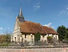
France Normandie Corbon Eglise
Corbon is a former commune in the Calvados department in the Normandy region in northwestern France. In January 2015 it merged with the commune of Notre-Dame-d'Estrées to the new commune Notre-Dame-d'Estrées-Corbon.
Population
| Year | Pop. | ±% |
|---|---|---|
| 1962 | 96 | — |
| 1968 | 82 | −14.6% |
| 1975 | 72 | −12.2% |
| 1982 | 66 | −8.3% |
| 1990 | 65 | −1.5% |
| 1999 | 56 | −13.8% |
| 2008 | 67 | +19.6% |
See also
References
Wikimedia Commons has media related to Corbon (Calvados).
This article is issued from Wikipedia. The text is licensed under Creative Commons - Attribution - Sharealike. Additional terms may apply for the media files.