Fairfax County | |
|---|---|
 Mount Vernon mansion | |
 Flag  Seal 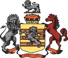 Logo | |
 Location within the U.S. state of Virginia | |
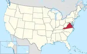 Virginia's location within the U.S. | |
| Coordinates: 38°50′N 77°17′W / 38.83°N 77.28°W | |
| Country | |
| State | |
| Founded | June 19, 1742 |
| Named for | Thomas Fairfax, 6th Lord Fairfax of Cameron |
| Seat | Fairfax (independent city)1 |
| Largest town | Herndon |
| Area | |
| • Total | 406 sq mi (1,050 km2) |
| • Land | 391.02 sq mi (1,012.7 km2) |
| • Water | 15.47 sq mi (40.1 km2) 3.8% |
| Population (2020) | |
| • Total | 1,150,309 |
| • Density | 2,941.82/sq mi (1,135.84/km2) |
| Time zone | UTC−5 (Eastern) |
| • Summer (DST) | UTC−4 (EDT) |
| ZIP Codes | 20120, 20121, 20122, 20124, 20151, 20152, 20153, 20164, 20166, 20170, 20171, 20172, 20190, 20191, 20192, 20194, 20195, 20196, 22003, 22009, 22015, 22018, 22019, 22027, 22030, 22031, 22032, 22033, 22035, 22037, 22038, 22039, 22041, 22042, 22043, 22044, 22046, 22060, 22066, 22067, 22079, 22081, 22082, 22101, 22102, 22106, 22116, 22121, 22124, 22150, 22151, 22152, 22153, 22158, 22159, 22160, 22161, 22180, 22181, 22182, 22183, 22185, 22199, 22203, 22204, 22205, 22206, 22207, 22213, 22302, 22303, 22304, 22306, 22307, 22308, 22309, 22310, 22311, 22312, 22315 |
| Area code | 703, 571 |
| Congressional districts | 8th, 10th, 11th |
| Website | www |
| 1 Administrative and court offices are located in unincorporated areas in Fairfax County | |
Fairfax County, officially the County of Fairfax, is a county in the Commonwealth of Virginia. It is part of Northern Virginia and borders both the city of Alexandria and Arlington County and forms part of the suburban ring of Washington, D.C., the nation's capital. The county is predominantly suburban in character with some urban and rural pockets.
As of the 2020 census, the population was 1,150,309,[1] making it the most populous jurisdiction in Virginia, with around 13% of the state's population, the most populous jurisdiction in the Washington metropolitan area, with around 20% of the MSA population, and the most populous location in the Washington–Baltimore combined statistical area, with around 13% of the CSA population. The county seat is Fairfax; however, because it is an independent city under Virginia law, the city of Fairfax is not part of the county.[2]
Fairfax was the first U.S. county to reach a six-figure median household income and has the fifth-highest median household income among all U.S. counties as of 2020.[3][4] As part of the Washington, D.C. metropolitan area, it is usually included atop or near the top of lists of the wealthiest areas in the United States.[5][6][7]
The county is home to the headquarters of four intelligence agencies, the Central Intelligence Agency, National Geospatial-Intelligence Agency, National Reconnaissance Office, National Counterterrorism Center; the Office of the Director of National Intelligence is also based in the county. In academia, the county is home to the flagship campus of George Mason University, CIA University-Sherman Kent School for Intelligence Analysis, and several Northern Virginia Community College campuses. Seven Fortune 500 companies are headquartered in the county as of 2012.[8]
History
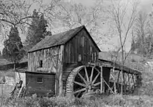

Present-day Fairfax County was initially inhabited by the Algonquian-speaking Doeg tribe.
17th century
In 1608, Captain John Smith documented the Doeg tribe's villages, which included Namassingakent and Nemaroughquand on the south bank of the Potomac River in present-day Fairfax County.[10] By 1670, Virginian colonists from the Northern Neck region drove the Doeg Tribe out of present-day Fairfax County and into Maryland.
18th century
Fairfax County was formed in 1742 from the northern part of Prince William County, and was named after Thomas Fairfax, 6th Lord Fairfax of Cameron, proprietor of the Northern Neck.[11][12] The Fairfax family name is derived from the Old English phrase for "blond hair", Fæger-feax.
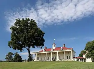
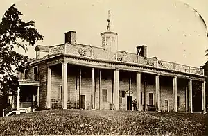
The county's initial settlements were along the Potomac River. George Washington settled in Fairfax County and built his home, Mount Vernon, facing the Potomac. Gunston Hall, the home of George Mason, is nearby. Fort Belvoir is partly on the estate of Belvoir Manor, built along the Potomac by William Fairfax in 1741.
Thomas Fairfax, the only member of the British nobility ever to reside in the colonies, lived at Belvoir before moving to the Shenandoah Valley. The Belvoir mansion and several of its outbuildings were destroyed by fire immediately after the Revolutionary War in 1783, and George Washington noted the plantation complex deteriorated into ruins.
In 1757, the northwestern two-thirds of Fairfax County became Loudoun County. In 1789, part of Fairfax County was ceded to the federal government to form Alexandria County, then part of the District of Columbia.
19th century
Alexandria County was returned to Virginia in 1846, reduced in size by the secession of the independent city of Alexandria in 1870, and renamed Arlington County in 1920.
During the American Civil War the Battle of Chantilly, also known as Ox Hill, part of the Second Battle of Bull Run, was fought within Fairfax County. Other areas of Civil War conflict in the county included Minor's Hill, Munson's Hill, and Upton's Hill.
20th century
The Fairfax County town of Falls Church became an independent city in 1948.[13] The Fairfax County town of Fairfax was named an independent city in 1961.[14]
The federal government's growth during and after World War II spurred rapid growth in the county and transformed it from a rural to suburban region. Large businesses began settling in the county, and the opening of Tysons Corner Center spurred the rise of Tysons Corner. The technology boom and a steady government-driven economy created rapid growth and an increasingly large and diverse population. The economy has also made Fairfax County one of the nation's wealthiest counties.[15]
A general aviation airport along U.S. Route 50 west of Seven Corners, Falls Church Airpark, operated in the county from 1948 to 1960. The facility's 2,650-foot unpaved runway was used extensively by private pilots and civil defense officials. Residential development, multiple accidents, and the demand for retail space led to its closure in 1960.[16][17][18]
Geography
According to the U.S. Census Bureau, the county has an area of 406 square miles (1,050 km2), of which 391 square miles (1,010 km2) is land and 15 square miles (39 km2) (3.8%) is water.[19]
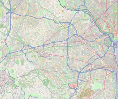
Fairfax County is bounded on the north and southeast by the Potomac River. Across the river to the northeast is Washington, D.C., across the river to the north is Montgomery County, Maryland, and across the river to the southeast are Prince George's County, Maryland and Charles County, Maryland. The county is partially bounded on the north and east by Arlington County and the independent cities of Alexandria and Falls Church. It is bounded on the west by Loudoun County, and on the south by Prince William County.
Most of the county lies in the Piedmont region, with rolling hills and deep stream valleys such as Difficult Run and its tributaries. West of Route 28, the hills give way to a flat, gentle valley that stretches west to the Bull Run Mountains in Loudoun County. Elevations in the county range from near sea level along the tidal sections of the Potomac River in the southeast portion of the county to more than 500 feet (150 m) in the Tysons Corner area.
Adjacent jurisdictions
- Arlington County – east
- Charles County, Maryland – southeast
- City of Alexandria – east
- City of Fairfax – surrounded by Fairfax County
- City of Falls Church – east
- Loudoun County – northwest
- Montgomery County, Maryland – north
- Prince George's County, Maryland – east
- Prince William County – southwest
Geology
The Piedmont hills in the central county are made up of ancient metamorphic rocks such as schist, the roots of several ancestral ranges of the Appalachians. The western valley is floored with more recent shale and sandstone. This geology is similar to adjacent bands of rocks in Maryland and further south in Virginia along the eastern front of the Appalachians.
An area of 11 square miles (30 km2) of the county is known to be underlain with natural asbestos.[20] Much of the asbestos is known to emanate from fibrous tremolite or actinolite. The threat was discovered in 1987, prompting the county to establish laws to monitor air quality at construction sites, control soil taken from affected areas, and require freshly developed sites to lay 6 inches (150 mm) of clean, stable material over the ground.[21][22]
For instance, during the construction of Centreville High School a large amount of asbestos-laden soil was removed and then trucked to Vienna for the construction of the I-66/Nutley Street interchange. Fill dirt then had to be trucked in to make the site level. Marine clays can be found in widespread areas of the county east of Interstate 95, mostly in the Lee and Mount Vernon districts. These clays contribute to soil instability, leading to significant construction challenges for builders.[23]
Government and politics
Fairfax County uses the urban county executive form of government, which county voters approved in a 1966 referendum.[24][25]
Under the urban county executive plan, the county is governed by the 10-member Fairfax County Board of Supervisors with the day-to-day running of the county tasked to the appointed Fairfax County executive.
Nine of the board members are elected from the single-member districts of Braddock, Dranesville, Franconia, Hunter Mill, Mason, Mount Vernon, Providence, Springfield, and Sully, while the chairman is elected at-large.
In addition to the Board of Supervisors, three constitutional officers—the Commonwealth's Attorney, clerk of the Circuit Court and sheriff—and the 12 members of the Fairfax County School Board are directly elected by the voters of Fairfax County.
Fairfax County also has a Consumer Protection Commission. The Commission advises the Board of Supervisors and the Department of Cable and Consumer Services on consumer affairs, investigates illegal, fraudulent, deceptive, or dangerous consumer practices, and refers apparent violations of Virginia law to the Commonwealth Attorney or County Attorney for investigation.[26]
The Fairfax County Government Center is west of the City of Fairfax in an unincorporated area.[27] Fairfax County contains an exclave unincorporated area in the City of Fairfax's central business district, where many county facilities (including the courthouses and jail) are.[28][29]
Fairfax County was once considered a Republican bastion, but in recent years Democrats have made significant inroads, gaining control of the Board of Supervisors and the School Board (officially nonpartisan) as well as the offices of sheriff and Commonwealth's Attorney. Democrats also hold all the Fairfax seats in the Virginia House of Delegates and every seat in the Senate.
Fairfax County encompasses parts of three congressional districts, the 8th District, the 10th District, and the 11th District. Democrats represent all three districts, with Jennifer Wexton representing the 10th, Don Beyer representing the 8th, and Gerry Connolly representing the 11th.
Communities closer to Washington, D.C., generally favor Democrats by a larger margin than outlying communities. In elections in 2000, 2001, and 2005, Fairfax County supported Democrats for U.S. Senate and governor. In 2004, Democratic presidential nominee John Kerry won the county, becoming the first Democrat to do so since Lyndon B. Johnson in 1964 (the last time Democrats carried the state until 2008). Kerry defeated George W. Bush in the county, 53% to 46%.
Democratic gubernatorial candidate Tim Kaine carried Fairfax County with over 60% of the vote in 2005, helping him win 51.7% of the statewide vote. In 2006, U.S. Senate candidate Jim Webb carried the county with 58.9% of the vote while winning the statewide election.
In the state and local elections of November 2007, Fairfax Democrats picked up one seat in the House of Delegates, two seats in the Senate, and one seat on the Board of Supervisors, making their majority there 8–2.
On November 4, 2008, Fairfax County continued its shift towards the Democrats, with Barack Obama and Mark Warner each garnering over 60% of the vote for president and U.S. Senate, respectively. Also, the Fairfax-anchored 11th District United States House of Representatives seat held by Thomas M. Davis for 14 years was won by Gerry Connolly, the Democratic chairman of the Fairfax County Board of Supervisors.
Braddock supervisor Sharon Bulova won a special election on February 3, 2009, to succeed Connolly as chairman of the Board of Supervisors, continuing a Democratic hold on the office that dates to 1995. Delegate David Marsden won a special election on January 12, 2010, to succeed Ken Cuccinelli in the 37th State Senate district.[30] Fairfax County is now represented in the Virginia State Senate by an all-Democratic delegation.[31]
In the 2010 congressional elections, Republican challenger Keith Fimian nearly won the election for the 11th District seat, losing to Connolly by 981 votes out of over 225,000 cast (a margin of 0.4%). Jim Moran and Frank Wolf were reelected, 61%–37% and 63%–35%, respectively.
In 2012, Fairfax County solidly backed Obama for reelection as president, as he nearly matched his 2008 performance, winning the county 59.6% to 39.1%. Former Governor Tim Kaine, running for the U.S. Senate in 2012, carried Fairfax County with 61% of the vote as part of his statewide victory. Representatives Connolly, Moran, and Wolf were also reelected.
Although Republican governor Bob McDonnell won Fairfax County with 51% of the vote in 2009, the Republican resurgence in Fairfax was short-lived. In the 2013 election, Democratic gubernatorial candidate Terry McAuliffe won Fairfax County with 58% of the vote, defeating incumbent state attorney general and former Republican state senator from Fairfax Ken Cuccinelli. McAuliffe's running mates, Ralph Northam and Mark Herring, also carried Fairfax County in their respective bids for lieutenant governor and attorney general. These Democratic victories mirrored the Democratic ticket's sweep of the state's three executive offices for the first time since 1989.
In the 2016 general election, Fairfax continued its trend towards Democratic candidates. Representatives Beyer and Connolly were reelected, the latter unopposed. Fairfax County supported Hillary Clinton for president with 64.4% of the vote to Donald Trump's 28.6%, exemplifying a heavy swing toward Democrats across Northern Virginia.
In 2020, Democratic presidential nominee Joe Biden won the county with 69.89% of the vote, the best percentage for a Democrat in the county since 1916.
| Year | Republican | Democratic | Third party | |||
|---|---|---|---|---|---|---|
| No. | % | No. | % | No. | % | |
| 2020 | 168,401 | 28.03% | 419,943 | 69.89% | 12,479 | 2.08% |
| 2016 | 157,710 | 28.61% | 355,133 | 64.43% | 38,340 | 6.96% |
| 2012 | 206,773 | 39.07% | 315,273 | 59.57% | 7,241 | 1.37% |
| 2008 | 200,994 | 38.93% | 310,359 | 60.12% | 4,901 | 0.95% |
| 2004 | 211,980 | 45.94% | 245,671 | 53.25% | 3,728 | 0.81% |
| 2000 | 202,181 | 48.86% | 196,501 | 47.49% | 15,093 | 3.65% |
| 1996 | 176,033 | 48.19% | 170,150 | 46.58% | 19,080 | 5.22% |
| 1992 | 170,488 | 44.26% | 160,186 | 41.58% | 54,544 | 14.16% |
| 1988 | 200,641 | 61.10% | 125,711 | 38.28% | 2,013 | 0.61% |
| 1984 | 183,181 | 62.88% | 107,295 | 36.83% | 822 | 0.28% |
| 1980 | 137,620 | 57.41% | 73,734 | 30.76% | 28,351 | 11.83% |
| 1976 | 110,424 | 53.62% | 92,037 | 44.69% | 3,496 | 1.70% |
| 1972 | 112,135 | 66.26% | 54,844 | 32.40% | 2,267 | 1.34% |
| 1968 | 57,462 | 48.98% | 44,796 | 38.18% | 15,061 | 12.84% |
| 1964 | 30,755 | 38.68% | 48,680 | 61.22% | 82 | 0.10% |
| 1960 | 28,006 | 51.65% | 26,064 | 48.07% | 149 | 0.27% |
| 1956 | 20,761 | 55.71% | 15,633 | 41.95% | 873 | 2.34% |
| 1952 | 13,020 | 60.90% | 8,329 | 38.96% | 30 | 0.14% |
| 1948 | 4,930 | 51.95% | 3,719 | 39.19% | 840 | 8.85% |
| 1944 | 4,046 | 52.81% | 3,582 | 46.75% | 34 | 0.44% |
| 1940 | 2,371 | 41.89% | 3,263 | 57.65% | 26 | 0.46% |
| 1936 | 1,584 | 34.99% | 2,913 | 64.35% | 30 | 0.66% |
| 1932 | 1,368 | 32.93% | 2,714 | 65.33% | 72 | 1.73% |
| 1928 | 2,507 | 67.10% | 1,229 | 32.90% | 0 | 0.00% |
| 1924 | 765 | 30.00% | 1,586 | 62.20% | 199 | 7.80% |
| 1920 | 987 | 37.71% | 1,598 | 61.06% | 32 | 1.22% |
| 1916 | 472 | 28.33% | 1,179 | 70.77% | 15 | 0.90% |
| 1912 | 187 | 13.98% | 992 | 74.14% | 159 | 11.88% |
| 1908 | 404 | 25.90% | 1,143 | 73.27% | 13 | 0.83% |
| 1904 | 422 | 34.93% | 774 | 64.07% | 12 | 0.99% |
| 1900 | 1,507 | 41.22% | 2,135 | 58.40% | 14 | 0.38% |
| 1896 | 1,877 | 46.74% | 2,109 | 52.51% | 30 | 0.75% |
| 1892 | 1,537 | 41.21% | 2,168 | 58.12% | 25 | 0.67% |
| 1888 | 1,824 | 47.38% | 2,010 | 52.21% | 16 | 0.42% |
| 1884 | 1,681 | 47.17% | 1,883 | 52.83% | 0 | 0.00% |
| 1880 | 1,399 | 44.77% | 1,726 | 55.23% | 0 | 0.00% |
| Position | Name | Party | First Election | District | |
|---|---|---|---|---|---|
| Chairman | Jeff McKay | Democratic | 2019 | At-large | |
| Supervisor | James R. Walkinshaw | Democratic | 2019 | Braddock | |
| Supervisor | John Foust | Democratic | 2007 | Dranesville | |
| Supervisor | Walter L. Alcorn | Democratic | 2019 | Hunter Mill | |
| Supervisor | Rodney L. Lusk | Democratic | 2019 | Lee (now Franconia) | |
| Supervisor | Penelope Gross | Democratic | 1995 | Mason | |
| Supervisor | Daniel "Dan" Storck | Democratic | 2015 | Mount Vernon | |
| Supervisor | Dalia A. Palchik | Democratic | 2019 | Providence | |
| Supervisor | Patrick "Pat" Herrity | Republican | 2007 | Springfield | |
| Supervisor | Kathy Smith | Democratic | 2015 | Sully | |
| Position | Name | Party | First Election | District | |
|---|---|---|---|---|---|
| Sheriff | Stacey Kincaid | Democratic | 2013 | At-large | |
| Commonwealth's Attorney | Steve Descano | Democratic | 2019 | At-large | |
| Clerk of Circuit Court | John T. Frey | Republican | 1991 | At-large | |
| Position | Name | Party | First Election | District | |
|---|---|---|---|---|---|
| Delegate | Kathleen Murphy | Democratic | 2015 | 34 | |
| Delegate | Holly Seibold | Democratic | 2023 | 35 | |
| Delegate | Ken Plum | Democratic | 1977 | 36 | |
| Delegate | David Bulova | Democratic | 2005 | 37 | |
| Delegate | Kaye Kory | Democratic | 2009 | 38 | |
| Delegate | Vivian Watts | Democratic | 1981 | 39 | |
| Delegate | Dan Helmer | Democratic | 2019 | 40 | |
| Delegate | Eileen Filler-Corn | Democratic | 2010 | 41 | |
| Delegate | Kathy Tran | Democratic | 2017 | 42 | |
| Delegate | Mark Sickles | Democratic | 2003 | 43 | |
| Delegate | Paul Krizek | Democratic | 2015 | 44 | |
| Delegate | Elizabeth Bennett-Parker | Democratic | 2021 | 45 | |
| Delegate | Rip Sullivan | Democratic | 2014 | 48 | |
| Delegate | Alfonso Lopez | Democratic | 2011 | 49 | |
| Delegate | Marcus Simon | Democratic | 2013 | 53 | |
| Delegate | Karrie Delaney | Democratic | 2017 | 67 | |
| Delegate | Irene Shin | Democratic | 2021 | 86 | |
| Position | Name | Party | First Election | District | |
|---|---|---|---|---|---|
| Senator | Adam Ebbin | Democratic | 2011 | 30 | |
| Senator | Barbara Favola | Democratic | 2011 | 31 | |
| Senator | Janet Howell | Democratic | 1991 | 32 | |
| Senator | Jennifer Boysko | Democratic | 2019 | 33 | |
| Senator | Chap Petersen | Democratic | 2007 | 34 | |
| Senator | Dick Saslaw | Democratic | 1980 | 35 | |
| Senator | Scott Surovell | Democratic | 2015 | 36 | |
| Senator | Dave Marsden | Democratic | 2010 | 37 | |
| Senator | George Barker | Democratic | 2007 | 39 | |
| Position | Name |
|---|---|
| Commissioner | Harold G. Belkowitz, Esq. |
| Commissioner | Chester J. Freedenthal |
| Vice Chairperson | Denis Gulakowski |
| Commissioner | Dirck A. Hargraves |
| Commissioner | Pratik J. Kharat |
| Commissioner | Dennis Dean Kirk, Esq. |
| Chairperson | Jason J. Kratovil |
| Commissioner | Triston "Chase" O'Savio |
| Commissioner | Michael J. Roark |
| Secretary | Jacqueline G. Rosier |
| Commissioner | Dr. Maurice B. Springer |
| Commissioner | Paul Svab |
Demographics
| Census | Pop. | Note | %± |
|---|---|---|---|
| 1790 | 12,320 | — | |
| 1800 | 13,317 | 8.1% | |
| 1810 | 13,111 | −1.5% | |
| 1820 | 11,404 | −13.0% | |
| 1830 | 9,204 | −19.3% | |
| 1840 | 9,370 | 1.8% | |
| 1850 | 10,682 | 14.0% | |
| 1860 | 11,834 | 10.8% | |
| 1870 | 12,952 | 9.4% | |
| 1880 | 16,025 | 23.7% | |
| 1890 | 16,655 | 3.9% | |
| 1900 | 18,580 | 11.6% | |
| 1910 | 20,536 | 10.5% | |
| 1920 | 21,943 | 6.9% | |
| 1930 | 25,264 | 15.1% | |
| 1940 | 40,929 | 62.0% | |
| 1950 | 98,557 | 140.8% | |
| 1960 | 275,002 | 179.0% | |
| 1970 | 455,021 | 65.5% | |
| 1980 | 596,901 | 31.2% | |
| 1990 | 818,584 | 37.1% | |
| 2000 | 969,749 | 18.5% | |
| 2010 | 1,081,726 | 11.5% | |
| 2020 | 1,150,309 | 6.3% | |
| U.S. Decennial Census[33] 1790–1960[34] 1900–1990[35] 1990–2000[36] 2010[37] 2020[38] | |||
2020 census
| Race / Ethnicity | Pop 1980[39] | Pop 2000[40] | Pop 2010[37] | Pop 2020[38] | % 1980 | % 2000 | % 2010 | % 2020 |
|---|---|---|---|---|---|---|---|---|
| White alone (NH) | 514,330 | 624,296 | 590,622 | 542,001 | 86.17% | 64.38% | 54.60% | 47.12% |
| Black or African American alone (NH) | 34,618 | 81,287 | 96,078 | 108,339 | 5.8% | 8.38% | 8.88% | 9.42% |
| Native American or Alaska Native alone (NH) | 1,235[lower-alpha 1] | 1,834 | 1,843 | 1,437 | 0.21% | 0.19% | 0.17% | 0.12% |
| Asian alone (NH) | 22,463[lower-alpha 2] | 125,585 | 188,737 | 233,858 | 3.76% | 12.95% | 17.45% | 20.33% |
| Pacific Islander alone (NH) | 262[lower-alpha 3] | 616 | 779 | 772 | 0.04% | 0.06% | 0.07% | 0.07% |
| Some Other Race alone (NH) | 2,473 | 3,359 | 7,046 | 0.26% | 0.31% | 0.61% | ||
| Mixed Race/Multi-Racial (NH) | N/A | 26,700 | 31,826 | 57,622 | N/A | 2.75% | 2.94% | 5.01% |
| Hispanic or Latino (any race) | 19,535 | 106,958 | 168,482 | 199,234 | 3.27% | 11.03% | 15.58% | 17.32% |
| Total | 596,901 | 969,749 | 1,081,726 | 1,150,309 | 100.00% | 100.00% | 100.00% |
2010 census
As of 2010, there were 1,081,726 people, 350,714 households, and 250,409 families residing in the county. The population density was 2,455 inhabitants per square mile (948/km2). There were 359,411 housing units at an average density of 910 per square mile (350/km2). The ethnic makeup of the county was:
| Percentage | Ethnic group |
|---|---|
| 62.68% | White |
| 9.17% | Black or African American |
| 0.36% | Native American |
| 17.53% | Asian |
| 0.07% | Pacific Islander |
| 4.54% | other races |
| 3.65% | two or more races. |
| 15.58% | Hispanics or Latinos of any race. |
The largest ancestry groups were:
| Percentage | Ancestry group |
|---|---|
| 11.2% | German |
| 10.2% | Irish |
| 8.6% | English |
| 5.1% | American |
| 5.1% | Italian |
| 4.1% | Indian |
| 4.0% | Salvadoran |
| 3.8% | Korean |
| 3.3% | Sub-Saharan African |
| 2.7% | Vietnamese |
| 2.6% | Polish |
| 2.4% | Chinese |
| 2.4% | Arabs |
| 2.2% | Scottish |
| 1.9% | French |
| 1.8% | Spanish |
| 1.7% | Mexican |
| 1.7% | Bolivian |
| 1.4% | Filipino |
| 1.4% | Russian |
| 1.3% | Scotch-Irish |
| 1.2% | Peruvian |
| 1.1% | Honduran |
| 1.0% | Guatemalan |
| 1.0% | Pakistani |
Ethnic structure of Fairfax County
In 2000, there were 350,714 households, of which 36.30% had children under the age of 18 living with them, 59.40% were married couples living together, 8.60% had a female householder with no husband present, and 28.60% were non-families. 21.40% of all households were made up of individuals, and 4.80% had someone living alone who was 65 years of age or older. The average household size was 2.74 and the average family size was 3.20.
The age distribution was 25.40% under the age of 18, 7.50% from 18 to 24, 33.90% from 25 to 44, 25.30% from 45 to 64, and 7.90% who were 65 years of age or older. The median age was 36 years. For every 100 females, there were 98.60 males. For every 100 females aged 18 and over, there were 96.20 males.
The median income for a household in the county was $81,050, and the median income for a family was $92,146; in a 2007 estimate, these figures rose to $102,460 and $120,804, respectively. Males had a median income of $60,503 versus $41,802 for females. The per capita income for the county was $36,888. About 3.00% of families and 4.50% of the population were below the poverty line, including 5.20% of those under age 18 and 4.00% of those age 65 or over. A more recent report from the 2007 American Community Survey indicated that poverty in Fairfax County, Virginia had risen to 4.9%.[4]
Judged by household median income, Fairfax County is among the highest-income counties in the country, and was first on that list for many years. In the 2000 census, it was overtaken by Douglas County, Colorado. According to 2005 U.S. Census Bureau estimates, it had the second-highest median household income behind neighboring Loudoun County, at $94,610. In 2007, Fairfax County reclaimed its position as the richest county in America, in addition to becoming the first county in American history to have a median household income over $100,000, though not the first jurisdiction.[41] In 2008, Loudoun County reclaimed the top position, with Fairfax County a statistically insignificant second.[42][43] In 2012, Fairfax County's median household income was $108,439.[44]
Fairfax County males have the highest life expectancy in the nation at 81.1 years, while females had the eighth highest at 83.8.[45]
Education
Primary education
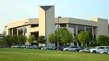
The county is served by the Fairfax County Public Schools system, to which the county government allocates 52.2% of its budget.[46] Including state and federal government contributions, along with citizen and corporate contributions, this brings the 2008 budget for the school system to $2.2 billion.[47] The school system has estimated that, based on the 2008 fiscal year budget, the county will be spending $13,407 on each student.[48]
The Fairfax County Public School system contains the Thomas Jefferson High School for Science and Technology, a Virginia Governor's School. TJHSST consistently ranks at or near the top of all U.S. high schools due to the extraordinary number of National Merit semifinalists and finalists, its students' high average SAT scores, and the number of students who annually perform nationally recognized research in the sciences and engineering. As a Governor's School, TJHSST draws students not only from Fairfax County, but also from Arlington, Loudoun, Fauquier, and Prince William counties, and the City of Falls Church.
Fairfax County is also home to several Catholic elementary and middle schools, which fall under the Roman Catholic Diocese of Arlington. Paul VI Catholic High School is Fairfax County's diocese-run Catholic high school. Oakcrest School is an all-girls Catholic school in Fairfax County, which is not run by the diocese.
Colleges and universities
George Mason University is just outside the city of Fairfax, near the geographic center of Fairfax County. Northern Virginia Community College (NVCC) serves Fairfax County with campuses in Annandale and Springfield and a center in Reston that is a satellite branch of the Loudoun campus. The NVCC Alexandria campus borders Fairfax County. The Central Intelligence Agency University and its Sherman Kent School for Intelligence Analysis are both located in Fairfax County, specifically in Chantilly and Reston respectively. The University of Fairfax, a for-profit proprietary college and alleged diploma mill was once headquartered in Vienna, Virginia.[49][50] Virginia Commonwealth University's School of Medicine recently constructed a medical campus wing at Inova Fairfax Hospital in order to allow third- and fourth-year medical students to study at other state-of-the-art facilities in Northern Virginia.[51]
Economy

Fairfax County's economy revolves around professional services and technology. Many residents work for the government or contractors of the federal government. The government is the largest employer, with Fort Belvoir in southern Fairfax the county's single largest source of federal employment. Fairfax County has a gross county product of approximately $95 billion.
Major employers in the county include Volkswagen Group of America, Hilton Worldwide,[53] DXC Technology (formerly Computer Sciences Corporation), Northrop Grumman, Science Applications International Corporation (SAIC), Leidos, Booz Allen Hamilton, Gannett, Capital One, General Dynamics, ICF International, Freddie Mac, Sallie Mae, ManTech International, Mars, NII and NVR. The county is home to seven Fortune 500 company headquarters,[54] 11 Hispanic 500 companies,[55] and five companies on the Black Enterprise 500 list.
The county's economy is supported by the Fairfax County Economic Development Authority, which provides services and information to promote Fairfax County as a leading business and technology center. The FCEDA is the nation's largest non-state economic development authority. Fairfax County is also home to the Northern Virginia Technology Council, a trade association for local technology companies.[56][57] Fairfax County has a higher concentration of high-tech workers than Silicon Valley.[58]
Tysons
_from_the_overpass_for_Virginia_State_Route_694_(Lewinsville_Road)_in_Mclean%252C_Fairfax_County%252C_Virginia%252C_with_the_skyline_of_Tysons_Corner_visible_in_the_distance.jpg.webp)
The Tysons in the county is Virginia's largest office market and the nation's largest suburban business district, with 26,600,000 square feet (2,470,000 m2) of office space.[59][60] It is the country's 12th-largest business district and is expected to grow substantially in the coming decades. It contains a quarter of the county's total office space inventory, which was 105,200,000 square feet (9,770,000 m2) as of 2006, representing roughly the same size as the Lower Manhattan region of New York City.[61] Forbes wrote that the area is "often described as the place where the Internet was invented, but today it looks increasingly like the center of the global military-industrial complex",[62] because it is home to the nation's first ISPs, many of which are now defunct, and attracts numerous defense contractors that have relocated from other states to or near Tysons Corner.
Tysons draws over 100,000 workers from around the Washington metropolitan region. It also draws 55,000 shoppers daily to its two super-regional malls, Tysons Corner Center and Tysons Galleria. Washington, D.C., in comparison, draws approximately 62,500 shoppers daily.
After years of stalling and controversy, the $5.2 billion expansion of the Washington Metro Silver Line in Virginia from Washington, D.C., to Dulles International Airport was funded by the Federal Transit Administration in December 2008.[63] The Silver Line added four stations in Tysons, including a station between Tysons Corner Center and Tysons Galleria.
Along with the expansion of Washington Metro, Fairfax County government has a plan to "urbanize" the Tysons area. The plan calls for a private-public partnership and a grid-like street system to make Tysons a more urban environment, tripling available housing to allow more workers to live near their workplaces. The goal is to have 95% of Tysons Corner within 1⁄2-mile (800 m) of a metro station.[64]
Employment
Fairfax County's average weekly wage during the first quarter of 2005 was $1,181, 52% more than the national average.[65] By comparison, the average weekly wage was $1,286 for Arlington—the Washington metropolitan area's highest—$1,277 for Washington, D.C., and $775 for the U.S. as a whole.[65] The types of jobs available in the area make it very attractive to highly educated workers. The relatively high wages may be partially due to the area's high cost of living.[65]
In early 2005, Fairfax County had 553,107 total jobs, up from 372,792 in 1990. In the area, this is second to Washington's 658,505 jobs in 2005 (down from 668,532 in 1990).[65]
As of the 2002 Economic Census, Fairfax County has the largest professional, scientific, and technical service sector in the Washington, D.C., area—in terms of the number of business establishments; total sales, shipments, and receipts; payrolls; and number of employees—exceeding the next-largest, Washington, D.C., by roughly a quarter overall, and double that of neighboring Montgomery County.[66]
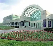
The headquarters of the Central Intelligence Agency (CIA) are in Langley, on Fairfax County's northeastern border.
Top employers
According to the county's 2021 Comprehensive Annual Financial Report,[67] the county's largest employers are:
| # | Employer | # of Employees | % of Total County Employment |
|---|---|---|---|
| 1 | Federal Government | 26,543 | 4.30 |
| 1 | Fairfax County Public Schools | 25,389 | 4.12 |
| 3 | Fairfax County Government | 12,128 | 1.97 |
| 4 | Inova Health System | 10,000-12,000 | 1.78 |
| 5 | George Mason University | 5,000-9,999 | 1.22 |
| 6 | Booz Allen Hamilton | 5,000-9,999 | 1.22 |
| 7 | Amazon | 5,000-9,999 | 1.22 |
| 8 | Federal Home Loan Mortgage Corporation | 5,000-9,999 | 1.22 |
| 9 | SAIC | 5,000-9,999 | 1.22 |
| 10 | Capital One | 5,000-9,999 | 1.22 |
Arts and culture
Annual festivals include the "Celebrate Fairfax!" festival held in June at the Fairfax County Government Center in Fairfax City, the Northern Virginia Fine Arts Festival[68] held in May at the Reston Town Center in Reston, and the International Children's Festival held in September at the Wolf Trap National Park for the Performing Arts, which features a performing arts center outside Vienna.
Fairfax County supports a summer concert series held in multiple venues throughout the county on various nights. The concert series are called Arts in the Parks, Braddock Nights, Lee District Nights, Mt. Vernon Nights, Nottoway Nights, Spotlight by Starlight, Sounds of Summer and Starlight Cinema.[69]
Capital One Hall, which is part of the Capital One Headquarters Complex in Tysons, is a major performing arts center. The space holds performances from a variety of musicians and performing artists across various fields. The Hall opened in 2021 and seats 1,600 in its main theater.
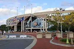
EagleBank Arena (originally the Patriot Center), on the Fairfax campus of George Mason University just outside the City of Fairfax, hosts concerts and shows. The nearby Center for the Arts at George Mason is a major year-round arts venue, and the Workhouse Arts Center in Lorton, Virginia includes studios for artists, event facilities for performing groups, and gallery exhibitions in addition to hosting the annual Clifton Film Festival.[70] Smaller local art venues include:
- Alden Theater at the McLean Community Center
- ArtSpace Herndon
- Center Stage at the Reston Community Center
- Greater Reston Arts Center
- James Lee Community Center Theater
- Vienna Arts Society
Transportation
Roads
Several major highways run through Fairfax County, including the Capital Beltway (Interstate 495), Interstate 66, Interstate 95, and Interstate 395. The American Legion Bridge connects Fairfax to Montgomery County, Maryland. The George Washington Memorial Parkway, Dulles Toll Road, and Fairfax County Parkway are also major arteries. Other notable roads include Braddock Road, Old Keene Mill Road, Little River Turnpike, State Routes 7, 28, and 123, and U.S. Routes 1, 29, and 50.
The county is in the Washington, D.C., metro area, the nation's third most congested area.[71][72][73]
Northern Virginia, including Fairfax County, is the third worst congested traffic area in the nation, in terms of percentage of congested roadways and time spent in traffic. Of the lane miles in the region, 44 percent are rated "F" or worst for congestion. Northern Virginia residents spend an average of 46 hours a year stuck in traffic.
Major highways
_from_the_overpass_for_Virginia_State_Route_789_(Commerce_Street)_in_Springfield%252C_Fairfax_County%252C_Virginia.jpg.webp)
|
Air
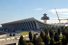
Washington Dulles International Airport lies partly within Fairfax County and provides most air service to the county. Fairfax is also served by two other airports in the Washington area, Ronald Reagan Washington National Airport and Baltimore-Washington International Thurgood Marshall Airport. Manassas Regional Airport, in neighboring Prince William County, is also used for regional cargo and private jet service.
From 1945 to 1961, the eastern part of Fairfax County hosted Falls Church Airpark, an airfield primarily used for general aviation and civil defense purposes until encroaching residential development forced its closure.[74] The area the airport occupied is now mainly used as a shopping center, with the western end of the complex occupied by the Thomas Jefferson branch of the Fairfax County Public Library system. Parts of several apartment complexes are also on some of the airport's former grounds.[16][17]
Public transportation
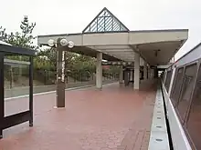
Fairfax County has multiple public transportation services, including the Washington Metro's Orange, Blue, Yellow, and Silver lines. The Silver line, which runs through the Tysons, Reston, and Herndon areas of the county, opened in 2014, later extended in 2022, as the first new Washington Metro line since the Green Line opened in 1991.[75]
In addition, the VRE (Virginia Railway Express) provides commuter rail service to Union Station in Washington, D.C., with stations in Fairfax County. The VRE's Fairfax County stations are Lorton and Franconia/Springfield on the Fredericksburg line, and Burke Centre, Rolling Road, and Backlick Road on the Manassas line.[76]
Fairfax County contracts its bus service, the Fairfax Connector, to Transdev. The county is also served by WMATA's Metrobus service.
Parks and recreation
The county has many protected areas, a total of over 390 county parks on more than 23,000 acres (93 km2).[77] The Fairfax County Park Authority maintains parks and recreation centers through the county. There are also two national protected areas that are inside the county at least in part, including the Elizabeth Hartwell Mason Neck National Wildlife Refuge, the George Washington Memorial Parkway, and Wolf Trap National Park for the Performing Arts. The Mason Neck State Park is also in Lorton.
Fairfax County is a member of the Northern Virginia Regional Park Authority.
The Reston Zoo is in Reston, Virginia.[78] The National Zoo is nearby in Washington, D.C.
Trails
The county maintains many miles of bike trails running through parks, adjacent to roads and through towns such as Vienna and Herndon. The Washington & Old Dominion Railroad Trail runs through Fairfax County, offering one of the region's best, and safest, routes for recreational walking and biking. In addition, nine miles (14 km) of the Mount Vernon Trail runs through Fairfax County along the Potomac River.
Compared to other regions of the Washington area, Fairfax County has a dearth of designated bike lanes for cyclists wishing to commute in the region. On May 16, 2008, Bike-to-Work Day, the Fairfax County Department of Transportation released the first countywide bicycle route map.[79]
The Fairfax Cross County Trail runs from Great Falls National Park in the county's northern end to Occoquan Regional Park in the southern end. Consisting of mostly dirt paths and short asphalt sections, the trail is used mostly by recreational mountain bikers, hikers, and horse riders.
Communities

Three incorporated towns, Clifton, Herndon, and Vienna, are in Fairfax County.[80]
The independent cities of Falls Church and Fairfax were formed out of areas formerly under Fairfax County's jurisdiction but are politically separate. Nevertheless, the Postal Service has long considered several portions of Fairfax County to be unincorporated Falls Church and Fairfax City. Several portions of the county also have Alexandria mailing addresses; many locals refer to these neighborhoods collectively as "South Alexandria", "Lower Alexandria", or "Alexandria, Fairfax County".[81] "South Alexandria" communities include Hollin Hills, Franconia, Groveton, Hybla Valley, Huntington, Belle Haven, Mount Vernon, Fort Hunt, Engleside, Burgundy Village, Waynewood, Wilton Woods, Rose Hill, Virginia Hills, Hayfield, and Kingstowne.
It has been proposed[82] to convert the entire county into a single independent city, primarily to gain more control over taxes and roads. The most recent such proposal was made on June 30, 2009.
Other communities in Fairfax County are unincorporated areas. Virginia law dictates that no unincorporated area of a county may be incorporated as a separate town or city following the adoption of the urban county executive form of government.[83] Fairfax County adopted the urban county executive form of government in 1966.[24][25]
As of the 2000 census, Fairfax County's 13 largest communities are all unincorporated CDPs, the largest of which are Centreville, Reston, and McLean, each with a population over 45,000. (The largest incorporated place in the county is Herndon, its 14th-largest community.)
Census-designated places
The following localities in Fairfax County are identified by the U.S. Census Bureau as unincorporated Census-designated places:[84]
- Annandale
- Bailey's Crossroads
- Belle Haven
- Braddock
- Bull Run
- Burke
- Burke Centre
- Centreville
- Chantilly
- Crosspointe
- Difficult Run
- Dranesville
- Dunn Loring
- Fair Lakes
- Fair Oaks
- Fairfax Station
- Floris
- Fort Belvoir
- Fort Hunt
- Franconia
- Franklin Farm
- George Mason
- Great Falls
- Great Falls Crossing
- Greenbriar
- Groveton
- Hayfield
- Huntington
- Hutchison
- Hybla Valley
- Idylwood
- Kings Park
- Kings Park West
- Kingstowne
- Lake Barcroft
- Laurel Hill
- Lincolnia
- Long Branch
- Lorton
- Mantua
- Mason Neck
- McLean
- McNair
- Merrifield
- Mount Vernon
- Navy
- Newington
- Newington Forest
- North Springfield
- Oakton
- Pimmit Hills
- Ravensworth
- Reston
- Rose Hill
- Seven Corners
- South Run
- Springfield
- Sully Square
- Tysons
- Union Mill
- Wakefield
- West Falls Church
- West Springfield
- Wolf Trap
- Woodburn
- Woodlawn
Other unincorporated communities
|
|
|
|
Population ranking
The population ranking of the following table is based on 2020 United States Census Bureau data.[85]
† county seat
| Rank | City/Town/etc. | Municipal type | Population (2020) |
|---|---|---|---|
| 1 | Centreville | CDP | 73,518 |
| 2 | Reston | CDP | 63,226 |
| 3 | McLean | CDP | 50,773 |
| 4 | Annandale | CDP | 43,363 |
| 5 | Burke | CDP | 42,312 |
| 6 | Oakton | CDP | 36,732 |
| 7 | Fair Oaks | CDP | 34,052 |
| 8 | Springfield | CDP | 31,339 |
| 9 | West Falls Church | CDP | 30,243 |
| 10 | Bailey's Crossroads | CDP | 24,749 |
| 11 | Herndon | Town | 24,655 |
| 12 | West Springfield | CDP | 24,369 |
| 13 | Chantilly | CDP | 24,301 |
| 14 | Tysons | CDP | 24,261 |
| 15 | † Fairfax | City | 24,146 |
| 16 | Lincolnia | CDP | 22,922 |
| 17 | McNair | CDP | 21,598 |
| 18 | Rose Hill | CDP | 21,045 |
| 19 | Merrifield | CDP | 20,488 |
| 20 | Lorton | CDP | 20,072 |
| 21 | Woodlawn | CDP | 20,859 |
| 22 | Franklin Farm | CDP | 19,189 |
| 23 | Franconia | CDP | 18,943 |
| 24 | Idylwood | CDP | 17,954 |
| 25 | Fort Hunt | CDP | 17,231 |
| 26 | Kingstowne | CDP | 16,825 |
| 27 | Wolf Trap | CDP | 16,496 |
| 28 | Vienna | Town | 16,473 |
| 29 | Hybla Valley | CDP | 16,319 |
| 30 | Great Falls | CDP | 15,953 |
| 31 | Groveton | CDP | 15,725 |
| 32 | Huntington | CDP | 13,749 |
| 33 | Kings Park West | CDP | 13,465 |
| 34 | Newington | CDP | 13,223 |
| 35 | Newington Forest | CDP | 12,957 |
| 36 | Mount Vernon | CDP | 12,914 |
| 37 | Fairfax Station | CDP | 12,420 |
| 38 | Wakefield | CDP | 11,805 |
| 39 | Dranesville | CDP | 11,785 |
| 40 | George Mason | CDP | 11,162 |
| 41 | Difficult Run | CDP | 10,600 |
| 42 | Lake Barcroft | CDP | 9,770 |
| 43 | Dunn Loring | CDP | 9,464 |
| 44 | Seven Corners | CDP | 9,131 |
| 45 | Woodburn | CDP | 8,797 |
| 46 | Greenbriar | CDP | 8,421 |
| 47 | Fair Lakes | CDP | 8,404 |
| 48 | Floris | CDP | 8,341 |
| 49 | Laurel Hill | CDP | 8,307 |
| 50 | Long Branch | CDP | 7,890 |
| 51 | Fort Belvoir | CDP | 7,637 |
| 52 | Mantua | CDP | 7,503 |
| 53 | North Springfield | CDP | 7,430 |
| 54 | Bull Run | CDP | 6,972 |
| 55 | Belle Haven | CDP | 6,851 |
| 56 | Pimmit Hills | CDP | 6,569 |
| 57 | Braddock | CDP | 6,549 |
| 58 | South Run | CDP | 6,462 |
| 59 | Hutchison | CDP | 6,231 |
| 60 | Crosspointe | CDP | 5,722 |
| 61 | Union Mill | CDP | 4,997 |
| 62 | Kings Park | CDP | 4,537 |
| 63 | Navy | CDP | 4,327 |
| 64 | Hayfield | CDP | 4,154 |
| 65 | Ravensworth | CDP | 2,680 |
| 66 | Sully Square | CDP | 2,300 |
| 67 | Mason Neck | CDP | 2,025 |
| 68 | Great Falls Crossing | CDP | 1,392 |
| 69 | Clifton | Town | 243 |
Notable people
|
Historic figures
Politicians
Professionals
Sports figures
|
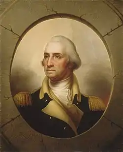 George Washington lived at Mount Vernon in Fairfax County. 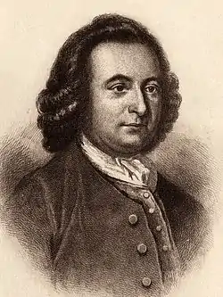 George Mason lived at Gunston Hall in Fairfax County.
Entertainers
Other
|
Sister cities
Fairfax County's sister cities are:[96]
 Songpa (Seoul), South Korea (2009)
 Harbin, China (2009)
 Keçiören (Ankara), Turkey (2012)
See also
- Fairfax County Chamber of Commerce
- Fairfax County Economic Development Authority
- Fairfax County Fire and Rescue Department
- Fairfax County Police Department
- Fairfax County Sheriff's Office
- List of companies headquartered in Northern Virginia
- List of federal agencies in Northern Virginia
- National Register of Historic Places listings in Fairfax County, Virginia
Explanatory notes
- ↑ Includes all people who gave "American Indian", "Eskimo", or "Aleut" as their race, regardless of Hispanic identity.
- ↑ Includes all people who gave "Japanese", "Chinese", "Filipino", "Korean", "Asian Indian", or "Vietnamese" as their race, regardless of Hispanic identity.
- ↑ Includes all people who gave "Hawaiian", "Guamanian", or "Samoan" as their race, regardless of Hispanic identity.
Notes
- ↑ "U.S. Census Bureau QuickFacts: Fairfax County, Virginia". United States Census Bureau. Retrieved November 7, 2021.
- ↑ "Find a County". National Association of Counties. Retrieved September 15, 2019.
- ↑ Morello, Carol; Keating, Dan (December 2010). "D.C. region is nation's richest, most educated". The Washington Post. Retrieved December 18, 2010.
- 1 2 Bishaw, Alemayehu; Semega, Jessica (August 2008). "Income, Earnings, and Poverty Data From the 2007 American Community Survey" (PDF). American Community Survey Reports. p. 7. Archived from the original (PDF) on May 5, 2010. Retrieved April 25, 2010.
- ↑ Stebbins, Samuel; Sauter, Michael B. "25 richest cities in America: Does your metro area make the list?". USA Today. Gannett. Retrieved July 30, 2022.
- ↑ Schmidt, Ann (December 18, 2019). "The 20 wealthiest counties in the U.S., including these Washington, DC, suburbs: Report". Fox Business. Fox News Media. Retrieved September 12, 2022.
- ↑ Burrows, Dan (August 2, 2021). "The 10 "Real" Richest Counties in the U.S." Kiplinger. Future plc. Retrieved September 25, 2022.
- ↑ Brett Krasnove (May 9, 2014). "Fortune 500". Fortune. Retrieved March 16, 2016.
- ↑ Bamberger, Shelomoh, ha-Le?vi, Waters-Son, and West & Johnston. "Map of battles on Bull Run, near Manassas, on the line of Fairfax & Prince William Counties, in Virginia, fought between the forces of the Confederate States and of the United States of America." Map. 1861. Norman B. Leventhal Map Center, https://collections.leventhalmap.org/search/commonwealth:xg94j217q (accessed June 26, 2017).
- ↑ Swanton, John R. (1952), The Indian Tribes of North America, Smithsonian Institution, pp. 67–69, ISBN 978-0-8063-1730-4, OCLC 52230544
- ↑ Gannett, Henry (1905). The Origin of Certain Place Names in the United States. Govt. Print. Off. pp. 123.
- ↑ "The Historical Society of Fairfax County Virginia". Fairfax County Historical Society. Retrieved January 25, 2010.
- ↑ About Falls Church Archived July 21, 2009, at the Wayback Machine Retrieved June 10, 2009
- ↑ "City History". City of Fairfax. Archived from the original on May 5, 2006. Retrieved April 25, 2010.
- ↑ Matt Woolsey (January 22, 2008). "America's Richest Counties". Forbes. Retrieved January 25, 2010.
- 1 2 Freeman, Paul "Falls Church Airpark, Falls Church, VA" Abandoned & Little-Known Airfields. Retrieved March 19, 2014
- 1 2 Rollo, Vera (2003) Virginia Airports: A Historical Survey of Airports and Aviation From the Earliest Days. Richmond, VA: Virginia Aviation Historical Society Archived July 23, 2015, at the Wayback Machine
- ↑ Day, Kathleen (September 21, 1987) "Small Airports Nosediving in Number" The Washington Post, page B1
- ↑ "US Gazetteer files: 2010, 2000, and 1990". United States Census Bureau. February 12, 2011. Retrieved April 23, 2011.
- ↑ "Naturally Occurring Asbestos in Fairfax County, Virginia". Fairfax County. Retrieved September 5, 2016.
- ↑ Janet Raloff (July 8, 2006). "Dirty Little Secret". Science News Online. Archived from the original on January 16, 2008. Retrieved April 26, 2010.
- ↑ C. James Dusek and John M. Yetman. "Control and Prevention of Asbestos Exposure from Construction in Naturally Occurring Asbestos" (PDF). Archived from the original (PDF) on September 27, 2006. Retrieved July 12, 2013.
- ↑ "Overcoming Problems with Marine Clays". Fairfax County. Archived from the original on April 7, 2010. Retrieved April 25, 2010.
- 1 2 "Voters in Fairfax Will Get 5 Ballots". The Washington Post. October 13, 1966. ProQuest 142900460.
- 1 2 Burchard, Hank (February 8, 1967). "Redistricting of Fairfax Offers Something to Please Everyone". The Washington Post. ProQuest 143222311.
- 1 2 "Consumer Protection Commission | Cable and Consumer Services". www.fairfaxcounty.gov. Retrieved August 8, 2023.
- ↑ "Facilities & Locations". Fairfax County. Archived from the original on March 22, 2009. Retrieved April 4, 2009.
- ↑ "Fairfax city, Virginia". U.S. Census Bureau. Archived from the original on December 18, 2005. Retrieved April 4, 2009.
- ↑ "Fairfax County General District Court". Fairfax County. Archived from the original on March 31, 2009. Retrieved April 4, 2009.
- ↑ "Democrats claim GOP Fairfax seat in Virginia Senate". The Washington Post.
- ↑ Kravitz, Denny (January 13, 2010). "Democrat wins Va. Senate race". The Washington Post. Retrieved April 25, 2010.
- ↑ Leip, David. "Dave Leip's Atlas of U.S. Presidential Elections". uselectionatlas.org.
- ↑ "Census of Population and Housing from 1790-2000". US Census Bureau. Retrieved January 24, 2022.
- ↑ "Historical Census Browser". University of Virginia Library. Retrieved January 2, 2014.
- ↑ "Population of Counties by Decennial Census: 1900 to 1990". United States Census Bureau. Retrieved January 2, 2014.
- ↑ "Census 2000 PHC-T-4. Ranking Tables for Counties: 1990 and 2000" (PDF). United States Census Bureau. Archived (PDF) from the original on October 9, 2022. Retrieved January 2, 2014.
- 1 2 "P2 HISPANIC OR LATINO, AND NOT HISPANIC OR LATINO BY RACE - 2010: DEC Redistricting Data (PL 94-171) - Fairfax County, Virginia". United States Census Bureau.
- 1 2 "P2 HISPANIC OR LATINO, AND NOT HISPANIC OR LATINO BY RACE - 2020: DEC Redistricting Data (PL 94-171) - Fairfax County, Virginia". United States Census Bureau.
- ↑ "1980 census of population" (PDF). United States Census Bureau.
- ↑ "P004HISPANIC OR LATINO, AND NOT HISPANIC OR LATINO BY RACE [73] - Fairfax County, Virginia". United States Census Bureau.
- ↑ Archived December 14, 2014, at the Wayback Machine United Way of the National Capital Area – Fairfax/Falls Church Retrieved September 26, 2010
- ↑ "Mansions for Sale in Virginia". The Luxury Brokers. Retrieved April 26, 2010.
- ↑ Fairfax County QuickFacts from the US Census Bureau Archived July 13, 2011, at the Wayback Machine. Quickfacts.census.gov. Retrieved on August 16, 2013.
- ↑ "WTOP: Washington, DC's Top News, Traffic, and Weather". WTOP. November 18, 2014. Retrieved March 16, 2016.
- ↑ "Fairfax County Budget – FY 2007" (PDF). Fairfax County. February 27, 2006. Archived (PDF) from the original on October 9, 2022. Retrieved August 2, 2008.
- ↑ "Office of Budget Services". Fairfax County Public Schools. Archived from the original on May 10, 2010. Retrieved April 25, 2010.
- ↑ "Fairfax County Public Schools - Moved". Archived from the original on March 3, 2016. Retrieved March 16, 2016.
- ↑ "List of Black Listed Universities in USA". MS in US. Retrieved June 4, 2023.
- ↑ du Plessis, Carien (March 1, 2015). "SA's US ambassador in new 'dodgy degree' drama". News24. Retrieved June 4, 2023.
- ↑ "VCU School of Medicine – Inova Campus". Virginia Commonwealth University. Archived from the original on May 13, 2009. Retrieved April 30, 2009.
- ↑ "Fairfax County high school ranked the best in the nation; two other county schools..." Editorial. Reuters. November 30, 2007. Archived from the original on February 19, 2009. Retrieved March 16, 2016.
- ↑ Frederick, Missy (February 4, 2009). "Hilton Hotels picks Fairfax County for new HQ Read more: Hilton Hotels picks Fairfax County for new HQ – Los Angeles Business from bizjournals". Washington Business Journal. Retrieved April 25, 2010.
- ↑ "Fortune 500: Our Annual Ranking of America's Largest Corporations". CNN Money. Retrieved April 25, 2010.
- ↑ Echols, Tucker (July 21, 2009). "Hispanic businesses boosting Fairfax County". Washington Business Journal. Retrieved April 25, 2010.
- ↑ "Microsoft's Bill Gates Selects March 13 NVTC Titans Breakfast as Forum for Providing His Perspective on the Future of Technology Innovation". Reuters (via PR Newswire). March 11, 2008. Archived from the original on February 17, 2009. Retrieved April 25, 2010.
- ↑ "Meg Whitman, Former CEO and President of eBay Addresses Crowd of Approximately 800 at NVTC's TechCelebration Annual Banquet". Northern Virginia Technology Council. October 27, 2008. Archived from the original on January 3, 2009. Retrieved May 3, 2009.
- ↑ Tidwell, Mike (November 2, 2008). "High-Tech, High-Income, High-Polluting Virginia". The Washington Post. Retrieved April 25, 2010.
- ↑ "Tysons Corner, Virginia". BeyondDC. Archived from the original on March 3, 2007. Retrieved January 20, 2007.
- ↑ "Tysons Corner Business Area". Fairfax County Economic Development Authority. Archived from the original on March 3, 2010. Retrieved April 20, 2010.
- ↑ "The CoStar Office Market Watch". The Washington Post. Retrieved November 12, 2009.
- ↑ "Why Virginia's Become Mecca For Military Contractors". Forbes. October 10, 2011. Retrieved March 16, 2016.
- ↑ "Silver Line To Dulles Wins Crucial Federal Okay". The Washington Post. Retrieved March 16, 2016.
- ↑ Lisa Selin Davis (June 11, 2009). "A (Radical) Way to Fix Suburban Sprawl". Time. Archived from the original on June 15, 2009.
- 1 2 3 4 Perrins, Gerald; Nilsen, Diane (December 2006). "Industry Dynamics in the Washington, D.C. area: has a second job core emerged?" (PDF). Monthly Labor Review. Archived (PDF) from the original on October 9, 2022. Retrieved April 25, 2010.
- ↑ "American Community Survey 2012 Profiles for Fairfax County, Virginia" (PDF). U.S. Census Bureau. September 2012. Archived (PDF) from the original on October 9, 2022. Retrieved August 9, 2017.
- ↑ "County of Fairfax, Virginia Comprehensive Annual Financial Report For the Fiscal Year Ended June 30, 2021" (PDF). fairfaxcounty.gov. Archived (PDF) from the original on October 9, 2022. Retrieved January 15, 2022.
- ↑ GRACE, Festival Archived December 11, 2010, at the Wayback Machine. Restonarts.org (July 31, 2008). Retrieved on August 16, 2013.
- ↑ "2009 Summer Entertainment Series". Fairfax County. Retrieved April 2, 2010.
- ↑ "Clifton Film Fest". Arts Fairfax.
- ↑ "Measuring Virginia's Traffic Congestion, Infrastructure and Land Use – Virginia Performs". Council on Virginia's Future. Archived from the original on February 11, 2008. Retrieved September 3, 2007.
- ↑ Schrank, David; Lomax, Tim (June 2002). "The 2002 Urban Mobility Report". Texas Transportation Institute.
{{cite journal}}: Cite journal requires|journal=(help) - ↑ "Solid Waste Management Plan for Fairfax County, Chapter 2" (PDF). June 2004. Archived from the original (PDF) on September 29, 2007. Retrieved September 3, 2007.
(cites the Urban Mobility Report for 2002)
- ↑ Bredemeler, Brandon (November 9, 1970) "At 95 Former Va. Realtor Still Donates to Build Park" The Washington Post, page C1
- ↑ "Silver Line opening will be a boon for Northern Virginia". The Washington Times.
- ↑ "Station Map". Virginia Railway Express. Archived from the original on August 10, 2009. Retrieved April 2, 2010.
- ↑ "Fairfax County Park Authority". Fairfax County. Archived from the original on February 25, 2009. Retrieved March 3, 2009.
- ↑ "About the Zoo". Reston Zoo. Retrieved September 26, 2010.
- ↑ "Fairfax County Bicycle Route Map". Fairfax County. Archived from the original on May 4, 2010. Retrieved April 23, 2010.
- ↑ "Subcounty population estimates: Montana through Wyoming 2000–2007". United States Census Bureau, Population Division. Archived from the original (CSV) on May 8, 2009. Retrieved May 9, 2009.
- ↑ "About homes and condos of Alexandria VA in Fairfax County". Nesbitt Realty.
- ↑ "Fairfax Executive Suggests Dropping 'County'". The Washington Post. July 1, 2009.
- ↑ "§ 15.2-817. No unincorporated area to be incorporated after adoption of urban county form of government". Retrieved March 16, 2016.
- ↑ "Census-Designated Places in Fairfax County, Virginia". Geographic Names Information System. United States Geological Survey. Retrieved January 28, 2012.
- ↑ "Fairfax County, Virginia". United States Census Bureau. Retrieved November 6, 2021.
- ↑ "George Mason". Gunston Hall. Archived from the original on November 3, 2012. Retrieved April 21, 2009.
- ↑ "A Brief Biography of George Washington". Mount Vernon Plantation. Archived from the original on August 23, 2011. Retrieved April 25, 2010.
- ↑ "Birthplace of Fitzhugh Lee". Marker History. Archived from the original on March 28, 2012. Retrieved August 2, 2011.
- ↑ "Astronaut Bio: Catherine Coleman". NASA. November 2009. Retrieved April 25, 2010.
- ↑ NASA HQ (June 29, 2009). "NASA Selects New Astronauts for Future Space Exploration". NASA. Retrieved June 29, 2009.
- ↑ "Ed Moses". USA Swimming. Archived from the original on May 13, 2007. Retrieved December 2, 2007.
- ↑ "Biography Jun-Jae-Young". KBS World. Archived from the original on December 1, 2010. Retrieved April 23, 2010.
- ↑ "Lauren Graham Biography". Yahoo! Movies. Retrieved February 3, 2009.
- ↑ "Amy Ziff Biography". IMDb Movies. Retrieved May 24, 2015.
- ↑ "Elizabeth Ziff Biography". IMDb Movies. Retrieved May 24, 2015.
- ↑ "Sisterhood Partnerships". Fairfax County. Retrieved November 1, 2020.
External links
- Official Fairfax County sites
- Fairfax County Government website
- Fairfax County Public Schools
- Fairfax County Public Library System
- Property lookup database from the Fairfax County Department of Tax Administration
- Other websites
 Geographic data related to Fairfax County, Virginia at OpenStreetMap
- Festival information for Celebrate Fairfax!
- Fairfax County Economic Development Authority
- Fairfax County Chamber of Commerce
- Tourism information from the Fairfax County Convention and Visitors Corporation
- County of Fairfax at the Wayback Machine (archived June 1, 2002)
- County of Fairfax at the Wayback Machine (archived January 5, 1997)
