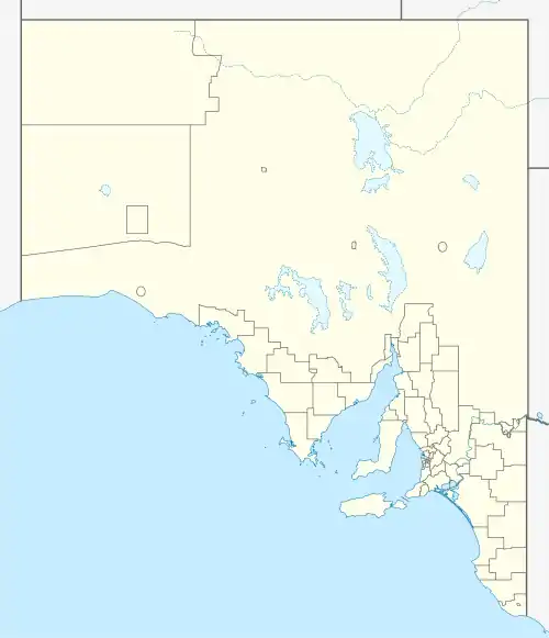
| Hopetoun South Australia | |||||||||||||||
|---|---|---|---|---|---|---|---|---|---|---|---|---|---|---|---|
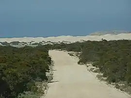 Approach to Fowlers Bay in the Hundred of Caldwell | |||||||||||||||
 Hopetoun | |||||||||||||||
| Coordinates | 31°33′11″S 131°58′52″E / 31.553°S 131.981°E | ||||||||||||||
| Established | 21 January 1892[1] | ||||||||||||||
| Area | 6,200 km2 (2,400 sq mi)[2] | ||||||||||||||
| LGA(s) | District Council of Ceduna | ||||||||||||||
| |||||||||||||||
The County of Hopetoun is one of the 49 counties of South Australia on the state's west coast.[2] It was proclaimed in 1892 by Governor Algernon Keith-Falconer and named for John Hope then the Governor of Victoria.[2]
Hundreds
The County of Hopetoun contains the following 9 hundreds, covering approximately the south-eastern half of its total area:
- Inland from northwest to southeast: Bice, Lucy, Miller, Trunch, and May (Yalata, Coorabie)
- On the south coastline from west to east: Russell, Wookata, Sturdee, and Caldwell (Coorabie, Fowlers Bay)
See also
References
- ↑ Kingston, C.C. (21 January 1892). "Untitled proclamation re new county and new hundreds" (PDF). Government of South Australia. pp. 120–121. Retrieved 10 September 2019.
- 1 2 3 "Placename Details: County of Hopetoun". Property Location Browser. Government of South Australia. 14 January 2009. SA0031106. Archived from the original on 7 December 2015. Retrieved 13 August 2019.
This article is issued from Wikipedia. The text is licensed under Creative Commons - Attribution - Sharealike. Additional terms may apply for the media files.