Cream Ridge, New Jersey | |
|---|---|
 Center of Cream Ridge at County Route 539 and Burlington Path Road | |
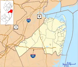
 Cream Ridge Location in Monmouth County  Cream Ridge Location in New Jersey  Cream Ridge Location in the United States | |
| Coordinates: 40°08′06″N 74°31′27″W / 40.13500°N 74.52417°W | |
| Country | |
| State | |
| County | Monmouth |
| Township | Upper Freehold |
| Area | |
| • Total | 3.04 sq mi (7.88 km2) |
| • Land | 3.02 sq mi (7.82 km2) |
| • Water | 0.02 sq mi (0.06 km2) |
| Elevation | 131 ft (40 m) |
| Population | |
| • Total | 630 |
| • Density | 208.54/sq mi (80.52/km2) |
| FIPS code | 34-15730[4] |
| GNIS feature ID | 875715[2] |
Cream Ridge is an unincorporated community and census-designated place (CDP)[5] located within Upper Freehold Township in Monmouth County, in the U.S. state of New Jersey.[6] The rural area is made up of farmland, on which are located many horse farms. Numerous small business line with County Route 539.
Demographics
As of the 2020 United States census, the population was 630.[3]
| Census | Pop. | Note | %± |
|---|---|---|---|
| 2020 | 630 | — | |
| U.S. Decennial Census[7] 2020[3] | |||
History
The soil in Cream Ridge is Freehold sandy loam, some of the richest in the state of New Jersey. Many of the early residents became relatively wealthy gentleman farmers, with the actual farm work done by tenant farmers. Most of the early families were Presbyterians, Quakers, or Northern Baptists. Some of the surnames associated with the area are Holmes, Meirs, Rue, Cox, Wright, Lawrence, and Ridgway. The gentleman farmer lifestyle was dramatically curtailed during the Great Depression and after World War II, although remnants of this bygone lifestyle existed into the 1980s.
Notable people
People who were born in, residents of, or otherwise closely associated with Cream Ridge include:
- Linda K. Meirs (1884–1972), American Red Cross and Army nurse during World War I who was one of the first six American recipients of the Florence Nightingale Medal.[8]
- Ross Scheuerman (born 1993), running back for the Hamilton Tiger-Cats of the Canadian Football League.[9]
References
- ↑ "ArcGIS REST Services Directory". United States Census Bureau. Retrieved October 11, 2022.
- 1 2 "Cream Ridge". Geographic Names Information System. United States Geological Survey, United States Department of the Interior.
- 1 2 3 Census Data Explorer: Cream Ridge CDP, New Jersey, United States Census Bureau. Accessed June 15, 2023.
- ↑ Geographic Codes Lookup for New Jersey, Missouri Census Data Center. Accessed June 9, 2023.
- ↑ State of New Jersey Census Designated Places - BVP20 - Data as of January 1, 2020, United States Census Bureau. Accessed December 1, 2022.
- ↑ Locality Search, State of New Jersey. Accessed February 21, 2015.
- ↑ "Census of Population and Housing". Census.gov. Retrieved June 4, 2016.
- ↑ "Historically Speaking: Linda Konover Meirs 1884-1972 Part Five", Messenger-Press, March 28, 2002. Accessed July 9, 2019. "Melinda Konover Meirs was born in Cream Ridge on June 5, 1884.... She lived in Cream Ridge during World War II, and would use her sugar ration to make cookies for the GIs, whom she considered 'her boys.'"
- ↑ O'Gorman, George. "Eagles sign former Allentown High star Ross Scheuerman", The Trentonian, January 21, 2016. Accessed October 1, 2017. "The Eagles signed former Allentown High and Lafayette College running back Ross Scheuerman on Thursday.... A Cream Ridge resident who was twice an All-CVC selection and Mercer County Player of the Year and All-State, Scheuerman was also the Delaware Valley Scholar Athlete in 2012."
