Crumpton, Maryland | |
|---|---|
 Crumpton | |
| Coordinates: 39°14′29″N 75°55′18″W / 39.24139°N 75.92167°W | |
| Country | United States |
| State | Maryland |
| County | Queen Anne's |
| Area | |
| • Total | 1.05 sq mi (2.71 km2) |
| • Land | 0.94 sq mi (2.43 km2) |
| • Water | 0.11 sq mi (0.28 km2) |
| Elevation | 10 ft (3 m) |
| Population (2020) | |
| • Total | 496 |
| • Density | 528.22/sq mi (203.92/km2) |
| Time zone | UTC-5 (Eastern (EST)) |
| • Summer (DST) | UTC-4 (EDT) |
| ZIP code | 21628 |
| Area code(s) | 410 & 443 |
| GNIS feature ID | 597301[2] |
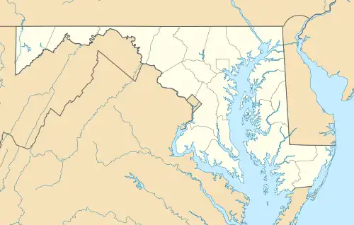
Crumpton is a census-designated place in Queen Anne's County, Maryland, United States. Crumpton is located along the Chester River, 5 miles (8.0 km) west-southwest of Millington. Crumpton has a post office with the ZIP code 21628.[3]
Crumpton changed from an unincorporated community to a census-designated place for the 2020 Census.[4]
Per the 2020 Census, the population was 496.[5]
Demographics
| Census | Pop. | Note | %± |
|---|---|---|---|
| 2020 | 496 | — | |
| U.S. Decennial Census[6] 2020[7] | |||
2020 census
| Race / Ethnicity | Pop 2020[7] | % 2020 |
|---|---|---|
| White alone (NH) | 396 | 79.84% |
| Black or African American alone (NH) | 23 | 4.64% |
| Native American or Alaska Native alone (NH) | 2 | 0.40% |
| Asian alone (NH) | 6 | 1.21% |
| Pacific Islander alone (NH) | 0 | 0.00% |
| Some Other Race alone (NH) | 4 | 0.81% |
| Mixed Race/Multi-Racial (NH) | 20 | 4.03% |
| Hispanic or Latino (any race) | 45 | 9.07% |
| Total | 496 | 100.00% |
Note: the US Census treats Hispanic/Latino as an ethnic category. This table excludes Latinos from the racial categories and assigns them to a separate category. Hispanics/Latinos can be of any race.
References
- ↑ "2020 U.S. Gazetteer Files". United States Census Bureau. Retrieved April 26, 2022.
- ↑ "Crumpton". Geographic Names Information System. United States Geological Survey, United States Department of the Interior.
- ↑ ZIP Code Lookup Archived 2011-06-15 at the Wayback Machine
- ↑ "TIGERweb v18.0". Decennial IT Division for Geography Division, U.S. Census Bureau. Retrieved February 26, 2021.
- ↑ "Crumpton CDP, Maryland". United States Census Bureau. Retrieved March 13, 2022.
- ↑ "Decennial Census of Population and Housing by Decades". US Census Bureau.
- 1 2 "P2 HISPANIC OR LATINO, AND NOT HISPANIC OR LATINO BY RACE - 2020: DEC Redistricting Data (PL 94-171) - Crumpton CDP, Maryland". United States Census Bureau.
External links
Wikimedia Commons has media related to Crumpton, Maryland.
- Map of Crumpton, from the Historical Society of Kent County collection
Municipalities and communities of Queen Anne's County, Maryland, United States | ||
|---|---|---|
| Towns | 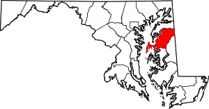 | |
| CDPs | ||
| Other communities | ||
| Footnotes | ‡This populated place also has portions in an adjacent county or counties | |
This article is issued from Wikipedia. The text is licensed under Creative Commons - Attribution - Sharealike. Additional terms may apply for the media files.