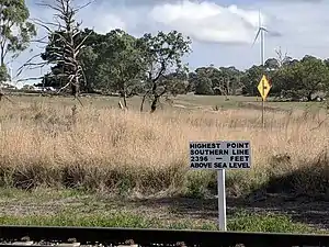
Cullerin railway station | |||||||||||
|---|---|---|---|---|---|---|---|---|---|---|---|
 Highest point on the line at the site of the former station | |||||||||||
| General information | |||||||||||
| Location | Cullerin Road Australia | ||||||||||
| Coordinates | 34°46′59″S 149°24′23″E / 34.7831°S 149.4064°E | ||||||||||
| Line(s) | Main South | ||||||||||
| Distance | 256.3km | ||||||||||
| History | |||||||||||
| Opened | 1880 | ||||||||||
| Closed | 1973 | ||||||||||
| Services | |||||||||||
| |||||||||||
Cullerin was a small railway station on the Main South railway line in Cullerin, New South Wales, Australia. It opened in 1875, and was located near the top of the Cullerin Range. It closed to passenger services in 1974.[1] It was later completely demolished and no trace of the station now survives. Legal names of the area were no longer recorded as of 1976.[2]
References
- ↑ Cullerin station, NSWrail.net, Accessed 19 August 2009
- ↑ "GEOGRAPHICAL NAMES ACT, 1966". Government Gazette of the State of New South Wales. No. 15. New South Wales, Australia. 30 January 1976. p. 455 – via National Library of Australia.
This article is issued from Wikipedia. The text is licensed under Creative Commons - Attribution - Sharealike. Additional terms may apply for the media files.