Curaçá | |
|---|---|
Municipality | |
| The Municipality of Curaçá | |
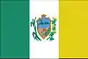 Flag  Seal | |
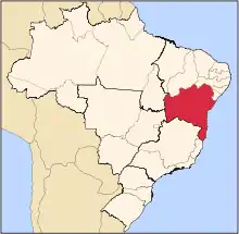
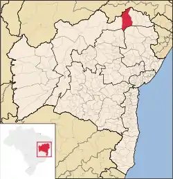 Localization of the city | |
| Coordinates: 08°59′31″S 39°54′28″W / 8.99194°S 39.90778°W | |
| Country | Brazil |
| Region | Northeast |
| State | Bahia |
| Founded | July 6, 1832 |
| Government | |
| • Mayor | Pedro Oliveira (2016-2020) |
| Area | |
| • Total | 6,442.190 km2 (2,487.343 sq mi) |
| Population (2020 [1]) | |
| • Total | 34,886 |
| • Density | 4.9/km2 (13/sq mi) |
| Time zone | UTC−3 (BRT) |
| HDI (2010) | 0.700 – high[2] |
| Website | www.curaca.ba.gov.br |
Curaçá is the northernmost city in the Brazilian state of Bahia.
The municipality was designated a priority area for conservation and sustainable use when the Caatinga Ecological Corridor was created in 2006.[3]
References
This article is issued from Wikipedia. The text is licensed under Creative Commons - Attribution - Sharealike. Additional terms may apply for the media files.