| Daga River | |
|---|---|
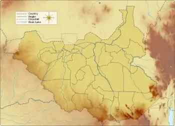
 Location of mouth in South Sudan | |
| Location | |
| Countries | South Sudan, Ethiopia |
| Physical characteristics | |
| Mouth | |
• coordinates | 9°32′N 33°24′E / 9.533°N 33.400°E |
The Daga River (or Khor Daga) is a river in South Sudan. It rises in the mountains of the Mirab Welega Zone in Ethiopia, just east of the South Sudan - Ethiopia border, where it is known as the Deqe Sonka Shet.[1] It flows west past the town of Daga Post and enters the Machar Marshes,[2] where it loses its identity.
References
- ↑ Topographical map of Jonglei Archived 2011-09-29 at the Wayback Machine
- ↑ Sutcliffe, J. V.; Parls, Y. P. (1999). "The Sobat Basin and the Machar Marshes". The Hydrology of the Nile (PDF). Archived from the original (PDF) on 2011-07-05. Retrieved 2011-07-22. page 112
This article is issued from Wikipedia. The text is licensed under Creative Commons - Attribution - Sharealike. Additional terms may apply for the media files.