Dajabón | |
|---|---|
| San Joaquín de Dajabón | |
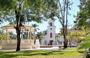 Dajabon Dominican Republic town church. | |
 Seal | |
 Dajabón | |
| Coordinates: 19°34′0″N 71°42′36″W / 19.56667°N 71.71000°W | |
| Country | Dominican Republic |
| Province | Dajabón |
| Founded | 1776 |
| Municipality | 1864 |
| Named for | Dajabón River |
| Area | 253.41 km2 (97.84 sq mi) |
| Elevation | 35 m (115 ft) |
| Population (2012)[3] | 25,983 |
| • Density | 100/km2 (270/sq mi) |
| • Urban | 18,725 |
| Including population of Cañongo. | |
| Climate | Aw |
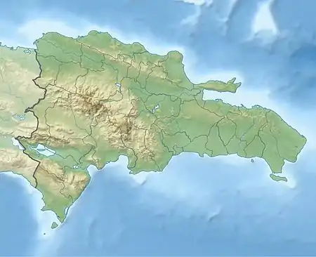
Dajabón is a municipality and capital of the Dajabón province in the Dominican Republic, which is located on the northwestern Dominican Republic frontier with Haiti. It is a market town with a population of about 26,000, north of the Cordillera Central mountain range.
Dajabón is located on the Dajabón River, also known as the Massacre River, due to an incident that took place in 1728, in which 30 French Buccaneers were killed by Spanish settlers.[4] The name also became popular after being the site of killings during the Parsley massacre, though the event was not the origin of its name.
History
A battle took place in what is now Dajabon between the Spanish and the French in the 17th century. At the time of the battle, the governor of the French colony, Mr. Cussy, was killed in the Battle of the Sabana Real de la Limonada, near modern-day Limonade in northern Haiti.[5]
The city was initially founded between 1771 and 1776, but was soon after abandoned during the War of Independence. During the 1822–44 Haitian occupation, the city was officially designated in French as Dahabon. It was settled again soon after the War of Restoration in 1865.
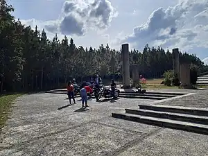
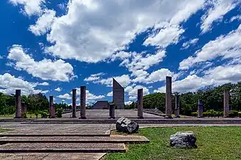
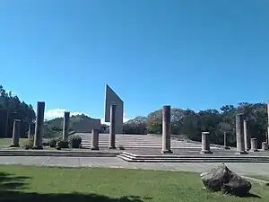
Dajabon Monument
Population

According to the Population and Housing Census, the municipality has a total population of 25,685, of which 12,644 were men and 13,041 women. The urban population of the municipality was 63.57%. This population data includes the population of the Cañongo municipal district.
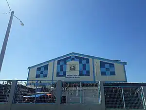
The bridge across the river connects Dajabón to the Haitian city of Ouanaminthe. On Mondays and Fridays, Haitians are permitted to temporarily cross the bridge to sell their goods. Most of the goods are used clothes, shoes, bulk dry goods, and housewares; an area of several acres on the western edge of the city becomes a crowded business place. In addition to the Haitians, Dominicans go to the market to sell food (vegetables grown in their country).
Dajabon Market
Climate
Dajabón has a hot tropical savanna climate (Köppen Aw).
| Climate data for Dajabón (1961-1990) | |||||||||||||
|---|---|---|---|---|---|---|---|---|---|---|---|---|---|
| Month | Jan | Feb | Mar | Apr | May | Jun | Jul | Aug | Sep | Oct | Nov | Dec | Year |
| Record high °C (°F) | 33.5 (92.3) |
35.5 (95.9) |
38.2 (100.8) |
35.4 (95.7) |
37.0 (98.6) |
36.5 (97.7) |
36.5 (97.7) |
39.0 (102.2) |
37.5 (99.5) |
35.2 (95.4) |
37.0 (98.6) |
35.0 (95.0) |
39.0 (102.2) |
| Mean daily maximum °C (°F) | 29.3 (84.7) |
29.9 (85.8) |
30.6 (87.1) |
30.7 (87.3) |
31.1 (88.0) |
32.3 (90.1) |
33.2 (91.8) |
33.3 (91.9) |
32.9 (91.2) |
31.9 (89.4) |
30.4 (86.7) |
29.2 (84.6) |
31.2 (88.2) |
| Mean daily minimum °C (°F) | 17.6 (63.7) |
17.9 (64.2) |
18.8 (65.8) |
19.8 (67.6) |
21.0 (69.8) |
21.8 (71.2) |
21.5 (70.7) |
21.7 (71.1) |
21.7 (71.1) |
21.3 (70.3) |
20.0 (68.0) |
18.3 (64.9) |
20.1 (68.2) |
| Record low °C (°F) | 11.0 (51.8) |
11.0 (51.8) |
12.5 (54.5) |
13.0 (55.4) |
14.0 (57.2) |
17.5 (63.5) |
17.5 (63.5) |
16.0 (60.8) |
17.0 (62.6) |
17.0 (62.6) |
13.0 (55.4) |
12.0 (53.6) |
11.0 (51.8) |
| Average rainfall mm (inches) | 34.0 (1.34) |
32.1 (1.26) |
48.2 (1.90) |
77.6 (3.06) |
182.8 (7.20) |
161.0 (6.34) |
99.9 (3.93) |
110.3 (4.34) |
149.3 (5.88) |
138.7 (5.46) |
74.4 (2.93) |
59.1 (2.33) |
1,167.4 (45.96) |
| Average rainy days (≥ 1.0 mm) | 4.3 | 2.8 | 3.5 | 5.7 | 10.8 | 10.8 | 7.8 | 8.4 | 10.7 | 10.3 | 6.1 | 4.1 | 85.3 |
| Average relative humidity (%) | 79.6 | 78.2 | 76.6 | 76.4 | 79.9 | 79.9 | 78.2 | 78.4 | 79.7 | 81.1 | 80.7 | 80.0 | 79.1 |
| Source: NOAA[6] | |||||||||||||
External links
- Dajabon, Encyclopædia Britannica
References
- ↑ Superficies a nivel de municipios, Oficina Nacional de Estadistica Archived April 17, 2009, at the Wayback Machine
- ↑ De la Fuente, Santiago (1976). Geografía Dominicana (in Spanish). Santo Domingo, Dominican Republic: Editora Colegial Quisqueyana.
- ↑ Censo 2012 de Población y Vivienda, Oficina Nacional de Estadistica Archived 2009-04-01 at the Wayback Machine
- ↑ "Massacre River". Haiti Observer. Retrieved 2017-05-08.
- ↑ "Gobernadores de la Isla de Santo Domingo (see page 375 for information on the battle of the Sabana Real de la Limonada in 1690)" (PDF). Archived from the original (PDF) on 2014-02-10. Retrieved 2014-06-27.
- ↑ "Dajabon Climate Normals 1961-1990". National Oceanic and Atmospheric Administration. Retrieved September 12, 2016.
