Danta | |
|---|---|
Village | |
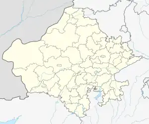
 Danta Location in Rajasthan, India  Danta Danta (India) | |
| Coordinates: 26°22′18″N 74°42′16″E / 26.3717°N 74.7044°E | |
| Country | India |
| State | Rajasthan |
| District | Ajmer |
| Tehsil | Ajmer tehsil |
| Population (2011)[1] | |
| • Total | 2,253 |
| Languages | |
| • Official | Hindi and Rajasthani |
| Time zone | UTC+5:30 (IST) |
| PIN | 305025[2] |
| Lok Sabha constituency | Ajmer[3] |
| Vidhan Sabha constituency | Pushkar[4] |
Danta is a village in Ajmer tehsil of Ajmer district of Rajasthan state in India.[5] The village falls under Danta gram panchayat.[6]
Demography
As per 2011 census of India, Danta has population of 2,253 of which 1,163 are males and 1,090 are females. Sex ratio of the village is 937.[1]
Transportation
Danta is connected by air (Kishangarh Airport), by train (Ajmer Junction railway station) and by road.
See also
References
- 1 2 District Census Handbook Ajmer, Village and Town Wise Primary Census Abstract (PDF). Directorate of Census Operations. 2011.
- ↑ "DANTA Pin Code – 305025, Ajmer All Post Office Areas PIN Codes, Search AJMER Post Office Address". ABP Live. Retrieved 23 January 2022.
- ↑ "Delimitation of Parliamentary & Assembly Constituencies Order – 2008". Election Commission of India. 26 November 2008. Retrieved 12 February 2021.
- ↑ "Statistical Data of Rajasthan LA 2018". Election Commission of India. Retrieved 12 February 2021.
- ↑ "अब कोविड की चपेट में नवजात: कोविड पॉजिटिव में बच्चों की बढ़ रही संख्या, हेल्थ डिपार्टमेन्ट की चिंता बढ़ी, 3315 एक्टिव केस". Dainik Bhaskar (in Hindi). Retrieved 23 January 2022.
- ↑ "District sub district identification code—Rajasthan Government" (PDF). Archived (PDF) from the original on 23 January 2014.
This article is issued from Wikipedia. The text is licensed under Creative Commons - Attribution - Sharealike. Additional terms may apply for the media files.