| Darlington Creek ruisseau Darlington | |
|---|---|
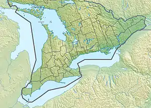
 Location of the mouth of Darlington Creek in southern Ontario | |
| Etymology | named for Darlington Township |
| Location | |
| Country | Canada |
| Province | Ontario |
| Regional Municipality | Durham |
| Municipality | Clarington |
| Physical characteristics | |
| Source | Unnamed field |
| • coordinates | 43°55′05″N 78°44′54″W / 43.91806°N 78.74833°W[1] |
| • elevation | 145[2] |
| Mouth | Lake Ontario |
• coordinates | 43°52′36″N 78°41′29″W / 43.87667°N 78.69139°W[3] |
• elevation | 74.1 m (243 ft)[4] |
| Basin features | |
| Progression | Lake Ontario→ Saint Lawrence River→ Gulf of Saint Lawrence |
| River system | Lake Ontario drainage basin |
Darlington Creek (French: ruisseau Darlington) is a stream in the municipality of Clarington, Regional Municipality of Durham in Ontario, Canada.[3][1][5][6][7] It is a tributary of Lake Ontario and is located in geographic Darlington Township, after which it is named.[5]
Course
Darlington Creek begins at an unnamed field at the west edge of the local Rundle Road at an elevation of 145 metres (476 ft)[2] and heads southwest, under Durham Highway 2, then south, parallel to Ontario Highway 418. It heads southeast, passes under the Canadian Pacific Railway main line, Ontario Highway 401, and the Canadian National Railway main lines, then turns south, and reaches its mouth at Lake Ontario. Lake Ontario flows via the Saint Lawrence River to the Gulf of Saint Lawrence.[1][5]
Watershed
Groundwater discharge from the bluffs left from glacial Lake Iroquois feed the headwaters of Darlington Creek.[8]
The watersheds of four other watercourses border the creek.[9] The longest, Bowmanville Creek, to the east, has its headwaters in the Oak Ridges Moraine. The other three watersheds are Tooley Creek, Farewell Creek, and Westside Creek.
References
- 1 2 3 "Toporama (on-line map and search)". Atlas of Canada. Natural Resources Canada. Retrieved 2021-02-18.
- 1 2 "Google Earth". Retrieved 2021-02-18.
- 1 2 "Darlington Creek". Geographical Names Data Base. Natural Resources Canada. Retrieved 2021-02-18.
- ↑ Inferred from Lake Ontario. Retrieved 2021-02-18.
- 1 2 3 "Ontario Geonames GIS (on-line map and search)". Ontario Ministry of Natural Resources and Forestry. 2014. Retrieved 2021-02-18.
- ↑ Restructured municipalities - Ontario map #5 (Map). Restructuring Maps of Ontario. Ontario Ministry of Municipal Affairs and Housing. 2006. Archived from the original on 2020-05-11. Retrieved 2021-02-18.
- ↑ Map 3 (PDF) (Map). 1 : 700,000. Official road map of Ontario. Ministry of Transportation of Ontario. 2020-01-01. Retrieved 2021-02-18.
- ↑ SooChan, G (May 2017). "Central Lake Ontario Conservation Authority Regional Groundwater Mapping Study" (PDF). Central Lake Ontario Conservation Authority. pp. 14, 30, 32, 68, 72. Retrieved 2021-02-18.
It is believed that groundwater discharge from the Iroquois Beach deposits and the lower sediments makes significant contributions to the upper reaches of the following Creeks that originate in the southern part of the study area: Pringle Creek, Corbett Creek, Robinson Creek, Tooley Creek, Darlington Creek, Westside Creek and Bennett Creek.
- ↑ "Watershed Health: Everyone Lives in a Watershed". Central Lake Ontario Conservation Authority. Retrieved 2021-02-18.