Davis Township | |
|---|---|
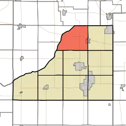 Location in Starke County | |
| Coordinates: 41°23′11″N 86°38′42″W / 41.38639°N 86.64500°W | |
| Country | |
| State | |
| County | Starke |
| Government | |
| • Type | Indiana township |
| Area | |
| • Total | 35.98 sq mi (93.2 km2) |
| • Land | 35.89 sq mi (93.0 km2) |
| • Water | 0.09 sq mi (0.2 km2) 0.25% |
| Elevation | 673 ft (205 m) |
| Population (2010) | |
| • Total | 1,043 |
| • Density | 29.1/sq mi (11.2/km2) |
| Time zone | UTC-6 (Central (CST)) |
| • Summer (DST) | UTC-5 (CDT) |
| ZIP codes | 46532, 46534 |
| Area code | 574 |
| GNIS feature ID | 453254 |
Davis Township is one of nine townships in Starke County, in the U.S. state of Indiana.[2] As of the 2010 census, its population was 1,043 and it contained 439 housing units.[3]
Geography
According to the 2010 census, the township has a total area of 35.98 square miles (93.2 km2), of which 35.89 square miles (93.0 km2) (or 99.75%) is land and 0.09 square miles (0.23 km2) (or 0.25%) is water.[3]
Cities, towns, villages
- Hamlet (west half)
Adjacent townships
- Union Township, LaPorte County (north)
- Johnson Township, LaPorte County (northeast)
- Oregon Township (east)
- Washington Township (southeast)
- Center Township (south)
- Jackson Township (southwest)
- Hanna Township, LaPorte County (west)
- Prairie Township, LaPorte County (west)
Major highways
Airports and landing strips
- Singletons Landing Strip
School districts
- Oregon-Davis School Corporation
Political districts
- Indiana's 2nd congressional district
- State House District 17
- State Senate District 5
References
- United States Census Bureau 2008 TIGER/Line Shapefiles
- United States Board on Geographic Names (GNIS)
- IndianaMap
- ↑ "US Board on Geographic Names". United States Geological Survey. October 25, 2007. Retrieved May 9, 2017.
- ↑ "Davis Township". Geographic Names Information System. United States Geological Survey, United States Department of the Interior. Retrieved July 5, 2009.
- 1 2 "Population, Housing Units, Area, and Density: 2010 - County -- County Subdivision and Place -- 2010 Census Summary File 1". United States Census. Archived from the original on February 12, 2020. Retrieved May 10, 2013.
External links
Places adjacent to Davis Township, Starke County, Indiana | |
|---|---|
Municipalities and communities of Starke County, Indiana, United States | ||
|---|---|---|
| City | Map of Indiana highlighting Starke County | |
| Towns | ||
| Townships | ||
| CDPs | ||
| Other communities | ||
| Footnotes | ‡This populated place also has portions in an adjacent county or counties | |
This article is issued from Wikipedia. The text is licensed under Creative Commons - Attribution - Sharealike. Additional terms may apply for the media files.