Decatur Township | |
|---|---|
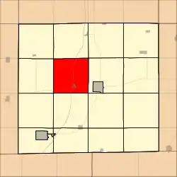 Location in Decatur County | |
| Coordinates: 40°45′59″N 93°50′13″W / 40.76639°N 93.83694°W | |
| Country | |
| State | |
| County | Decatur |
| Area | |
| • Total | 35.77 sq mi (92.65 km2) |
| • Land | 35.64 sq mi (92.3 km2) |
| • Water | 0.14 sq mi (0.35 km2) 0.38% |
| Elevation | 1,102 ft (336 m) |
| Population (2000) | |
| • Total | 425 |
| • Density | 11.9/sq mi (4.6/km2) |
| GNIS feature ID | 0467689 |
Decatur Township is a township in Decatur County, Iowa, USA. As of the 2000 census, its population was 425.
Geography
Decatur Township covers an area of 35.77 square miles (92.65 square kilometers); of this, 0.14 square miles (0.35 square kilometers) or 0.38 percent is water. The streams of Long Creek and Marks Branch run through this township.
Cities and towns
Adjacent townships
- Long Creek Township (north)
- Franklin Township (northeast)
- Center Township (east)
- Eden Township (southeast)
- Burrell Township (south)
- Bloomington Township (southwest)
- Grand River Township (west)
- Richland Township (northwest)
Cemeteries
The township contains six cemeteries: Cash, Decatur City, Palenstine, Shy, Waller and Woodmansee.
Major highways
References
External links
Municipalities and communities of Decatur County, Iowa, United States | ||
|---|---|---|
| Cities | Map of Iowa highlighting Decatur County | |
| Townships | ||
| Unincorporated communities | ||
This article is issued from Wikipedia. The text is licensed under Creative Commons - Attribution - Sharealike. Additional terms may apply for the media files.