| Site of Special Scientific Interest | |
 | |
| Location | Norfolk |
|---|---|
| Grid reference | TF 673 288[1] |
| Interest | Biological Geological |
| Area | 159.1 hectares (393 acres)[1] |
| Notification | 1986[1] |
| Location map | Magic Map |
| Designations | |
|---|---|
| Official name | Dersingham Bog |
| Designated | 12 September 1995 |
| Reference no. | 751[2] |
Dersingham Bog is a 159.1-hectare (393-acre) biological and geological Site of Special Scientific Interest in Norfolk, England.[1][3] It is a Nature Conservation Review site, Grade 2,[4] a National Nature Reserve[5] and a Ramsar site[2] It is part of the Norfolk Coast Area of Outstanding Natural Beauty,[6] and the Roydon Common & Dersingham Bog Special Area of Conservation[7] Part of it is a Geological Conservation Review site.[8]
Location

Dersingham Bog is near the West Norfolk Villages of Dersingham and Wolferton and is one of the few remaining wilderness areas left in this part of Norfolk which is otherwise dominated by intensive agriculture. The Reserve is part of the Sandringham Royal Estate.
Geology
The site lies on the north west Norfolk Greensand escarpment. It is notable for a rock dating from the Lower Cretaceous Period known as 'Dersingham Formation' which has been important in understanding the geology of the region.
Habitats and wildlife
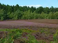
Dersingham Bog contains three distinct habitats, mire, heath and woodland. Acid valley mire is found over much of the low-lying parts of the reserve where the ground is waterlogged for most of the year. Dersingham Bog contains the largest remaining example of this kind of habitat in East Anglia.
The mire's make-up of wet acid peat makes it ideal conditions for some rare and diverse species of plants such as bog asphodels (Narthecium ossifragum), round-leaved sundew (Drosera rotundifolia), white beaked sedge (Rhynchospora alba) and cranberry. The mire also has some rare insects such as the black darter dragonfly (Sympetrum danae) and moths such as the light knot grass (Acronicta menyanthidis). In the dark it is possible to see glowworms. The mire lies on shallow peat and is bordered on one side by a steep escarpment containing large areas of dry heath and woodland which marks the edge of an ancient coastline. The woodland at Dersingham is quite recent and contains Scots pine, oak, sweet chestnut, sycamore and birch. The woodland glades attract birds such as redpoll, crossbill, long-eared owl, tree pipit, woodlark, shelduck, nightjar, and sparrowhawk.
Access
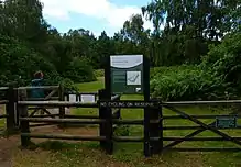
All of Dersingham is open access and there are many well-marked routes to follow which provide easy access for visitors to explore this wilderness. There are car parks at Wolferton and Scissors Cross, payment via RingGo app.
Management
The reserve is in the management of Natural England.
Memorial to John Denver
Dersingham Bog is the location of a bench which commemorates the life of American singer-songwriter and environmentalist John Denver. It was placed there by the Friends of John Denver UK in September 2006.
References
- 1 2 3 4 "Designated Sites View: Dersingham Bog". Sites of Special Scientific Interest. Natural England. Archived from the original on 19 August 2018. Retrieved 8 June 2018.
- 1 2 "Dersingham Bog". Ramsar Sites Information Service. Archived from the original on 12 June 2018. Retrieved 25 April 2018.
- ↑ "Map of Dersingham Bog". Sites of Special Scientific Interest. Natural England. Archived from the original on 27 June 2017. Retrieved 8 June 2018.
- ↑ Ratcliffe, Derek, ed. (1977). A Nature Conservation Review. Vol. 2. Cambridge, UK: Cambridge University Press. pp. 140, 215. ISBN 0521 21403 3.
- ↑ "Designated Sites View: Dersingham Bog". National Nature Reserves. Natural England. Archived from the original on 4 December 2018. Retrieved 25 May 2018.
- ↑ "Norfolk Coast AONB Management Plan 2014-19: Other Conservation Designations within the AONB" (PDF). Norfolk Coast AONB. Archived from the original (PDF) on 31 March 2012. Retrieved 25 May 2018.
- ↑ "Designated Sites View: Roydon Common and Dersingham Bog". Special Areas of Conservation. Natural England. Archived from the original on 15 February 2023. Retrieved 31 May 2018.
- ↑ "Dersingham (Berriasian, Valanginian, Hauterivian, Barremian)". Geological Conservation Review. Joint Nature Conservation Committee. Archived from the original on 26 May 2018. Retrieved 25 May 2018.
52°50′N 0°29′E / 52.83°N 0.48°E