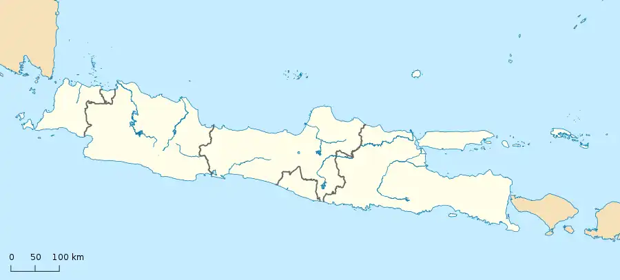
South Bogor
Bogor Selatan | |
|---|---|
 South Bogor  South Bogor | |
| Coordinates: 6°38′19″S 106°48′54″E / 6.63861°S 106.81500°E | |
| Country | Indonesia |
| Province | West Java |
| City | Bogor |
| Government | |
| • Head of District (Camat) | Abdul Rahman |
| Area | |
| • Total | 30.50 km2 (11.78 sq mi) |
| Population (2022 [1]) | |
| • Total | 216,501 |
| • Density | 7,098/km2 (18,380/sq mi) |
| Time zone | UTC+7 (IWST) |
| Area code | (+62) 251 |
| Vehicle registration | F |
| Villages | 16 |
| Website | kecbogorselatan |
South Bogor (Indonesian: Bogor Selatan, Sundanese: ᮘᮧᮌᮧᮁ ᮊᮤᮓᮥᮜ᮪ (Bogor Kulon)) is one of the six districts (kecamatan) in Bogor, West Java, Indonesia. The district covers an area of 30.50 km2, and had a population of 216,501 at the 2022 Census.[1] Administratively it is divided into sixteen administrative villages (kelurahan).
Demographics
Religion
Administrative divisions
Urban villages
| English name | Indonesian name | Area (km2) | Population (2022)[3] | Density (P/Km²) |
|---|---|---|---|---|
| Cikaret Village | Kelurahan Cikaret | 1.40 | 22,041 | 15,744 |
| Empang Village | Kelurahan Empang | 0.94 | 18,391 | 19,565 |
| Bondongan Village | Kelurahan Bondongan | 0.59 | 14,954 | 25,346 |
| Batutulis Village | Kelurahan Batutulis | 0.69 | 10,661 | 15,451 |
| Lawanggintung Village | Kelurahan Lawanggintung | 0.64 | 8,753 | 13,677 |
| Ranggamekar Village | Kelurahan Ranggamekar | 1.66 | 16,156 | 9,733 |
| Pamoyanan Village | Kelurahan Pamoyanan | 2.66 | 17,286 | 6,499 |
| Mulyaharja Village | Kelurahan Mulyaharja | 5.54 | 23,709 | 4,280 |
| Totals South Bogor District | 14.12 | 131,951 | 9,345 | |
| English name | Indonesian name | Area (km2) | Population (2022)[4] | Density (P/Km²) |
|---|---|---|---|---|
| Cipaku Village | Kelurahan Cipaku | 1.65 | 14,293 | 8,662 |
| Pakuan Village | Kelurahan Pakuan | 1.11 | 5,429 | 4,891 |
| Muarasari Village | Kelurahan Muarasari | 1.70 | 11,651 | 6,854 |
| Genteng Village | Kelurahan Genteng | 2.11 | 9,748 | 4,620 |
| Kertamaya Village | Kelurahan Kertamaya | 4.54 | 7,155 | 1,576 |
| Harjasari Village | Kelurahan Harjasari | 1.54 | 14,117 | 9,167 |
| Rancamaya Village | Kelurahan Rancamaya | 1.91 | 7,954 | 4,164 |
| Bojongkerta Village | Kelurahan Bojongkerta | 2.48 | 11,203 | 4,517 |
| Totals Rancamaya District [5] | 17.04 | 81,550 | 4,786 | |
References
- 1 2 "Kota Bogor Dalam Angka 2023" (visual). bogorkota.bps.go.id/. Retrieved 2 May 2023.
- ↑ "Visualisasi Data Kependudukan - Kementerian Dalam Negeri 2022" (visual). www.dukcapil.kemendagri.go.id. Retrieved 2 May 2023.
- ↑ Data Dukcapil, retrieved 2 May 2023
- ↑ Data Dukcapil, retrieved 2 May 2023
- ↑ Rencana Pemekaran Kecamatan di Kota Bogor, retrieved 2 May 2023
This article is issued from Wikipedia. The text is licensed under Creative Commons - Attribution - Sharealike. Additional terms may apply for the media files.