 |
|---|
|
|
Before the independence of South Sudan, the States of Sudan were subdivided into 133 districts. With the adoption of the Interim National Constitution of Sudan[1] and the Interim Constitution of Southern Sudan,[2] the ten states of South Sudan are, however, now divided into counties. The maps on this page represent the boundaries as they existed in 2006.[3] Current information is available from the Humanitarian Data Exchange.[4]
The districts are listed below, by state:
.png.webp)
Districts of Sudan
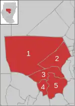
Al Jazirah
- Al Kamlin District
- East al Gazera District
- North al Gazera District
- Al Managil District
- South al Gazera District
- Um Al Gura District
- Wad Madani District
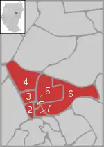
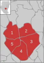
Al Qadarif

Districts of Al Qadarif
- Al Faw District
- Al Gadaref District
- Al Rahd District
- East Galabat District
- West Galabat District
- Al Fushqa District
- Butana District
- Qala al-Nahl District
- Al-Quresha District[5]
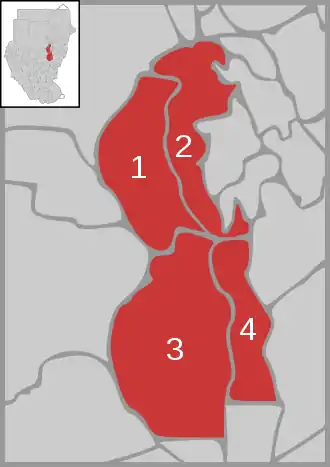
Blue Nile

Districts of Blue Nile
Kassala

Districts of Kassala
Khartoum
Districts of Khartoum
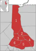
North Darfur
(Not representing the present state structure)

Districts of North Darfur
North Kurdufan
Districts of North Kurdufan
Northern

Districts of Northern Sudan
Red Sea

Districts of Red Sea
River Nile
Districts of River Nile
Sennar

Districts of Sennar
South Darfur
(Not reflecting the present state structure)
Districts of South Darfur
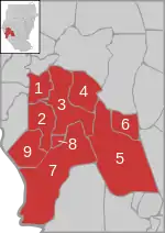
South Kurdufan
Districts of South Kurdufan
West Darfur
(Not representing the present state structure)

Districts of West Darfur
White Nile
Districts of White Nile
See also
References
- ↑ "text of the 2005 constitution in English" (PDF). Archived from the original (PDF) on 2007-06-14. (492 KiB)
- ↑ The Interim Constitution of Southern Sudan (PDF) (cushcommunity.org)
- ↑ "Sudan Administration Boundaries February 2006" (PDF). World Health Organization. Retrieved 16 July 2021.
- ↑ "Sudan - Subnational Administrative Boundaries". Humanitarian Data Exchange. 2020. Retrieved 16 July 2021.
- ↑ "الهيكل الإداري" [The Administrative Structure] (in Arabic). Gadarif State. 18 October 2010. Archived from the original on 2013-08-21. Retrieved 16 July 2021.
External links
Wikimedia Commons has media related to maps of districts in Sudan.
This article is issued from Wikipedia. The text is licensed under Creative Commons - Attribution - Sharealike. Additional terms may apply for the media files.